

Severe Thunderstorm Warning for Parts of St. Clair County Until 6 p.m.
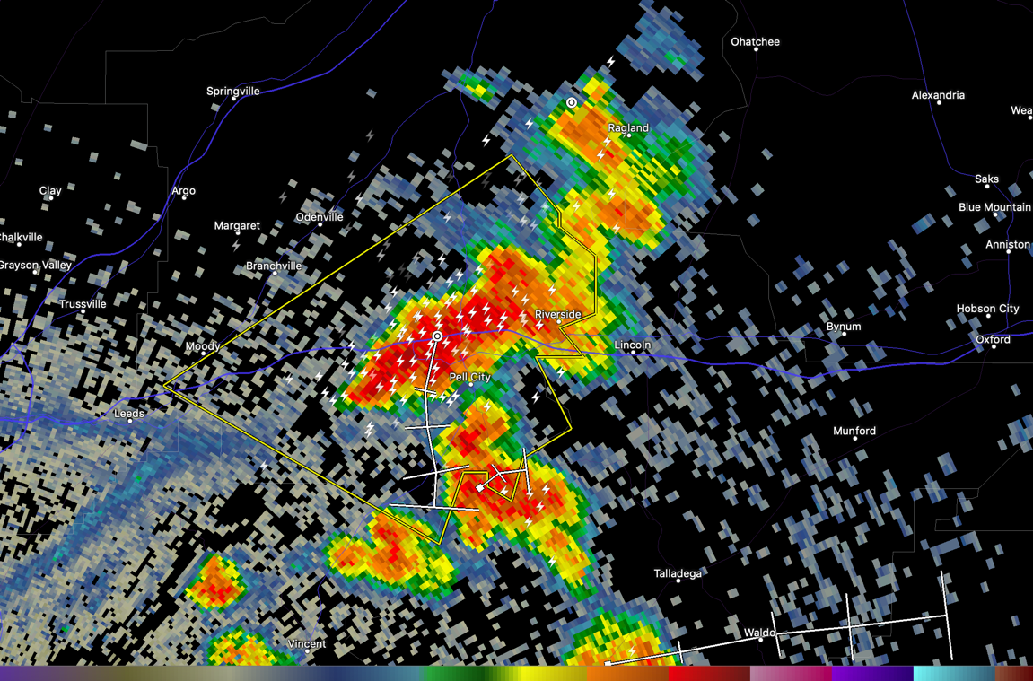
The National Weather Service in Birmingham has issued a
* Severe Thunderstorm Warning for…
Southwestern St. Clair County in central Alabama…
* Until 600 PM CDT.
* At 508 PM CDT, a severe thunderstorm was located over Pell City,
moving east at 10 mph.
HAZARD…60 mph wind gusts and quarter size hail.
SOURCE…Radar indicated.
IMPACT…Hail damage to vehicles is expected. Expect wind damage
to roofs, siding, and trees.
* Locations impacted include…
Pell City, Leeds, Moody, Riverside, Bald Rock, Logan Martin Lake,
St. Clair County Airport, Wattsville, Camp Winnataska, Chula Vista
and Cropwell.
Category: Alabama's Weather, ALL POSTS, Severe Weather
About the Author (Author Profile)
Bill Murray is the President of The Weather Factory. He is the site's official weather historian and a weekend forecaster. He also anchors the site's severe weather coverage. Bill Murray is the proud holder of National Weather Association Digital Seal #0001 @wxhistorianSubscribe
If you enjoyed this article, subscribe to receive more just like it.


