

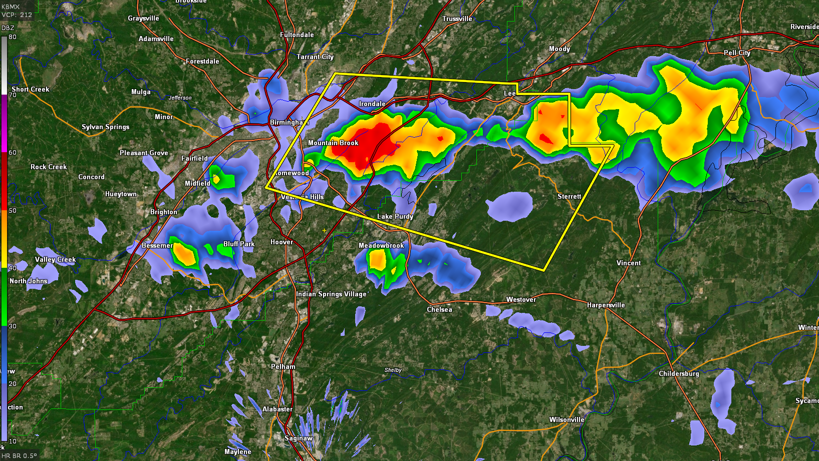
Severe Thunderstorm Warninig for Parts of Jefferson and Shelby Counties Until 7 p.m.
The National Weather Service in Birmingham has issued a
* Severe Thunderstorm Warning for…
Northeastern Shelby County in central Alabama…
East central Jefferson County in central Alabama…
* Until 700 PM CDT.
* At 610 PM CDT, a severe thunderstorm was located over Mountain
Brook, moving east at 10 mph.
HAZARD…60 mph wind gusts and quarter size hail.
SOURCE…Radar indicated.
IMPACT…Hail damage to vehicles is expected. Expect wind damage
to roofs, siding, and trees.
* Locations impacted include…
Eastern Birmingham, Vestavia Hills, Homewood, Mountain Brook,
Irondale, Leeds, Shops of Grand River, Kingston, Five Points South,
Vandiver, Barber Motorsports Park, Birmingham Airport, Greystone,
Samford University, Cahaba Heights, The Summit, Lake Purdy, Brook
Highland, Mount Laurel and Sterrett.
Category: Alabama's Weather, ALL POSTS, Severe Weather
About the Author (Author Profile)
Bill Murray is the President of The Weather Factory. He is the site's official weather historian and a weekend forecaster. He also anchors the site's severe weather coverage. Bill Murray is the proud holder of National Weather Association Digital Seal #0001 @wxhistorianSubscribe
If you enjoyed this article, subscribe to receive more just like it.


