Storms Moving In From Mississippi May Be Strong As Instability Has Risen
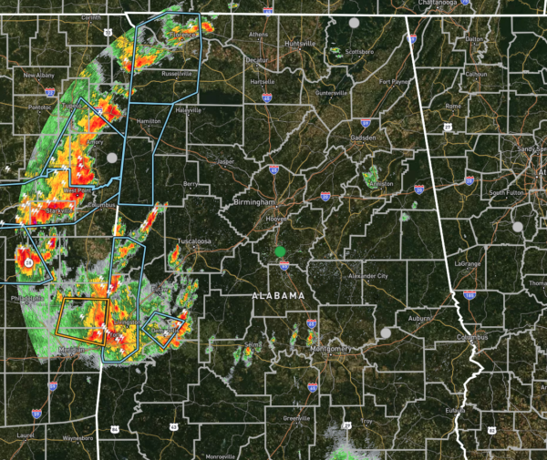
Radar check at 7:00 pm shows several clusters of thunderstorms moving southeast and entering the western portions of North/Central Alabama. There are a few Significant Weather Advisories that have been issued for nearly all of the counties along the AL/MS border in North/Central Alabama. Gusty winds of 30-40 MPH can be expected with these storms, along with copious amounts of rain and plenty of cloud-to-ground lightning.
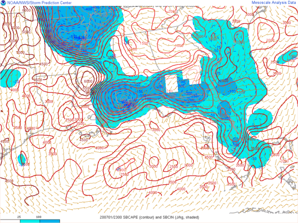
Instability values along the border are up in the 2500-3000 J/kg range, according to the latest SPC Hourly Mesoscale Analysis, and it looks like it will take a few hours for those numbers to drop enough for storms to fall apart.
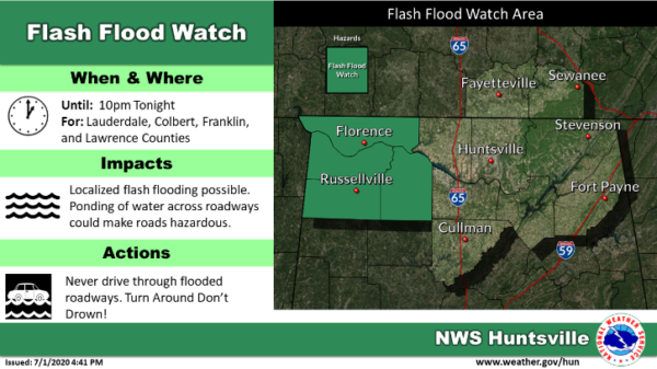
No convective watches are expected to be issued with these storms, but we still have a Flash Flood Watch up for Colbert, Franklin, Lauderdale, and Lawrence counties until 10:00 pm tonight.
Some of these storms may redevelop during the pre-dawn hours on Thursday morning along the left-over boundary from today’s storms, with the majority of those projected to occur over the southwestern parts of the area and down into Southwest Alabama.
Category: Alabama's Weather, ALL POSTS, Severe Weather


