

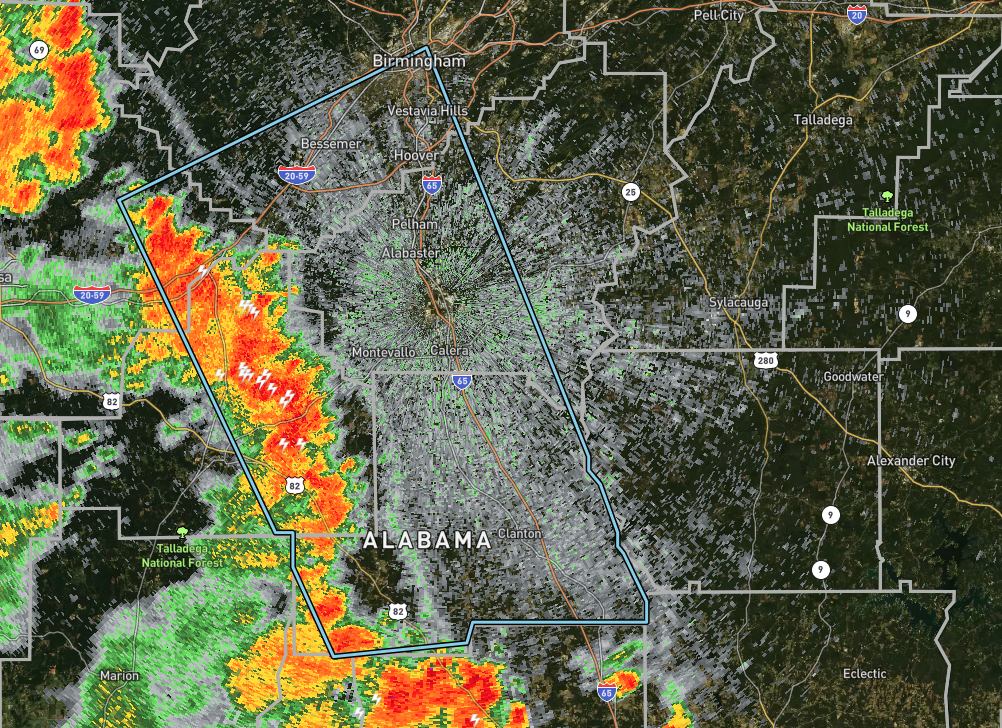
Strong Storms Moving Into Jefferson & Shelby Counties
…SIGNIFICANT WEATHER ADVISORY FOR CHILTON…EAST CENTRAL
TUSCALOOSA…SOUTHWESTERN SHELBY…EASTERN BIBB AND SOUTHWESTERN
JEFFERSON COUNTIES UNTIL 945 PM CDT…
At 838 PM CDT, Doppler radar was tracking strong thunderstorms along
a line extending from near Abernant to Parnell. Movement was east at
30 mph.
Winds in excess of 40 mph will be possible with these storms.
Locations impacted include…
Birmingham, Hoover, Vestavia Hills, Alabaster, Bessemer, Homewood,
Pelham, Mountain Brook, Helena, Hueytown, Calera, Fairfield, Clanton,
Montevallo, Columbiana, Centreville, Jemison, Midfield, Brighton and
Indian Springs Village.
PRECAUTIONARY/PREPAREDNESS ACTIONS…
Torrential rainfall is also occurring with these storms and may lead
to localized flooding. Do not drive your vehicle through flooded
roadways.
Category: Alabama's Weather, ALL POSTS, Severe Weather
About the Author (Author Profile)
Scott Martin is an operational meteorologist, professional graphic artist, musician, husband, and father. Not only is Scott a member of the National Weather Association, but he is also the Central Alabama Chapter of the NWA president. Scott is also the co-founder of Racecast Weather, which provides forecasts for many racing series across the USA. He also supplies forecasts for the BassMaster Elite Series events including the BassMaster Classic.Subscribe
If you enjoyed this article, subscribe to receive more just like it.


