

EXPIRED: Flash Flood Warning for Tuscaloosa Co. Until 12:15 am Wednesday
The National Weather Service in Birmingham has issued a
* Flash Flood Warning for…
South central Tuscaloosa County in west central Alabama…
* Until 1215 AM CDT.
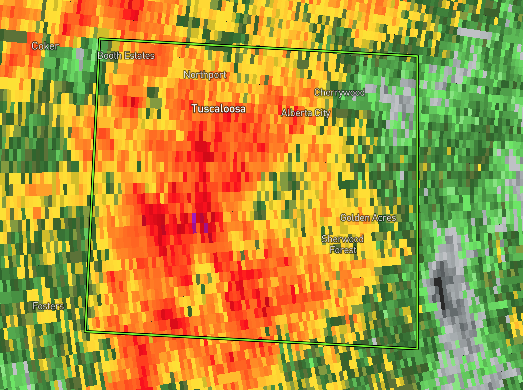
* At 914 PM CDT, emergency management reported thunderstorms
producing heavy rain across the warned area. Up to five inches of
rain have already fallen. Flash flooding is already occurring.
HAZARD…Life threatening flash flooding. Heavy rain producing
flash flooding.
SOURCE…Emergency management.
IMPACT…Life threatening flash flooding of creeks and streams,
urban areas, highways, streets and underpasses.
* Some locations that will experience flooding include…
Tuscaloosa, Northport, Holt, University Mall, McFarland Mall,
Shelton State Community College, Tuscaloosa Amphitheater, Bryant
Denny Stadium, Tuscaloosa Regional Airport, Englewood, Cottondale,
Little Sandy, Flatwoods, Maxwell, University Of Alabama Quad,
Taylorville, Palmore Park, Stillman College, Duncanville and Oliver
Lock And Dam.
PRECAUTIONARY/PREPAREDNESS ACTIONS…
Turn around, don’t drown when encountering flooded roads. Most flood
deaths occur in vehicles.
Be especially cautious at night when it is harder to recognize the
dangers of flooding.
Excessive runoff from heavy rainfall will cause flooding of small
creeks and streams, urban areas, highways, streets and underpasses as
well as other drainage areas and low lying spots.
Category: Alabama's Weather, ALL POSTS, Severe Weather
About the Author (Author Profile)
Scott Martin is an operational meteorologist, professional graphic artist, musician, husband, and father. Not only is Scott a member of the National Weather Association, but he is also the Central Alabama Chapter of the NWA president. Scott is also the co-founder of Racecast Weather, which provides forecasts for many racing series across the USA. He also supplies forecasts for the BassMaster Elite Series events including the BassMaster Classic.Subscribe
If you enjoyed this article, subscribe to receive more just like it.


