

EXPIRED Severe Thunderstorm Warning for Parts of Marion County Until 12:15 p.m.
The National Weather Service in Birmingham has issued a
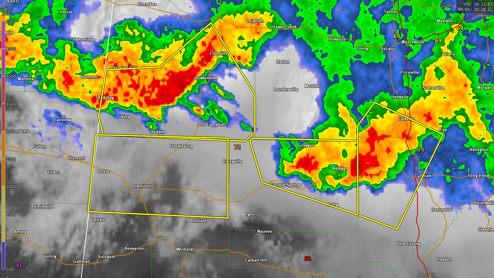
* Severe Thunderstorm Warning for…
Marion County in northwestern Alabama…
* Until 1215 PM CDT.
* At 1117 AM CDT, severe thunderstorms were located along a line
extending from Russellville to 7 miles southwest of Belgreen to
near Fairview, moving southeast at 40 mph.
HAZARD…60 mph wind gusts.
SOURCE…Radar indicated.
IMPACT…Expect damage to roofs, siding, and trees.
* Locations impacted include…
Hamilton, Hackleburg, Brinn, Weston, Lake Buttahatchee, Bear Creek,
Tessner, Shottsville, Pearces Mill, Rankin Fite Airport, Upper Bear
Creek Reservoir, Byrd, Bexar, Pigeye and Piney Grove.
Category: Alabama's Weather, ALL POSTS, Severe Weather
About the Author (Author Profile)
Bill Murray is the President of The Weather Factory. He is the site's official weather historian and a weekend forecaster. He also anchors the site's severe weather coverage. Bill Murray is the proud holder of National Weather Association Digital Seal #0001 @wxhistorianSubscribe
If you enjoyed this article, subscribe to receive more just like it.


