

CANCELED Severe T-Storm Warning for Autauga, Bullock, Elmore, Lowndes, Macon, Montgomery, Pike Co. Until 5:00 pm
The National Weather Service in Birmingham has issued a
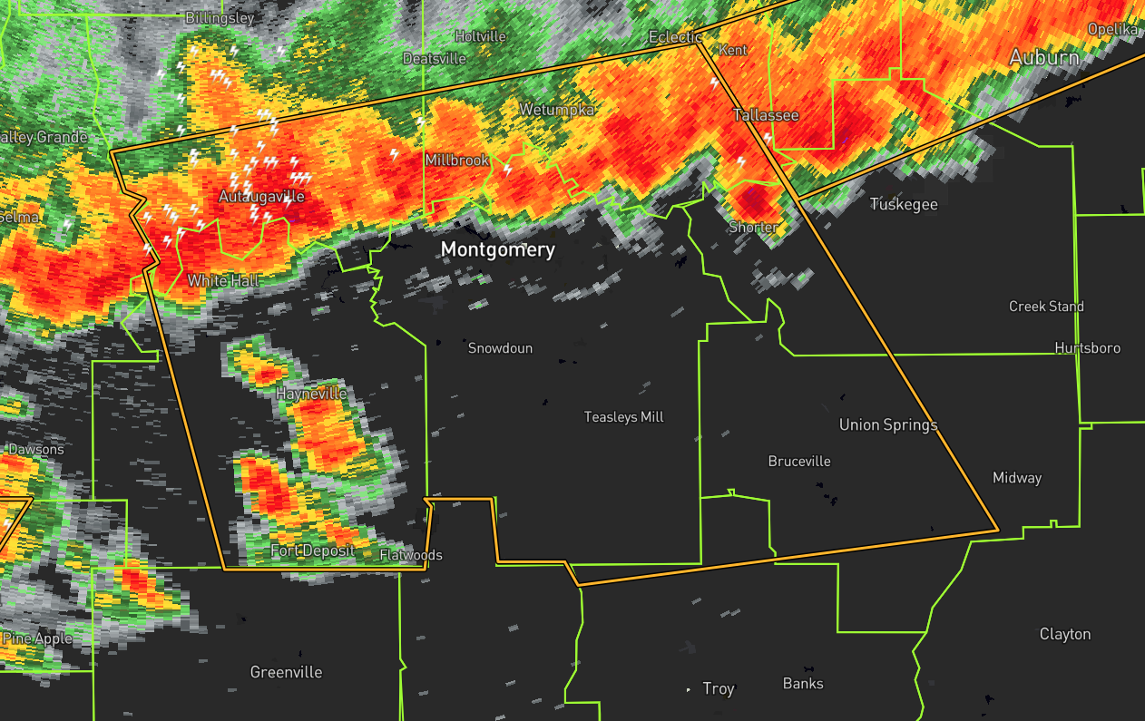
* Severe Thunderstorm Warning for…
Northwestern Pike County in southeastern Alabama…
Southern Autauga County in central Alabama…
Southern Elmore County in east central Alabama…
Western Bullock County in southeastern Alabama…
Lowndes County in south central Alabama…
Southwestern Macon County in southeastern Alabama…
Montgomery County in south central Alabama…
* Until 500 PM CDT.
* At 349 PM CDT, severe thunderstorms were located along a line
extending from near Benton to near Milstead, moving southeast at 35
mph.
HAZARD…60 mph wind gusts.
SOURCE…Radar indicated.
IMPACT…Expect damage to roofs, siding, and trees.
* Locations impacted include…
Montgomery, Prattville, Millbrook, Wetumpka, Union Springs, Fort
Deposit, Mosses, Hayneville, Meadville, Milstead, Pike Road,
Elmore, Coosada, Deatsville, Eclectic, Autaugaville, White Hall,
Shorter, Gordonville and Lowndesboro.
PRECAUTIONARY/PREPAREDNESS ACTIONS…
For your protection move to an interior room on the lowest floor of a
building.
Category: Alabama's Weather, ALL POSTS, Severe Weather
About the Author (Author Profile)
Scott Martin is an operational meteorologist, professional graphic artist, musician, husband, and father. Not only is Scott a member of the National Weather Association, but he is also the Central Alabama Chapter of the NWA president. Scott is also the co-founder of Racecast Weather, which provides forecasts for many racing series across the USA. He also supplies forecasts for the BassMaster Elite Series events including the BassMaster Classic.Subscribe
If you enjoyed this article, subscribe to receive more just like it.


