

Hot, Humid, & Unstable At Midday; Tropical Activity Ramping Up
The View Out Of The Window At 11:30 am
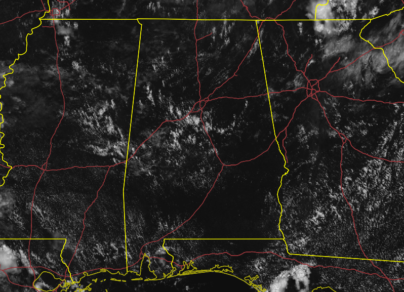
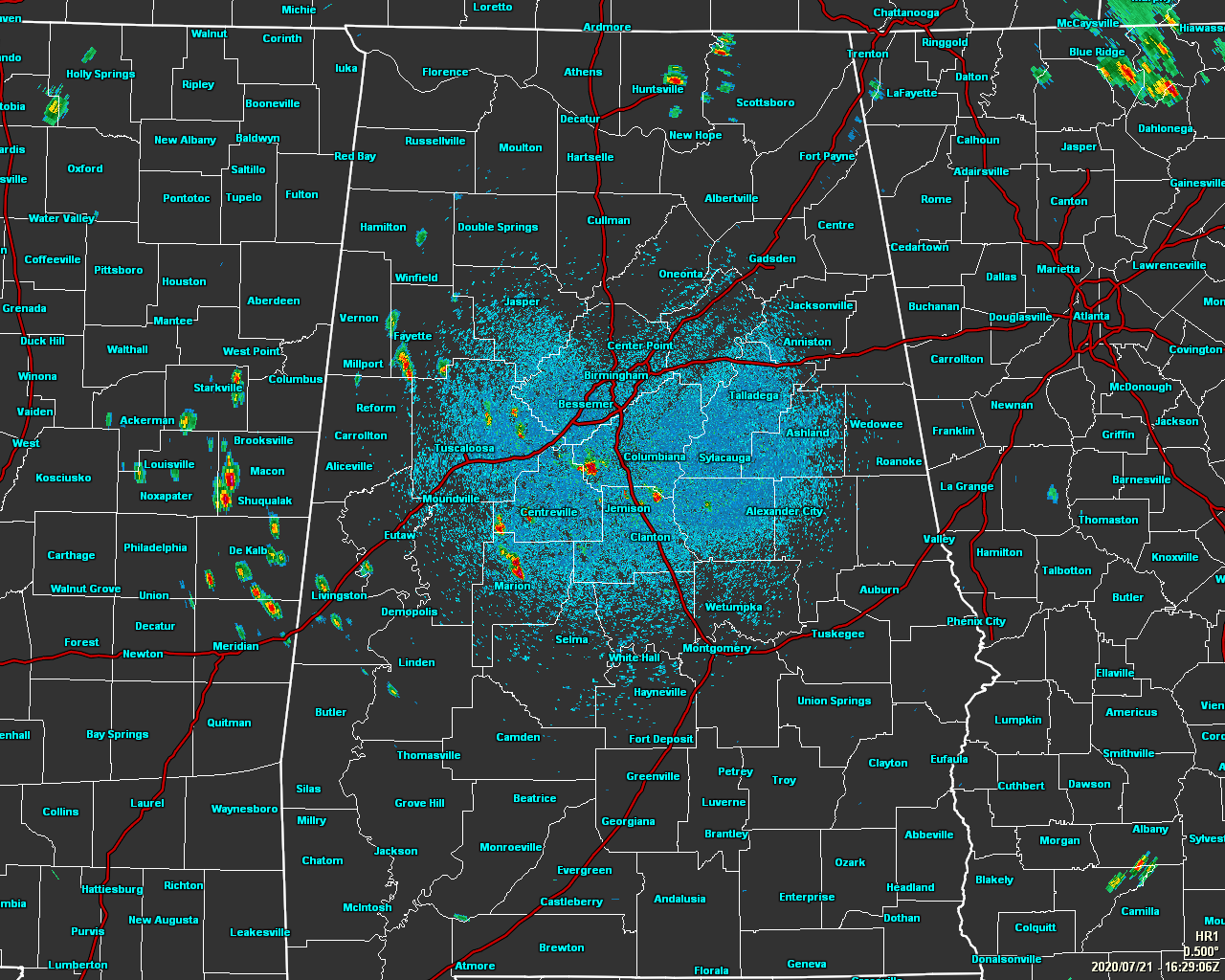
We are already seeing scattered shower and thunderstorm development over the central and west-central parts of the area as surfaced-based instability values have already hit the 3500-4500 J/kg range. Where it is not currently raining, skies are mostly sunny and conditions are hot and humid. Heat index values were in the 94-104 degree range across the area as of the 11:00 am Round-Up as temperatures are in the mid-80s to the lower 90s. Tuscaloosa was the hot spot at 92 degrees with a 76-degree dewpoint, making the heat index 104 degrees. The cool spot was Haleyville at 86 degrees with a 74-degree dewpoint, making the heat index 94 degrees. Birmingham was at 88 degrees with a 73-degree dewpoint, making the heat index 95 degrees.
______________________________
Forecast For The Rest Of Your Tuesday
Scattered showers and thunderstorms will continue to develop across the area throughout the rest of the afternoon and early evening hours until we start to lose the heating of the day and the high instability. Skies will eventually become partly to mostly cloudy where it is not raining and highs will top out in the lower to mid-90s for most across Central Alabama. Like yesterday, a few minor flooding issues may arise if one of these storms stay in place and persist for a while. Severe storms are not expected, but we may see one or two briefly become strong with gusty winds.
Showers and storms will begin to diminish around and after sunset, but a few may linger into the late-night hours. All showers should have diminished by the overnight and we’ll be left with mostly clear skies. Lows will be in the lower to mid-70s.
______________________________
The Tropics Are Heating Up
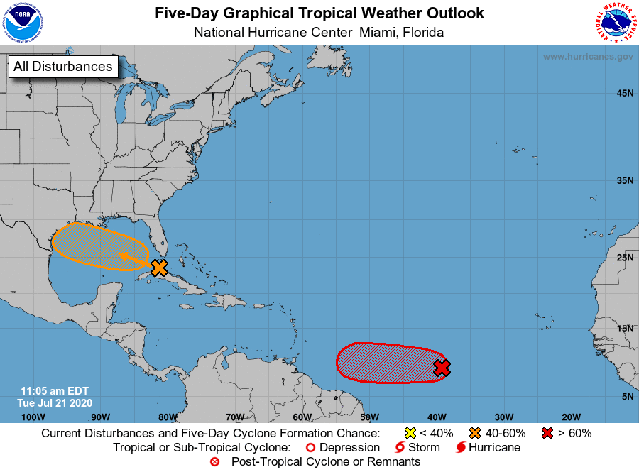
DISTURBANCE 1: A tropical wave is producing a large area of disorganized showers and thunderstorms over western Cuba, the northwestern Bahamas, southern Florida, and the adjacent Atlantic and Caribbean waters. Gradual development of this system is possible while it moves west-northwestward during the next few days. This system is expected to move over the southeastern Gulf of Mexico later today, the central Gulf on Wednesday, and the northwestern Gulf on Thursday and Friday. The Air Force Reserve Hurricane Hunter aircraft scheduled to investigate the system this afternoon has been canceled. Tropical cyclone formation chance through the next five days is medium at 40%.
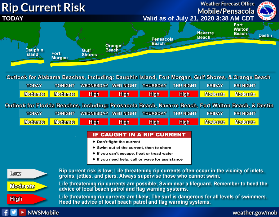
While this wave is not expected to form into a tropical storm at this point, the only threats that may be possible for the Gulf Coasts of Alabama and the Florida panhandle will be from increased wave heights and the risks for life-threatening rip currents. Here is the latest statement from NWS Mobile:
…HIGH RIP CURRENT RISK IN EFFECT FROM WEDNESDAY MORNING THROUGH LATE THURSDAY NIGHT…
* WHAT…Dangerous rip currents expected.
* WHERE…In Alabama, Mobile Coastal and Baldwin Coastal Counties. In Florida, Escambia Coastal, Santa Rosa Coastal and Okaloosa Coastal Counties.
* WHEN…From Wednesday morning through late Thursday night.
* IMPACTS…Rip currents can sweep even the best swimmers away from shore into deeper water.
PRECAUTIONARY/PREPAREDNESS ACTIONS…
Swim near a lifeguard. If caught in a rip current, relax and float. Don`t swim against the current. If able, swim in a direction following the shoreline. If unable to escape, face the shore and call or wave for help.
DISTURBANCE 2: Satellite imagery and recent satellite wind data indicate that the low-pressure system located about midway between the west coast of Africa and the Lesser Antilles continues to get better organized. If current trends continue, advisories could be initiated on this system as a tropical depression later today. Regardless of development during the next couple of days, less favorable conditions should limit additional development by the weekend. Tropical cyclone formation chance through the next five days is high at 80%.
Category: Alabama's Weather, ALL POSTS, Tropical
About the Author (Author Profile)
Scott Martin is an operational meteorologist, professional graphic artist, musician, husband, and father. Not only is Scott a member of the National Weather Association, but he is also the Central Alabama Chapter of the NWA president. Scott is also the co-founder of Racecast Weather, which provides forecasts for many racing series across the USA. He also supplies forecasts for the BassMaster Elite Series events including the BassMaster Classic.Subscribe
If you enjoyed this article, subscribe to receive more just like it.


