

Marginal Risk for Severe Storms Issued for the North & Northwestern Parts of Alabama
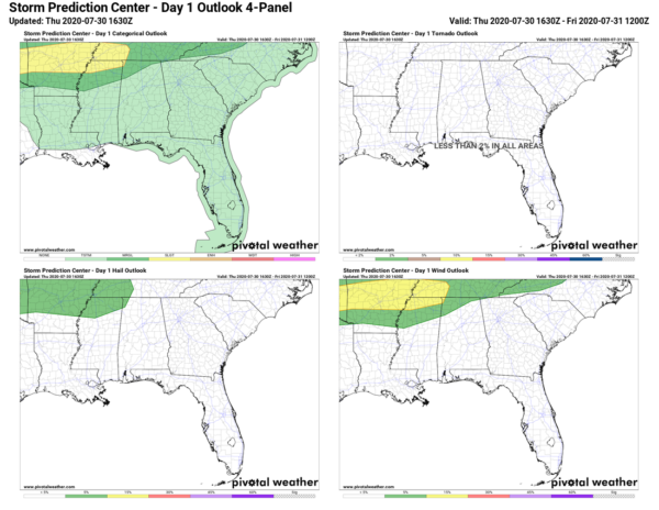
The latest update from the Storm Prediction Center has now introduced a Level 1 Marginal Risk for severe storms for the northwestern parts of Central Alabama and for a good chunk of North Alabama through the remainder of the day. The risk area includes locations along and north of a line from Stinson (Marion Co.) to Hartselle (Morgan Co.) to Skyline (Jackson Co.).
A few impulses will move into the northern parts of Alabama that could lead to convective development over the area later into the afternoon and evening hours. There is also the potential of an MCS moving into the area if it develops back to our west and northwest in western Tennessee and northern Mississippi. With plenty of instability being available, a few strong to severe thunderstorms will be possible in the risk area. Damaging winds up to 60 MPH will be the main threat.
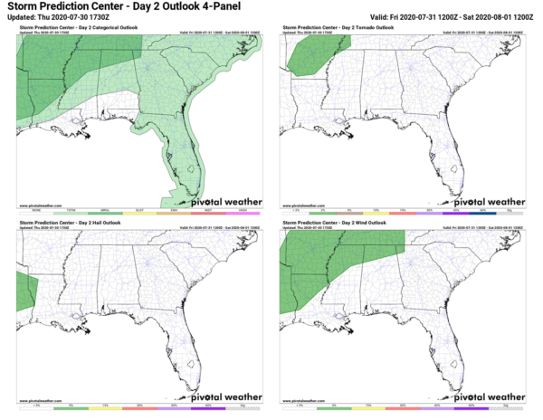
SPC has also introduced a Marginal Risk for severe storms for Friday as well as a nearby front will increase bulk shear rates a little closer to values that would be supportive for severe storms. Thunderstorms are expected to form along and out ahead of the front with damaging winds up to 60 MPH being the main threat once again. Most of this activity looks to take place during the afternoon and early evening hours.
Category: Alabama's Weather, ALL POSTS, Severe Weather
About the Author (Author Profile)
Scott Martin is an operational meteorologist, professional graphic artist, musician, husband, and father. Not only is Scott a member of the National Weather Association, but he is also the Central Alabama Chapter of the NWA president. Scott is also the co-founder of Racecast Weather, which provides forecasts for many racing series across the USA. He also supplies forecasts for the BassMaster Elite Series events including the BassMaster Classic.Subscribe
If you enjoyed this article, subscribe to receive more just like it.


