

10 a.m. Update on Isaias: Convection has Increased, but Still Struggling to Organize
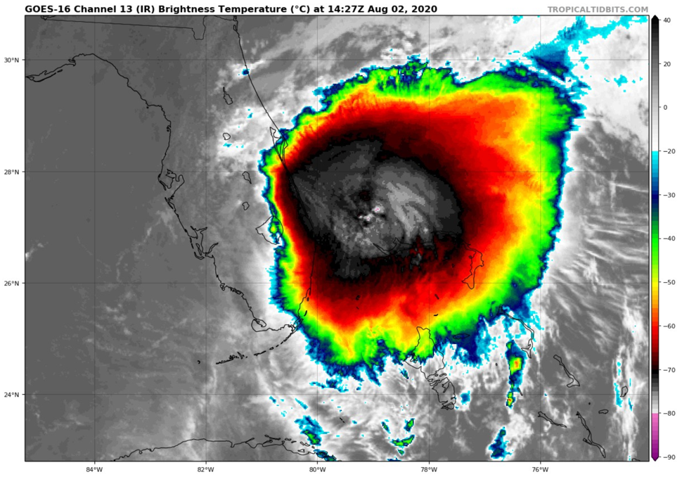
The convection associated with Tropical Storm Isaias has increased greatly this morning, but it has not translated into a lower central pressure or higher winds for the storm. The storms are east fo the low-level center.
As of the 10 a.m. advisory, here are the fast facts:
SUMMARY OF 1100 AM EDT…1500 UTC…INFORMATION
———————————————–
LOCATION…26.9N 79.6W
ABOUT 55 MI…90 KM SE OF FORT PIERCE FLORIDA
ABOUT 120 MI…195 KM SSE OF CAPE CANAVERAL FLORIDA
MAXIMUM SUSTAINED WINDS…65 MPH…100 KM/H
PRESENT MOVEMENT…NNW OR 340 DEGREES AT 8 MPH…13 KM/H
MINIMUM CENTRAL PRESSURE…995 MB…29.39 INCHES
Air Force and NOAA planes have recently departed the system and another Air Force flight is en route now. The last flight found maximum flight-level winds of 77 mph. The central pressure was 996 millibars. The Hurricane Center has adjusted that to 995 mb.
Tropical storm warnings extend all the way to north of Wilmington NC now.
A Tropical Storm Warning has been issued from South Santee River
South Carolina to Surf City North Carolina.
A Tropical Storm Watch has been issued for the North Carolina coast
from north of Surf City to Duck, including Pamlico and
Albemarle Sounds.
Isaias will spend today and much of tomorrow traveling up the coast of Florida with the worst weather offshore. By Monday night, it will be accelerating north-northeastward, making landfall on the South Carolina coast. It will then push through the Mid-Atlantic states on Tuesday and be over New England on Wednesday. By Thursday it will be over eastern Canada.
Storm surge will rise 1-3 feet above dry ground along the East Coast of Florida as the storm moves northward. Much of the Georgia Coast will see 1-3 feet with 2-4 feet along the South Carolina Coast. Large waves and rip currents will be a risk all along the East Coast.
Heavy rains will accompany the storm inland. The European model predicts places like Richmond, DC, Philadelphia, and New York could see 5-8 inches of rain. Serious flash flooding could occur.
About the Author (Author Profile)
Bill Murray is the President of The Weather Factory. He is the site's official weather historian and a weekend forecaster. He also anchors the site's severe weather coverage. Bill Murray is the proud holder of National Weather Association Digital Seal #0001 @wxhistorianSubscribe
If you enjoyed this article, subscribe to receive more just like it.


