

Storms Forming At Midday, Some Could Become Briefly Strong to Severe
A LOOK OUT THE WINDOW AT NOON
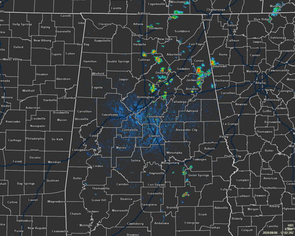
We have a good bit of scattered showers and thunderstorms over the northeastern quarter of Central Alabama as we move into the midday hour. That would include the locations east of I-65 and north of I-20. Much of the rest of the area is dry as of 12:00 pm, with the exception of a few isolated showers down in the southeastern parts of the area. There is a relatively big spread in temperatures as rain has cooled some locations while others are still seeing some sun. The cool spot is Cullman which is down to 79 degrees after a shower. The hot spot is Montgomery at 91 degrees. Birmingham was sitting at 87 degrees.
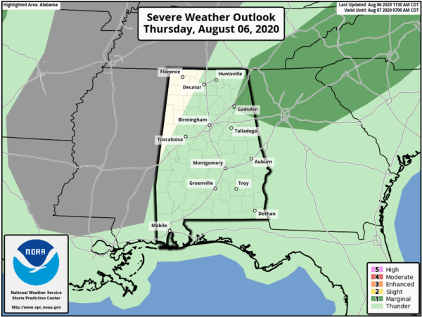
POTENTIAL FOR STRONG STORMS THIS AFTERNOON FOR PARTS OF THE AREA
We could see a few of these storms over the northeastern parts of the area become strong to briefly severe with isolated damaging wind gusts being the main threat. The rest of the area will see a chance of isolated to scattered showers and thunderstorms during the afternoon and into the early evening hours. Most of these should end quickly after sunset, but there may be one or two to linger around for a little while. Afternoon highs are expected to top out in the upper 80s to the upper 90s across the area from northwest to southeast. Skies will become partly cloudy tonight after the showers have been put to bed and overnight lows will be in the upper 60s to the mid-70s.
THE TROPICS
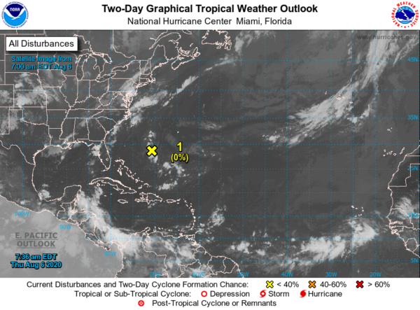
Invest 94L is fizzling out right before our eyes… It’s located about midway between Bermuda and the Bahamas is producing disorganized showers and a few thunderstorms. However, the circulation appears to be losing definition, and development is not expected due to dry air and increasing upper-level winds. This system is forecast to drift southwestward or meander for the next few days.
AND SPEAKING OF THE TROPICS
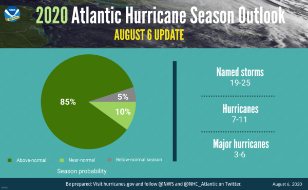
NOAA just released their updated forecast for the 2020 Atlantic Hurricane Season and has upped the risk for an above-normal season to 85%… that is up from 60% from the previous forecast released earlier this year. They are now expecting up to 19-25 named storms, with 7-11 of those becoming hurricanes, and 3-6 of those becoming major hurricanes (category 3 and up). See the Update From NOAA: Extremely Active Hurricane Season Possible for Atlantic Basin post for the full article.
Category: Alabama's Weather, ALL POSTS, Severe Weather, Tropical
About the Author (Author Profile)
Scott Martin is an operational meteorologist, professional graphic artist, musician, husband, and father. Not only is Scott a member of the National Weather Association, but he is also the Central Alabama Chapter of the NWA president. Scott is also the co-founder of Racecast Weather, which provides forecasts for many racing series across the USA. He also supplies forecasts for the BassMaster Elite Series events including the BassMaster Classic.Subscribe
If you enjoyed this article, subscribe to receive more just like it.


