

Occasional Showers/Storms Today; Drier Over The Weekend
RADAR CHECK: Several large areas of rain and thunderstorms are moving across Central Alabama early this morning with temperatures in the 70s. Today will be fairly wet for the state with occasional showers and storms; the high will be in the mid to upper 80s for most communities with only a limited amount of sunshine. Like recent days, stronger storms will produce gusty winds, heavy rain, and lots of lightning.
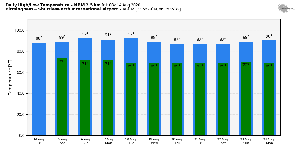
THE ALABAMA WEEKEND: The weather trends drier. Showers will be fewer in number tomorrow with a mix of sun and clouds, and Sunday will be mostly sunny with only a small risk of any one spot getting wet. The high tomorrow will be in the 87-90 degree range, followed by low 90s Sunday.
NEXT WEEK: The weather will be quiet Monday and Tuesday with a good supply of sunshine and only isolated showers. Then, showers and storms should gradually increase over the latter half of the week with rising moisture levels. Highs through the week will be generally in the 86-90 degree range, with lows in the 60s…. below average for August. See the Weather Xtreme video for maps, graphics, and more details.
TROPICS: Tropical Storm Josephine has winds of 40 mph, and is 675 miles east of the northern Leeward Islands. The system will pass north of the islands over the weekend, and will turn north Sunday and Monday, well east of the U.S. There is a pretty decent chance this will dissipate within 3-5 days due to strong shear.

NHC is also monitoring a broad area of low pressure over eastern North Carolina… it is forecast to move east-northeastward across the north Atlantic well to the southeast of New England and to the south of the Canadian Maritime provinces over the next several days. This system could acquire some subtropical or tropical characteristics during the next few days while it moves over the warm waters of the Gulf Stream. It will be moving away from the U.S. and is no threat to land.
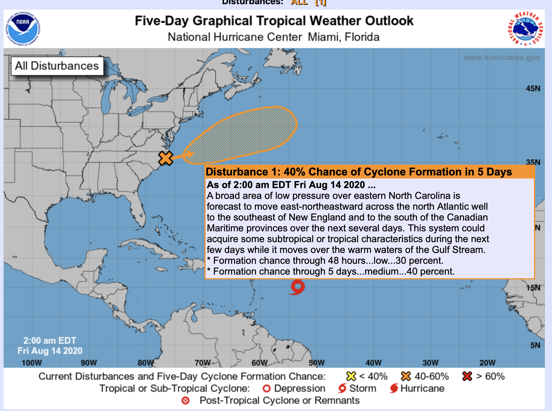
The rest of the Atlantic basin, including the Gulf of Mexico, is quiet.
ON THIS DATE IN 1969: Hurricane Camille, a powerful, deadly, and destructive hurricane formed just west of the Cayman Islands on this day. It rapidly intensified, and by the time it reached western Cuba the next day, it was a Category 3 hurricane. Hurricane Camille was spawned on August 5th by a tropical wave off the coast of Africa. The storm became a tropical disturbance four days later on the 9th and a tropical storm on the 14th with a 999-millibar pressure center and 55 mph surface winds.
BEACH FORECAST: Click here to see the AlabamaWx Beach Forecast Center page.
WEATHER BRAINS: Don’t forget you can listen to our weekly 90 minute show anytime on your favorite podcast app. This is the show all about weather featuring many familiar voices, including our meteorologists here at ABC 33/40.
CONNECT: You can find me on all of the major social networks…
Facebook
Twitter
Instagram
Pinterest
Snapchat: spannwx
Look for the next Weather Xtreme video here by 4:00 this afternoon… enjoy the day!
Category: Alabama's Weather, ALL POSTS, Weather Xtreme Videos
About the Author (Author Profile)
James Spann is one of the most recognized and trusted television meteorologists in the industry. He holds the AMS CCM designation and television seals from the AMS and NWA. He is a past winner of the Broadcast Meteorologist of the Year from both professional organizations.Subscribe
If you enjoyed this article, subscribe to receive more just like it.


