

EXPIRED Severe T-Storm Warning for Jackson & Madison Co. Until 4:00 PM
The storm which prompted the warning has weakened below severe
limits, and no longer poses an immediate threat to life or property.
Therefore, the warning will be allowed to expire.
The National Weather Service in Huntsville Alabama has issued a
* Severe Thunderstorm Warning for…
Northwestern Jackson County in northeastern Alabama…
Northeastern Madison County in north central Alabama…
* Until 400 PM CDT.
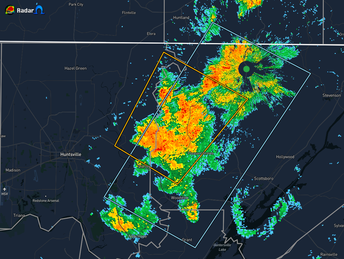
* At 333 PM CDT, a severe thunderstorm was located 8 miles northeast
of Gurley, or 12 miles east of Moores Mill, moving northeast at 20
mph.
HAZARD…60 mph wind gusts and nickel size hail.
SOURCE…Radar indicated.
IMPACT…Expect damage to roofs, siding, and trees.
* Locations impacted include…
Skyline, Gurley, Pleasant Groves, Maysville, Princeton, Trenton,
Garth, Hollytree, Brownsboro and Larkin.
PRECAUTIONARY/PREPAREDNESS ACTIONS…
For your protection move to an interior room on the lowest floor of a
building.
Category: Alabama's Weather, ALL POSTS, Severe Weather
About the Author (Author Profile)
Scott Martin is an operational meteorologist, professional graphic artist, musician, husband, and father. Not only is Scott a member of the National Weather Association, but he is also the Central Alabama Chapter of the NWA president. Scott is also the co-founder of Racecast Weather, which provides forecasts for many racing series across the USA. He also supplies forecasts for the BassMaster Elite Series events including the BassMaster Classic.Subscribe
If you enjoyed this article, subscribe to receive more just like it.


