

Marco Weakens to a Depression; Threat of Heavy Rain Still Possible Across the Central Gulf Coast
NHC UPDATE SUMMARY OF 10:00 PM CDT INFORMATION
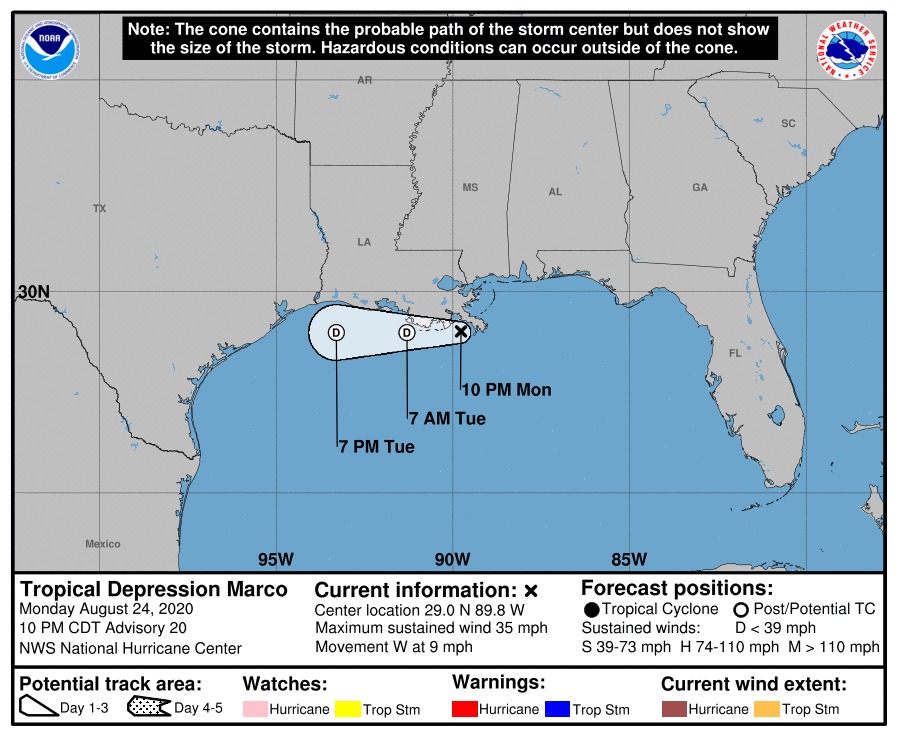
LOCATION: 45 miles west of the Mouth of the Mississippi River
MAXIMUM WINDS: 35 mph
MOVEMENT: west at 9 MPH
MINIMUM PRESSURE: 1007 MB or 29.74 in
WATCHES AND WARNINGS
There are no coastal watches or warnings in effect.
DISCUSSION AND OUTLOOK
At 1000 PM CDT (0300 UTC), the center of Tropical Depression Marco was located near latitude 29.0 North, longitude 89.8 West. The depression is moving toward the west near 9 mph (15 km/h). Marco is forecast to continue moving westward near the coast of Louisiana for the next day or so.
Maximum sustained winds have decreased to near 35 mph (55 km/h) with higher gusts. Additional weakening is expected, and Marco is forecast to become a remnant low on Tuesday. The system is then forecast to dissipate by early Wednesday.
The estimated minimum central pressure is 1007 MB (29.74 inches).
HAZARDS AFFECTING LAND
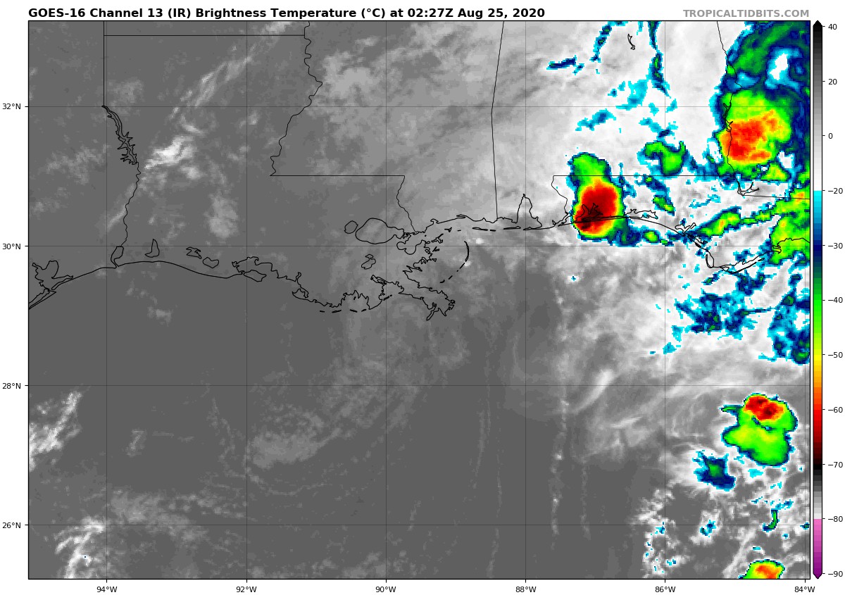
RAINFALL: Marco is expected to produce additional rainfall accumulations of 1 to 3 inches with additional isolated totals of 5 inches across portions of the north-central Gulf Coast and the Southeastern United States through Wednesday. Rain totals related to Marco near Apalachicola, Florida reached as high as 11.81 inches on Sunday per a CoCoRaHS report. The additional rainfall may result in areas of flash, urban and small stream flooding along the same area.
SURF: Swells generated by Marco are likely to affect portions of the northern Gulf Coast overnight. These swells are likely to cause life-threatening surf and rip current conditions. Please consult products from your local weather office.
TORNADOES: A brief tornado or two remains possible overnight across the Florida Panhandle, southwest Georgia, far southern Alabama, and far southern Mississippi.
Category: ALL POSTS, Severe Weather, Tropical
About the Author (Author Profile)
Scott Martin is an operational meteorologist, professional graphic artist, musician, husband, and father. Not only is Scott a member of the National Weather Association, but he is also the Central Alabama Chapter of the NWA president. Scott is also the co-founder of Racecast Weather, which provides forecasts for many racing series across the USA. He also supplies forecasts for the BassMaster Elite Series events including the BassMaster Classic.Subscribe
If you enjoyed this article, subscribe to receive more just like it.


