

EXPIRED Severe T-Storm Warning for Parts of Cullman, Madison, Morgan Co. Until 6:30 pm
The National Weather Service in Huntsville Alabama has issued a
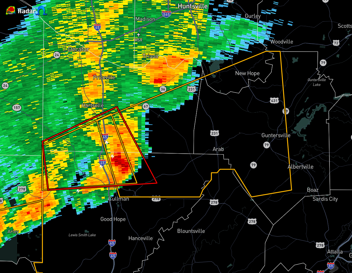
* Severe Thunderstorm Warning for…
Western Marshall County in northeastern Alabama…
Southeastern Madison County in north central Alabama…
Northeastern Cullman County in north central Alabama…
Southeastern Morgan County in north central Alabama…
* Until 630 PM CDT.
* At 549 PM CDT, a severe thunderstorm was located 8 miles southeast
of Falkville, or 10 miles northeast of Cullman, moving east at 45
mph.
HAZARD…60 mph wind gusts.
SOURCE…Radar indicated.
IMPACT…Expect damage to roofs, siding, and trees.
* Locations impacted include…
Albertville, Cullman, Guntersville, Arab, Owens Cross Roads,
Falkville, Holly Pond, Morgan City, Vinemont and Baileyton.
PRECAUTIONARY/PREPAREDNESS ACTIONS…
A Tornado Watch remains in effect until 800 PM CDT for north central,
northeastern and northwestern Alabama.
For your protection move to an interior room on the lowest floor of a
building.
Category: Alabama's Weather, ALL POSTS, Severe Weather
About the Author (Author Profile)
Scott Martin is an operational meteorologist, professional graphic artist, musician, husband, and father. Not only is Scott a member of the National Weather Association, but he is also the Central Alabama Chapter of the NWA president. Scott is also the co-founder of Racecast Weather, which provides forecasts for many racing series across the USA. He also supplies forecasts for the BassMaster Elite Series events including the BassMaster Classic.Subscribe
If you enjoyed this article, subscribe to receive more just like it.


