

EXPIRED Severe T-Storm Warning for Parts of Jackson, Madison Co. Until 6:45 pm
The National Weather Service in Huntsville Alabama has issued a
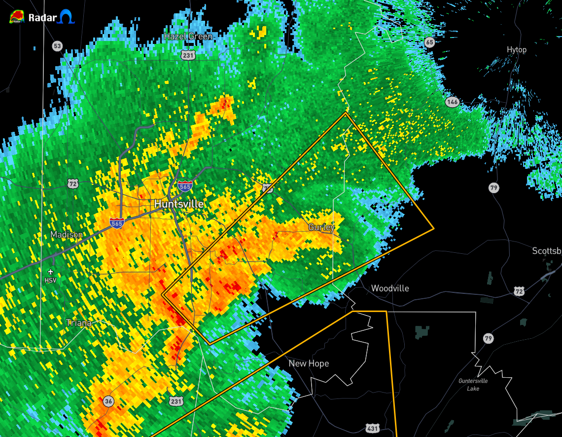
* Severe Thunderstorm Warning for…
West central Jackson County in northeastern Alabama…
Central Madison County in north central Alabama…
* Until 645 PM CDT.
* At 619 PM CDT, a severe thunderstorm was located over southeastern
Huntsville, moving northeast at 25 mph.
HAZARD…60 mph wind gusts.
SOURCE…Radar indicated.
IMPACT…Expect damage to roofs, siding, and trees.
* Locations impacted include…
Southern Huntsville, Redstone Arsenal, Owens Cross Roads, Gurley,
Paint Rock, Farley, Trenton, Garth, Hampton Cove and Brownsboro.
PRECAUTIONARY/PREPAREDNESS ACTIONS…
A Tornado Watch remains in effect until 800 PM CDT for north central
and northeastern Alabama…and Middle Tennessee.
Remain alert for a possible tornado! Tornadoes can develop quickly
from severe thunderstorms. If you spot a tornado go at once into the
basement or small central room in a sturdy structure.
For your protection move to an interior room on the lowest floor of a
building.
Category: Alabama's Weather, ALL POSTS, Severe Weather
About the Author (Author Profile)
Scott Martin is an operational meteorologist, professional graphic artist, musician, husband, and father. Not only is Scott a member of the National Weather Association, but he is also the Central Alabama Chapter of the NWA president. Scott is also the co-founder of Racecast Weather, which provides forecasts for many racing series across the USA. He also supplies forecasts for the BassMaster Elite Series events including the BassMaster Classic.Subscribe
If you enjoyed this article, subscribe to receive more just like it.


