

A Very Nice Labor Day Midday Across Central Alabama

As of 11:05 am, it is bright and sunny across all of Central Alabama, but over the extreme southern parts of the area, we can see some haze from smoke that is moving in from the west from the wildfires. Temperatures are in the upper 70s to the mid-80s as of the 11:00 am roundup. Tuscaloosa was the warm spot at 84 degrees while Pell City was the cool spot at 79 degrees. Birmingham was sitting at 81 degrees.
Skies will remain mainly sunny throughout the remainder of the daylight hours and temperatures will be very warm to hot. Afternoon highs will reach the upper 80s to the lower 90s across the area. For tonight and through the overnight hours, mainly clear skies can be expected. Lows will drop into the mid to upper 60s.
Moisture will start to move back up into Central Alabama on Tuesday as humidity levels will be on the rise. There may be just enough moisture that a few isolated showers and thunderstorms may be possible during the afternoon hours along and south of the US-80 and I-85 corridors. The rest of the area will have mostly sunny skies and dry. Highs will be in the upper 80s to the lower 90s.
VERY BUSY IN THE TROPICS
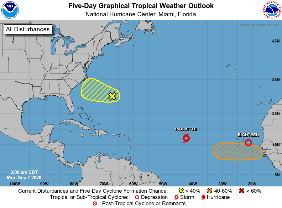
TD-17 strengthened into Tropical Storm Paulette earlier this morning and you can read about her stats and projected path HERE.
TD-18 formed this morning as well and looks to become Tropical Storm Rene very soon. You can read about the latest update from the NHC on TD-18 HERE.
We also have an area of low pressure located just southwest of Bermuda is producing disorganized showers and a few thunderstorms. Some slow development of this system is possible during the next several days while it moves generally westward or west-northwestward.
* Formation chance through 48 hours…low…10 percent.
* Formation chance through 5 days…low…30 percent.
Finally, a tropical wave is forecast to emerge off the west coast of Africa in a few days. Gradual development is anticipated once the system moves over water and a tropical depression could form late this week or over the weekend while the system moves generally westward across the eastern Atlantic.
* Formation chance through 48 hours…low…near 0 percent.
* Formation chance through 5 days…medium…40 percent.
ON THIS DAY IN WEATHER HISTORY
1970 – A lightning bolt struck a group of football players at Gibbs High School in Saint Petersburg, Florida, killing two persons and injuring 22 others. All the thirty-eight players and four coaches were knocked off their feet.
1988 – Fifty cities across the eastern U.S. reported record low temperatures for the date. The low of 56 degrees at Mobile, Alabama was their coolest reading of record for so early in the season. The mercury dipped to 31 degrees at Athens, Ohio, and to 30 degrees at Thomas, West Virginia.
Category: Alabama's Weather, ALL POSTS
About the Author (Author Profile)
Scott Martin is an operational meteorologist, professional graphic artist, musician, husband, and father. Not only is Scott a member of the National Weather Association, but he is also the Central Alabama Chapter of the NWA president. Scott is also the co-founder of Racecast Weather, which provides forecasts for many racing series across the USA. He also supplies forecasts for the BassMaster Elite Series events including the BassMaster Classic.Subscribe
If you enjoyed this article, subscribe to receive more just like it.


