

Rene is a Little Weaker for Now, May Approach Hurricane Strength by late Saturday
SUMMARY OF 1000 PM CDT…0300 UTC…INFORMATION
———————————————–
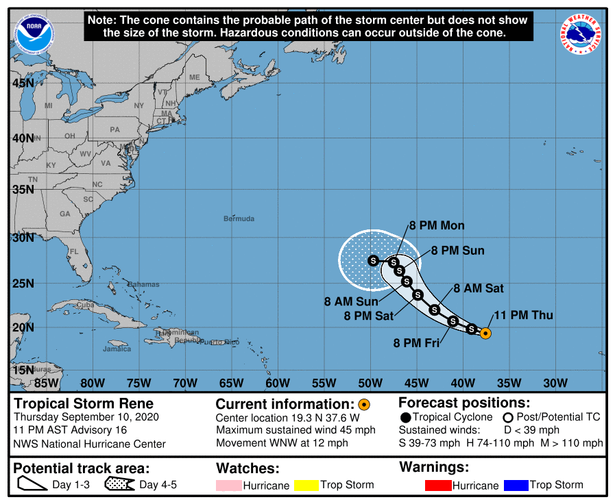
LOCATION…19.3N 37.6W
ABOUT 925 MI…1485 KM WNW OF THE CABO VERDE ISLANDS
MAXIMUM SUSTAINED WINDS…45 MPH…75 KM/H
PRESENT MOVEMENT…WNW OR 290 DEGREES AT 12 MPH…19 KM/H
MINIMUM CENTRAL PRESSURE…1002 MB…29.59 INCHES
WATCHES AND WARNINGS
——————–
There are no coastal watches or warnings in effect.
DISCUSSION AND OUTLOOK
———————-
At 1100 PM AST (0300 UTC), the center of Tropical Storm Rene was located near latitude 19.3 North, longitude 37.6 West. Rene is moving toward the west-northwest near 12 mph (19 km/h). This general motion is expected to continue through Friday, followed by a turn toward the northwest on Saturday. A northwestward motion at slower forward speed is forecast Saturday night and Sunday.
Satellite wind data indicate that the maximum sustained winds are near 45 mph (75 km/h) with higher gusts. Gradual strengthening is forecast during the next couple of days.
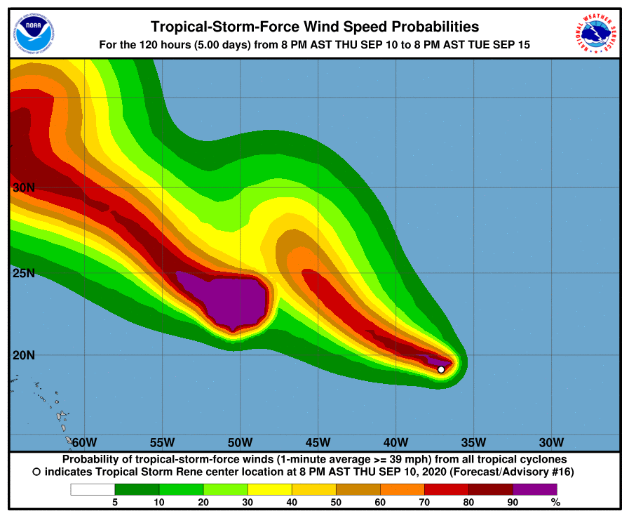
Tropical-storm-force winds extend outward up to 70 miles (110 km) from the center.
The estimated minimum central pressure is 1002 MB (29.59 inches).
HAZARDS AFFECTING LAND
———————-
None.
About the Author (Author Profile)
Scott Martin is an operational meteorologist, professional graphic artist, musician, husband, and father. Not only is Scott a member of the National Weather Association, but he is also the Central Alabama Chapter of the NWA president. Scott is also the co-founder of Racecast Weather, which provides forecasts for many racing series across the USA. He also supplies forecasts for the BassMaster Elite Series events including the BassMaster Classic.Subscribe
If you enjoyed this article, subscribe to receive more just like it.


