

Hey Nineteen!
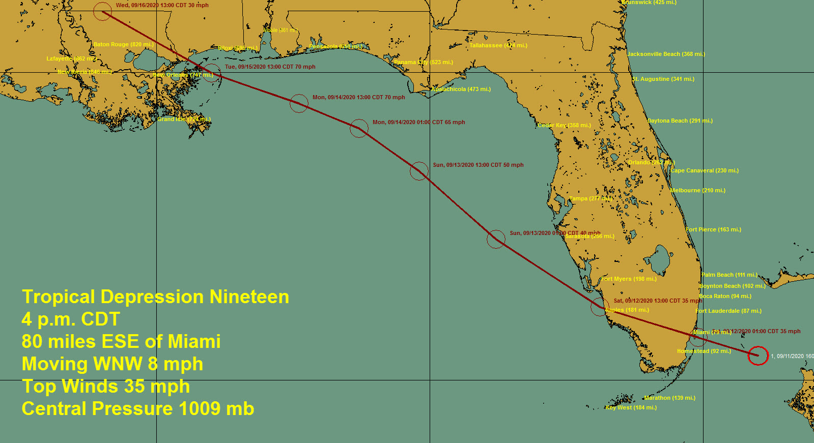
The NHC has initiated advisories on Tropical Depression Nineteen which just formed between Miami and the Bahamas.
The center is located about 80 miles east southeast of Miami. Movement is west-northwest 8 mph. This will carry the system across South Florida, and it should emerge into the southeastern Gulf of Mexico Saturday afternoon.
Top winds are 35 mph. It is not forecast to become a tropical storm until Saturday night when it should be just offshore of the west coast of Florida, about 50 miles southwest of St. Pete. But, it would not take much for it to become a tropical storm tonight before reaching the Florida coast, so don’t be surprised if that happens.
It will steadily intensify over the Gulf of Mexico with warm water temperatures and light wind shear.
Here is the forecast for Monday morning at 6 a.m. when tropical storm force winds could be being felt along the Northwest Florida coast. That could start near Apalachicola Sunday evening.
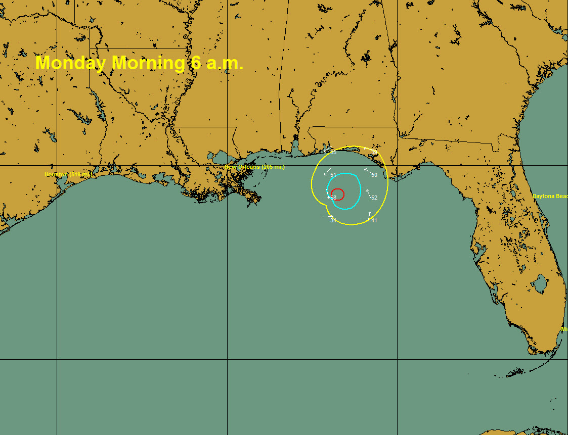
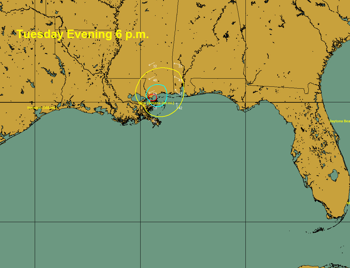
It could be south of Mobile Bay late Monday night/early Tuesday morning. Top winds would be around 70 mph or higher at that point.

It is forecast to be near hurricane strength, but perhaps stronger, when it makes landfall between the Mouth of the Mississippi River and Mobile Bay, most likely near the Louisiana/Mississippi border late Tuesday afternoon.
But there is a very real chance that it will be stronger and it could well be a hurricane when it does arrive on the northern Gulf Coast. How strong? We don’t know yet. Future model data will have a better handle on the system not that it is officially a depression.
There is a great deal more uncertainty than usual in the forecast track. The system could take a more westerly track that forecast and make landfall further west along the Louisiana coast. That is a real possibility. So impacts may be felt well outside the usual forecast cone. Here is the cone:
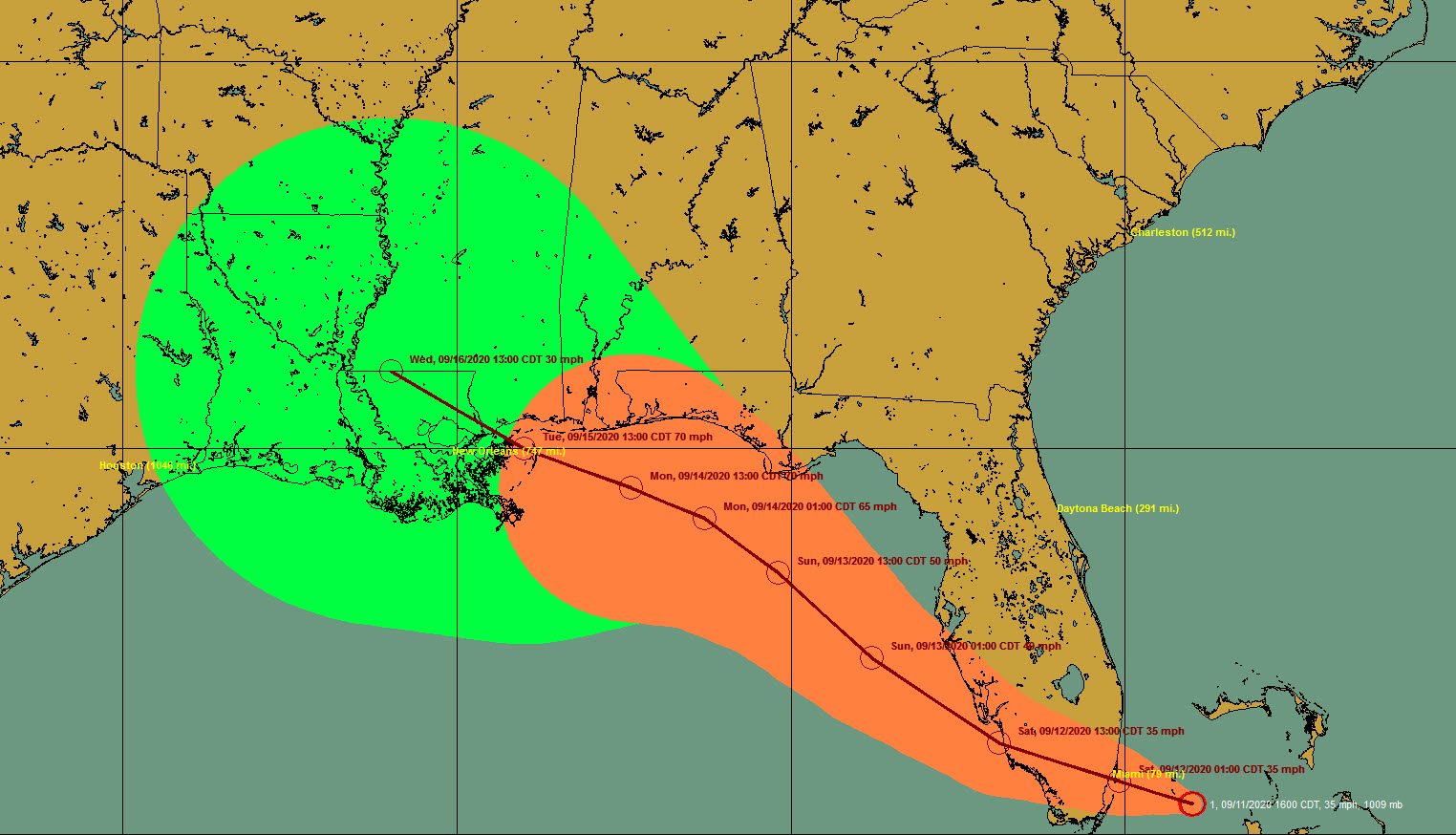
Residents and visitors all along the Gulf Coast of Northwest Florida, Alabama, Mississippi, and Southeast Lousiana should pay attention to the latest information on the storm throughout the weekend and into next week when it makes landfall.
For now, tropical-storm-force winds will likely be felt along the coast from Apalachicola, Florida all along the Panhandle Beaches, all along the Alabama coast, over all of the Mississippi coast, and into the New Orleans area. Strong tropical-storm-force winds will impact the area from east of New Orleans including Slidell across The Mississippi Coast onto at least part of the Alabama coast. There is a chance that hurricane-force winds will occur from near the Lousiana/Mississippi border to Pensacola if the storm is stronger than now anticipated.
Tropical storm or hurricane watches, as well as storm surge watches, could be issued later tonight or tomorrow morning for portions of the Gulf Coast.
Of course, tides will be much higher than normal all along the coast near and to the east of its track. Latest intensity forecasts will determine how high storm surge could be.
Surf will become dangerous and the rip current danger high all along the beaches of Alabama and Northwest Florida by Saturday night.
Heavy rains of 3-7 inches swill affect South Alabama and the Florida Panhandle.
It is uncertain how much impact Central Alabama will see from this system. Based on its current movement and forecast intensity, the impact will be small. But a stronger storm or a track more to the east could produce a greater impact.
Category: Alabama's Weather, ALL POSTS, Tropical
About the Author (Author Profile)
Bill Murray is the President of The Weather Factory. He is the site's official weather historian and a weekend forecaster. He also anchors the site's severe weather coverage. Bill Murray is the proud holder of National Weather Association Digital Seal #0001 @wxhistorianSubscribe
If you enjoyed this article, subscribe to receive more just like it.


