

Rene Continues West-Northwestward With No Change in Strength
SUMMARY OF 1100 PM AST…0300 UTC…INFORMATION
———————————————–
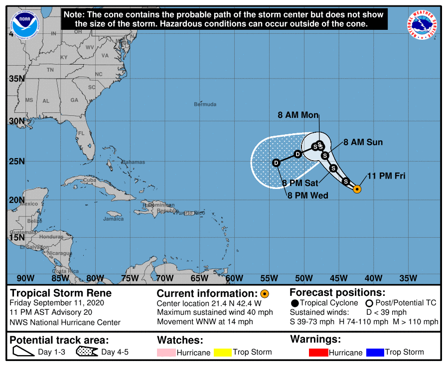
LOCATION…21.4N 42.4W
ABOUT 1260 MI…2025 KM WNW OF THE CABO VERDE ISLANDS
ABOUT 1360 MI…2190 KM ENE OF THE NORTHERN LEEWARD ISLANDS
MAXIMUM SUSTAINED WINDS…40 MPH…65 KM/H
PRESENT MOVEMENT…WNW OR 295 DEGREES AT 14 MPH…22 KM/H
MINIMUM CENTRAL PRESSURE…1004 MB…29.65 INCHES
WATCHES AND WARNINGS
——————–
There are no coastal watches or warnings in effect.

DISCUSSION AND OUTLOOK
———————-
Deep convection has persisted near the center of Rene since this afternoon and a couple of earlier microwave overpasses suggest that there has been an increase in banding over the southwestern portion of the circulation. Despite what appears to be an increase in organization, recent ASCAT data indicated that this has not translated into an increase in intensity. The scatterometer data still supports an initial wind speed of 35 kt. Environmental conditions are forecast to generally be conducive for some strengthening over the next 12-24 hours, however with Rene continuing to struggle to intensify the NHC wind speed prediction has again been reduced during that time. By 36-48 hours, Rene is expected to move beneath an area of strong upper-level west-northwesterly flow, and this increase in shear is expected to cause weakening. The ECMWF and GFS models significantly weaken Rene after 72 hours, with the ECMWF showing dissipation before the end of the forecast period. For now, the official forecast calls for Rene to weaken to a tropical depression by day 4, but it is possible that the system will degenerate into a trough of low pressure before day 5.
Rene is moving west-northwestward or 295/12 kt. The cyclone should turn toward the northwest as it moves around the western portion of a mid-level ridge over the eastern Atlantic. In a couple of days, a mid-level high is predicted to build to the northwest of Rene, which should cause the cyclone to slow down and turn westward, and then west-southwestward later in the forecast period. The track guidance is in fairly good agreement and the various consensus aids remained close to the previous official forecast. Therefore, the new NHC forecast is essentially an update of the previous advisory.
HAZARDS AFFECTING LAND
———————-
None.
About the Author (Author Profile)
Scott Martin is an operational meteorologist, professional graphic artist, musician, husband, and father. Not only is Scott a member of the National Weather Association, but he is also the Central Alabama Chapter of the NWA president. Scott is also the co-founder of Racecast Weather, which provides forecasts for many racing series across the USA. He also supplies forecasts for the BassMaster Elite Series events including the BassMaster Classic.Subscribe
If you enjoyed this article, subscribe to receive more just like it.


