

A Quick Check on Our Weather at 6:30 pm; Flash Flood Watch Expanded
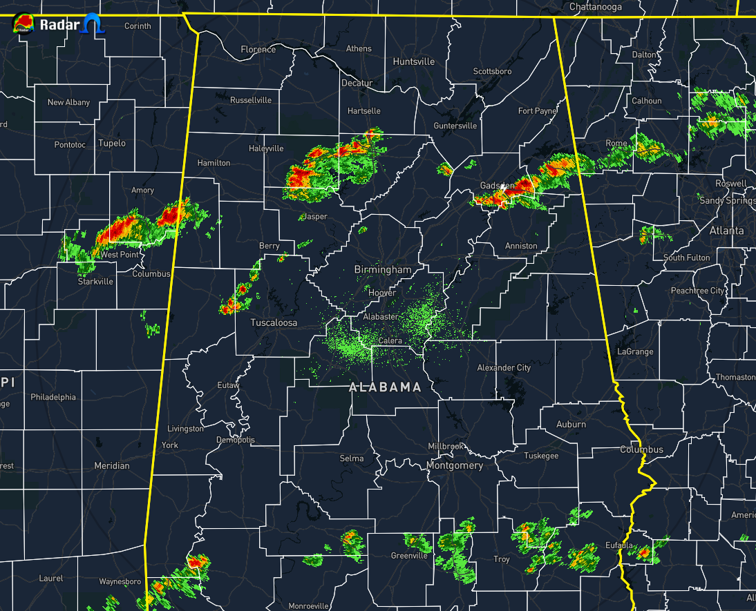
Even with the center of Sally’s circulation still over 130 miles to the south of the Gulf Coast, we are seeing a couple of the outermost rain bands moving generally westward across portions of Central Alabama. The northernmost broken band stretches from Centre to Ball Flat to Hokes Bluff to Riverside for the first cluster, from Vinemont to Addison to Poplar Springs to Nauvoo for the second cluster, and from Vernon and Sulligent to exiting the state and into extreme eastern Mississippi with the last cluster. Over the last five minutes, I have only seen one lightning strike throughout this whole broken band, but a decent amount of rain is currently falling with these.
The second ragged and broken band is affecting the extreme southeastern parts of Central Alabama mainly over portions of Pike, Barbour, and Bullock counties. No lightning is being detected with these showers and the returns are not as heavy with these. Other than a few scattered showers spaced out close to those bands, the rest of Central Alabama is dry at the moment.
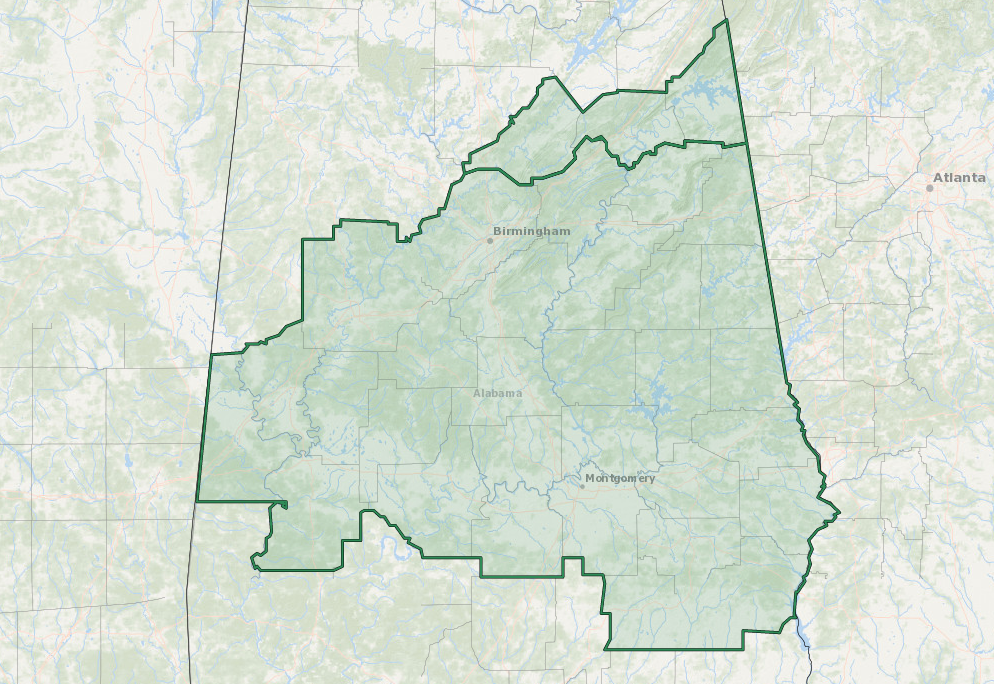
Blount, Cherokee, and Etowah counties were added to the Flash Flood Watch that already includes Autauga, Barbour, Bibb, Bullock, Calhoun, Chambers, Chilton, Clay, Cleburne, Coosa, Dallas, Elmore, Greene, Hale, Jefferson, Lee, Lowndes, Macon, Marengo, Montgomery, Perry, Pike, Randolph, Russell, Shelby, St. Clair, Sumter, Talladega, Tallapoosa, and Tuscaloosa counties in Central Alabama. The watch is set to start at 1:00 am Wednesday morning and is set to expire at 7:00 am Thursday morning.
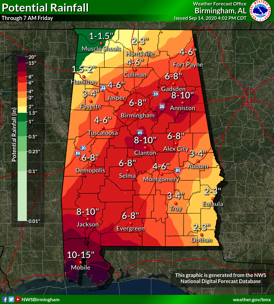
Potential rainfall amounts from now through 7:00 am Friday morning could reach as high as 8-10 inches in a few parts of the area while much of the are along and a little ways south of the I-59 corridor could see as much as 4-8 inches. The extreme southeastern portions could see 2-4 inches while the extreme northwestern parts could see 1-4 inches. Of course, there is the potential of a few localized areas receiving more than expected.
A Flash Flood Watch means that conditions may develop that lead to Flash Flooding. Flash Flooding is a very dangerous situation. You should monitor later forecasts and be prepared to take action should Flash Flood Warnings be issued. Do not attempt to cross a flooded area by foot or by vehicle. Turn around… don’t drown.
The next NHC update will be out on Hurricane Sally by 7:00 pm.
Category: Alabama's Weather, ALL POSTS, Tropical
About the Author (Author Profile)
Scott Martin is an operational meteorologist, professional graphic artist, musician, husband, and father. Not only is Scott a member of the National Weather Association, but he is also the Central Alabama Chapter of the NWA president. Scott is also the co-founder of Racecast Weather, which provides forecasts for many racing series across the USA. He also supplies forecasts for the BassMaster Elite Series events including the BassMaster Classic.Subscribe
If you enjoyed this article, subscribe to receive more just like it.


