

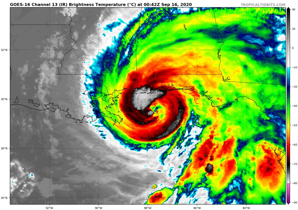
Sally Starting to Strengthen Again
…8 PM CDT POSITION AND INTENSITY UPDATE…
…SALLY A LITTLE STRONGER…
NHC is beginning hourly position updates for Hurricane Sally for as long as the eye remains well defined in NOAA Doppler radar images.
Data from an Air Force Reserve Hurricane Hunter aircraft indicate that Sally’s maximum winds have increased to near 85 mph (140 km/h). This new intensity will be incorporated into the next full advisory issued at 10 PM CDT. Some additional strengthening is possible before Sally’s center reaches the northern Gulf coast on Wednesday.
SUMMARY OF 800 PM CDT…0100 UTC…INFORMATION
———————————————–
LOCATION…29.7N 87.9W
ABOUT 70 MI…115 KM S OF MOBILE ALABAMA
ABOUT 70 MI…115 KM SW OF PENSACOLA FLORIDA
MAXIMUM SUSTAINED WINDS…85 MPH…140 KM/H
PRESENT MOVEMENT…N OR 010 DEGREES AT 2 MPH…4 KM/H
MINIMUM CENTRAL PRESSURE…972 MB…28.70 INCHES
Category: Alabama's Weather, ALL POSTS, Severe Weather, Tropical
About the Author (Author Profile)
Scott Martin is an operational meteorologist, professional graphic artist, musician, husband, and father. Not only is Scott a member of the National Weather Association, but he is also the Central Alabama Chapter of the NWA president. Scott is also the co-founder of Racecast Weather, which provides forecasts for many racing series across the USA. He also supplies forecasts for the BassMaster Elite Series events including the BassMaster Classic.Subscribe
If you enjoyed this article, subscribe to receive more just like it.


