

A Few Counties Removed from the Flash Flood Watch
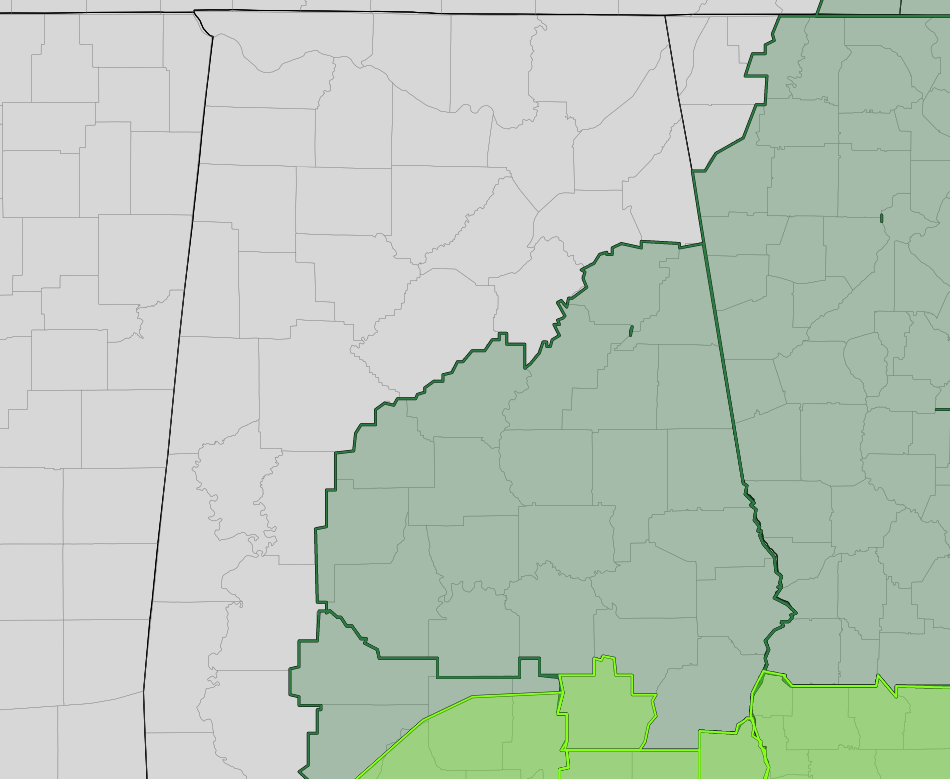
NWS Birmingham has removed Cherokee, Etowah, Hale, Marengo, and St. Clair counties from the Flash Flood Watch as flooding is no longer expected to pose a threat. Please continue to
heed and remaining road closures.
NWS Birmingham continues the Flash Flood Watch until 1:00 pm Thursday for Autauga, Barbour, Bibb, Bullock, Calhoun, Chambers, Chilton, Clay, Cleburne, Coosa, Dallas, Elmore, Lee, Lowndes, Macon, Montgomery, Perry, Pike, Randolph, Russell, Shelby, Talladega, and Tallapoosa counties in Central Alabama.
Periods of heavy rainfall are forecast to impact areas of Central Alabama today into Thursday in association with Sally. Forecast rainfall totals of 4 to 8 inches with locally higher amounts in the watch area could lead to significant flooding and flash flooding. This may become a life threatening situation, if you are near water or live in a low lying area, pay particular attention to warnings issued and be prepared to take quick action to move to higher ground.
Category: Alabama's Weather, ALL POSTS, Severe Weather, Tropical
About the Author (Author Profile)
Scott Martin is an operational meteorologist, professional graphic artist, musician, husband, and father. Not only is Scott a member of the National Weather Association, but he is also the Central Alabama Chapter of the NWA president. Scott is also the co-founder of Racecast Weather, which provides forecasts for many racing series across the USA. He also supplies forecasts for the BassMaster Elite Series events including the BassMaster Classic.Subscribe
If you enjoyed this article, subscribe to receive more just like it.


