

The Tropics Remain Very Active Even After Rene Dissipates & Sally is Weakening Well Inland
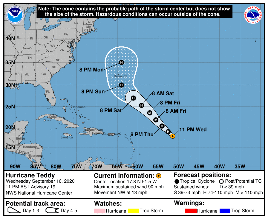
HURRICANE TEDDY
At 1100 PM AST (0300 UTC), the center of Hurricane Teddy was located
near latitude 17.8 North, longitude 51.5 West, or about 670 miles east-northeast of the Lesser Antilles. Teddy is moving toward the northwest near 13 mph (20 km/h), and this general motion is expected to continue through the weekend. Maximum sustained winds are near 90 mph (150 km/h) with higher gusts. Hurricane-force winds extend outward up to 35 miles (55 km) from the center and tropical-storm-force winds extend outward up to 255 miles (405 km). Strengthening is forecast during the next couple of days, and Teddy could become a major hurricane Thursday night or Friday. The estimated minimum central pressure is 976 MB (28.82 inches).
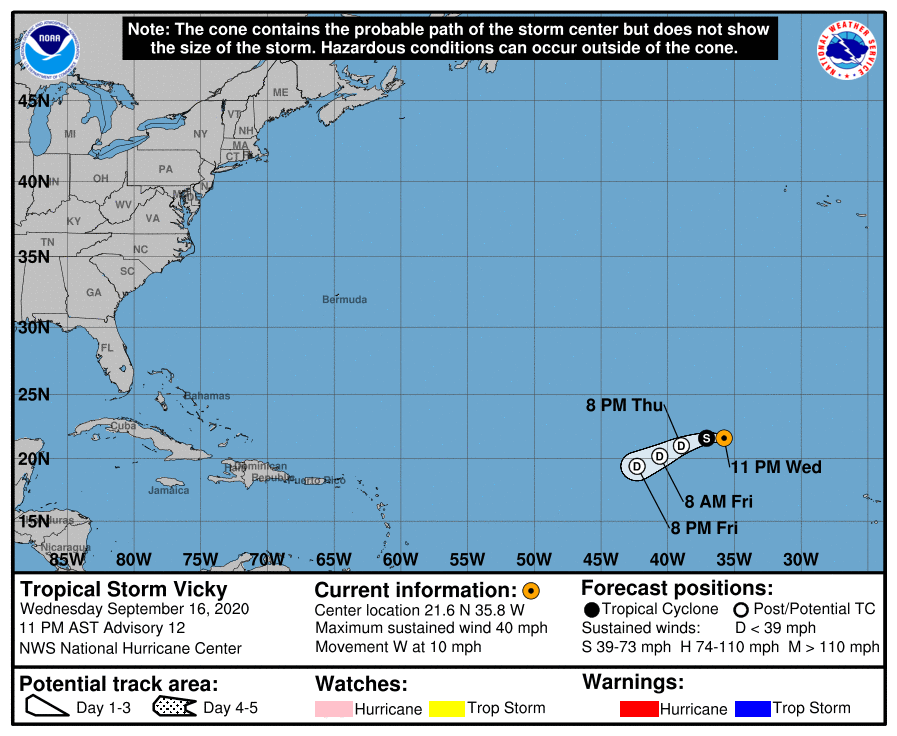
TROPICAL STORM VICKY
At 1100 PM AST (0300 UTC), the center of Tropical Storm Vicky was located near latitude 21.6 North, longitude 35.8 West, or about 860 miles west-northwest of the Cabo Verde Islands. Vicky is moving toward the west near 10 mph (17 km/h). This general motion is expected through Thursday morning, followed by a west-southwestward motion for a day or two after that. Maximum sustained winds are near 40 mph (65 km/h) with higher gusts. Tropical-storm-force winds extend outward up to 35 miles (55 km) from the center. Gradual weakening is anticipated, and Vicky is forecast to become a remnant low by late Thursday. The estimated minimum central pressure is 1008 MB (29.77 inches).

INVEST 90L
Showers and thunderstorms associated with a broad area of low pressure over the southwestern Gulf of Mexico have changed little in organization since yesterday. Upper-level winds are forecast to gradually become more conducive for development, and a tropical depression is likely to form late this week or over the weekend while the low meanders over the southern Gulf of Mexico.
* Formation chance through 48 hours…medium…50 percent.
* Formation chance through 5 days…high…70 percent.
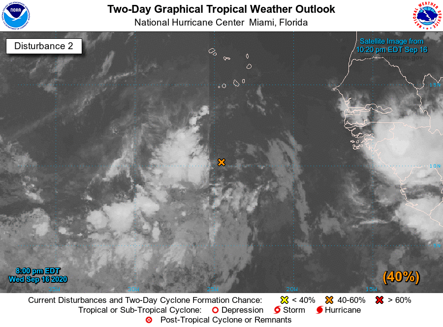
INVEST 98L
An elongated area of low pressure located a few hundred miles south of the Cabo Verde Islands is producing disorganized shower and thunderstorm activity. Environmental conditions are expected to be conducive for development during the next few days, and a tropical depression could form before upper-level winds become less favorable over the weekend. This system is forecast to move west-northwestward at 10 to 15 mph during the next several days.
* Formation chance through 48 hours…medium…40 percent.
* Formation chance through 5 days…medium…60 percent.
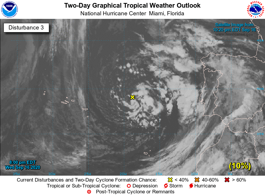
INVEST 99L
A non-tropical area of low pressure is located over the far northeastern Atlantic Ocean a few hundred miles east-northeast of the Azores. This system is forecast to move east-southeastward and then northeastward at about 10 mph over the next day or two, and its chances of acquiring some subtropical characteristics before it reaches the coast of Portugal late Friday appear to be decreasing. For more information on this system, see High Seas Forecasts issued by Meteo France.
* Formation chance through 48 hours…low…10 percent.
* Formation chance through 5 days…low…10 percent.
About the Author (Author Profile)
Scott Martin is an operational meteorologist, professional graphic artist, musician, husband, and father. Not only is Scott a member of the National Weather Association, but he is also the Central Alabama Chapter of the NWA president. Scott is also the co-founder of Racecast Weather, which provides forecasts for many racing series across the USA. He also supplies forecasts for the BassMaster Elite Series events including the BassMaster Classic.Subscribe
If you enjoyed this article, subscribe to receive more just like it.


