

Saturday Afternoon Update
After a cloudy and foggy start to the day, we are gradually seeing more sunshine as we roll into the afternoon hours. It is a warm Saturday afternoon across Central Alabama, now that we are seeing a mix of sun and clouds.
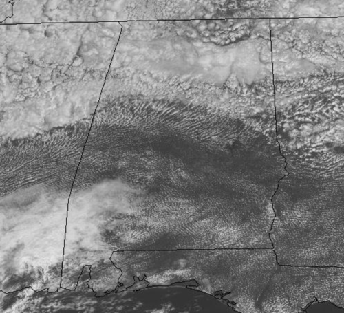
Temperatures this afternoon are in the 80s for most locations. Not much change in the forecast tomorrow with highs again in the 80s. Moisture levels will be on the rise so we are expecting some scattered showers/storms, mainly during the afternoon and evening hours.
MONDAY: Monday will partly sunny and warm with scattered showers and storms with highs in the low to mid-80s. Late Monday and into Tuesday a strong cold front will dive into Alabama, bringing with it higher rain chances Monday night and Tuesday.
TUESDAY FRONT: Tuesday will have clouds and showers with noticeably cooler temperatures as highs on Tuesday will be around the 70 degree mark. The front will bring with it a much cooler, drier, and refreshing air mass to the state.
REST OF WEEK: For Wednesday through Friday, expect days full of sunshine, with highs well down into the 70s, and lows in the upper 40s and low 50s. Even colder weather looks to arrive by the first weekend of October with highs perhaps in the 60s, and we may see lows down into the 30s, and even perhaps some patchy frost across North Alabama.
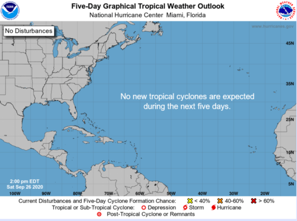
IN THE TROPICS: All is quiet and no development is expected through the next five days across the Atlantic Basin. Remember hurricane season runs through the end November, so we still have plenty of time time to add to an already historic season.
BEACH FORECAST CENTER: Get the latest weather and rip current forecasts for the beaches from Fort Morgan to Panama City on our Beach Forecast Center page. There, you can select the forecast of the region that you are interested in visiting.
WORLD TEMPERATURE EXTREMES: Over the last 24 hours, the highest observation outside the U.S. was 113.9F at Rivadavia, Argentina. The lowest observation was -91.1F at Amundsen-Scott South Pole Station, Antarctica.
CONTIGUOUS TEMPERATURE EXTREMES: Over the last 24 hours, the highest observation was 108F Brawley, CA. The lowest observation was 27F at Estcourt Station, ME.
WEATHER ON THIS DATE IN 1936: Denver, CO, was buried under 21.3 inches of snow, 19.4 inches of which fell in 24 hours. The heavy wet snow snapped trees and wires causing seven million dollars damage.
Category: Alabama's Weather, ALL POSTS
About the Author (Author Profile)
Macon, Georgia Television Chief Meteorologist, Birmingham native, and long time Contributor on AlabamaWX. Stormchaser. I did not choose Weather, it chose Me. College Football Fanatic. @Ryan_StinnetSubscribe
If you enjoyed this article, subscribe to receive more just like it.


