

Noon Forecast Update: Patches of Light Rain Today; Sunnier/Warmer Tomorrow; Perfect for Midweek; Cooler by Weekend
Persistent pesky patches of precipitation are the result of the remnant low of Hurricane Delta on this Sunday.
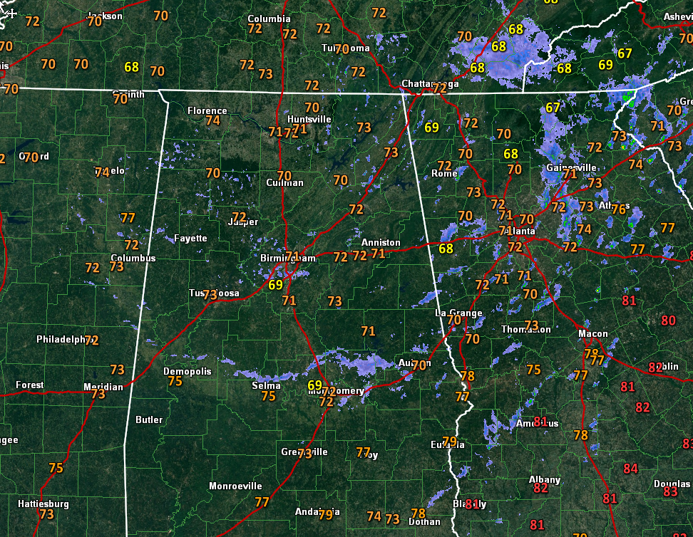
They are widespread across all of North and Central Alabama and will make outdoor activities a little uncomfortable in spots this afternoon.
Temperatures are in the lower 70s north and middle and upper 70s south as clouds hang tough.
80s will return on Monday. Although the day will start mostly cloudy, sunshine should gradually return allowing for the warm-up.
A dry cold front Monday night will bring perfect to town for Tuesday, Wednesday, and Thursday with highs in the upper 70s to lower 80s and lows in the 50s along with sunny skies.
Another front late Thursday will bring much cooler weather for the weekend with 40s for lows and highs limited to the upper 60s and lower 70s. There is a slight chance of a shower on Friday with that front, but it is not worth mentioning at this time.
Category: Alabama's Weather, ALL POSTS
About the Author (Author Profile)
Bill Murray is the President of The Weather Factory. He is the site's official weather historian and a weekend forecaster. He also anchors the site's severe weather coverage. Bill Murray is the proud holder of National Weather Association Digital Seal #0001 @wxhistorianSubscribe
If you enjoyed this article, subscribe to receive more just like it.


