A Brief Check on Our Weather Before 5:00 am
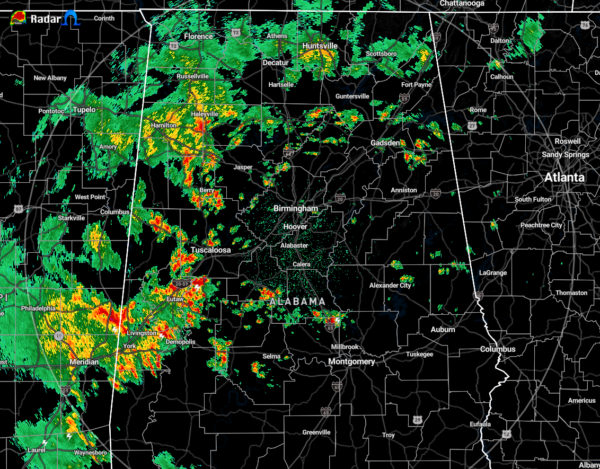
At 4:48 am, we have a good bit of shower and thunderstorm activity mainly along and west of the I-59 corridor as the cold front is making its way across the northwestern part of North/Central Alabama. While nothing is particularly strong at the moment, we do have a good bit of lightning in portions of Greene and Hale counties. These storms are moving to the north-northeast while the overall push is very slow to the east.
Temperatures were in the lower 60s to the lower 70s as of the 4:00 am roundup. Gadsden was the cool spot at 63 degrees while Birmingham and Montgomery were the warm spots at 71 degrees.
While a storm or two may briefly become strong out ahead of the cold front, severe weather will not be a big threat to your Saturday across the area. We may see a storm briefly become severe with strong winds as we did on Friday, but the overall odds of that are low. Gusty winds and small hail may be possible in any stronger storms.
Category: Alabama's Weather, ALL POSTS


