

Tropical Depression Twenty-Eight Forms Over the Caribbean; Tropical Storm Watch Issued for Western Cuba
SUMMARY OF 500 PM EDT…2100 UTC…INFORMATION (FROM NHC)
———————————————————
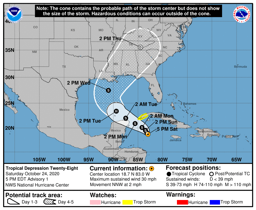
LOCATION…18.7N 83.0W
ABOUT 255 MI…405 KM SSE OF THE WESTERN TIP OF CUBA
ABOUT 280 MI…455 KM ESE OF COZUMEL MEXICO
MAXIMUM SUSTAINED WINDS…30 MPH…45 KM/H
PRESENT MOVEMENT…NNW OR 345 DEGREES AT 2 MPH…4 KM/H
MINIMUM CENTRAL PRESSURE…1005 MB…29.68 INCHES
WATCHES AND WARNINGS
——————–
A Tropical Storm Watch is in effect for…
* Pinar del Rio Cuba
DISCUSSION AND OUTLOOK
———————-
At 500 PM EDT (2100 UTC), the center of Tropical Depression Twenty-Eight was located near latitude 18.7 North, longitude 83.0 West. The depression is moving toward the north-northwest near 2 mph (4 km/h), and this motion is expected to continue through early Sunday. The system should gradually turn toward the west-northwest with a faster forward speed by Monday. On the forecast track, the center of the depression is anticipated to remain south of Cuba tomorrow and approach the Yucatan Channel or Yucatan Peninsula late Monday before emerging into the southern Gulf of Mexico on Tuesday.
Maximum sustained winds are near 30 mph (45 km/h) with higher gusts. Slow strengthening is forecast during the next 72 hours, and the system is expected to become a tropical storm on Sunday and could become a hurricane over the southern Gulf of Mexico on Tuesday.
The estimated minimum central pressure based on NOAA Hurricane Hunter aircraft data is 1005 MB (29.68 inches).
HAZARDS AFFECTING LAND
———————-
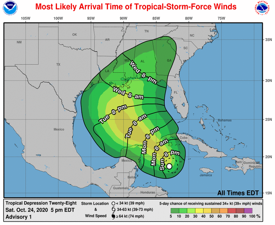
RAINFALL: Across portions of central and western Cuba, the Cayman Islands, Jamaica, the northeast Yucatan Peninsula of Mexico, southern Florida, and the Florida Keys, storm total rainfall of 4 to 8 inches with local amounts of 12 inches are possible through Wednesday.
WIND: Tropical-storm conditions are possible in the watch area on Monday.
About the Author (Author Profile)
Scott Martin is an operational meteorologist, professional graphic artist, musician, husband, and father. Not only is Scott a member of the National Weather Association, but he is also the Central Alabama Chapter of the NWA president. Scott is also the co-founder of Racecast Weather, which provides forecasts for many racing series across the USA. He also supplies forecasts for the BassMaster Elite Series events including the BassMaster Classic.Subscribe
If you enjoyed this article, subscribe to receive more just like it.


