

Zeta To Bring Rain To Alabama Wednesday/Thursday
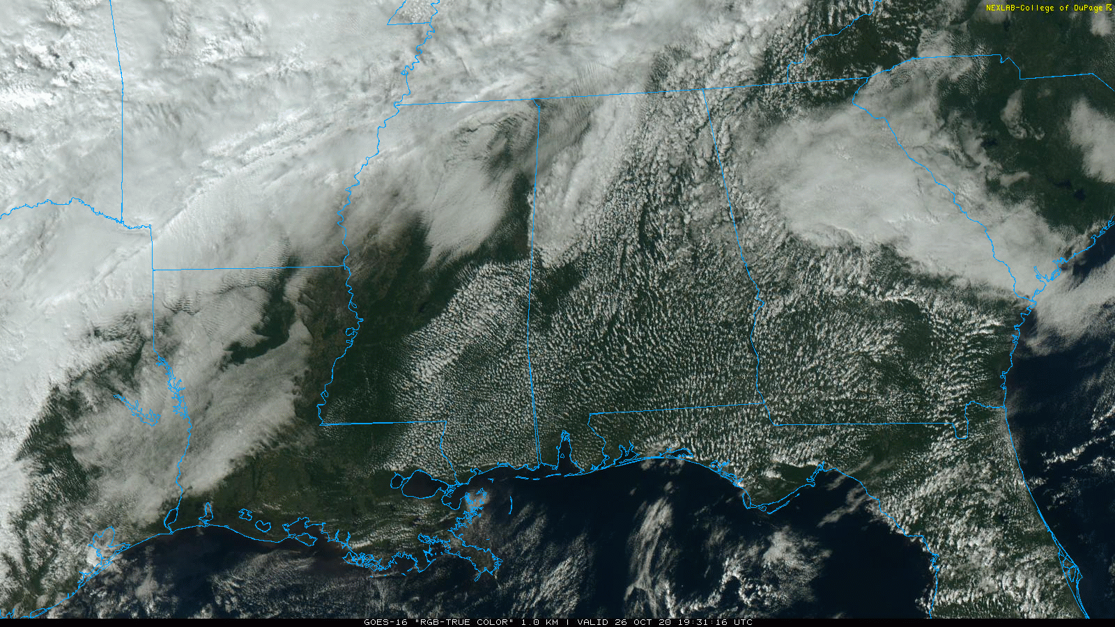
PARTLY SUNNY, MILD MONDAY AFTERNOON: Temperatures are mostly in the mid 70s across Alabama this afternoon with a partly sunny sky. No rain on radar, and the weather stays dry tonight. Tomorrow will be a tad warmer, with low 80s in most spots. A few scattered showers could show up tomorrow afternoon over the southern half of the state, but North Alabama will remain dry.
TROPICAL RAIN: Zeta has become a hurricane this afternoon, with sustained winds of 80 mph… it will move across the tip of the Yucatan Peninsula tonight, and then into the Gulf of Mexico tomorrow. Landfall should come Wednesday evening over Southeast Louisiana as an upper end tropical storm or minimal hurricane. A hurricane watch will be issued shortly for parts of the Central Gulf Coast by NHC.
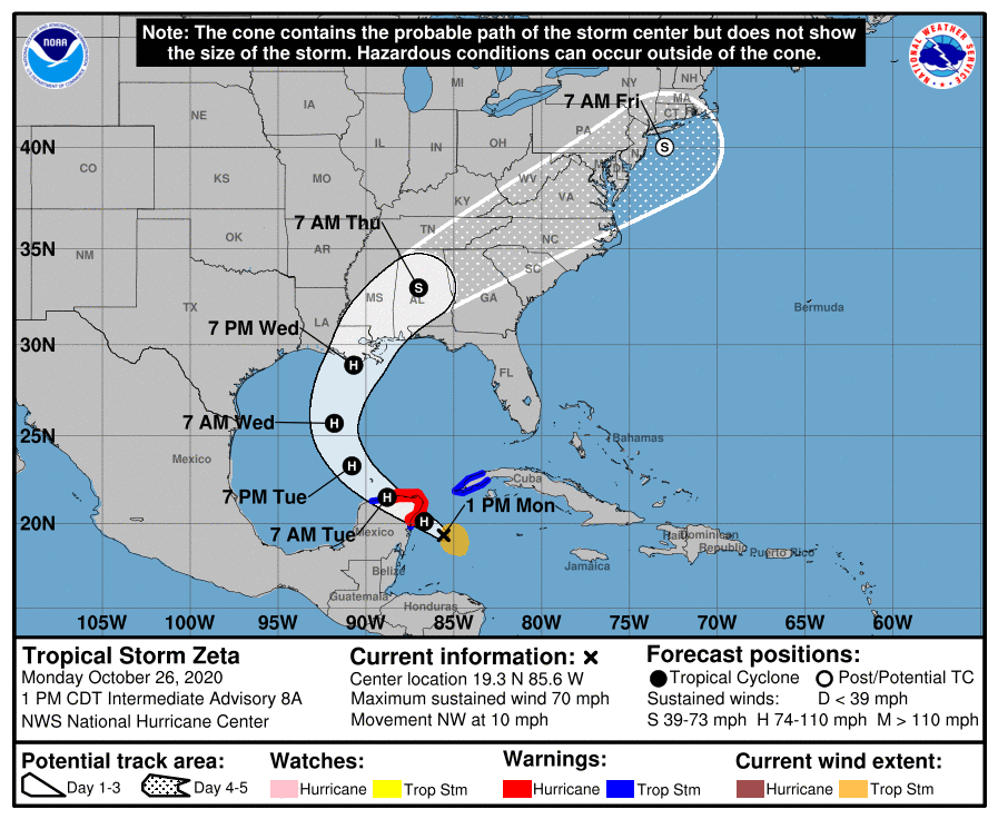
The remnant circulation will move through Alabama Wednesday night and early Thursday.
Just a reminder… the “dots” on a tracking map once a tropical system is inland don’t really represent the most significant impact. Most of the rain is displaced to the north and east of the center once inland, and the risk of isolated tornadoes is south of the track.
Some evening notes on Zeta…
*A tropical storm watch is in effect for the Alabama Gulf Coast and inland parts of Southwest Alabama. The tropical storm watch extends east to the Walton/Okaloosa County line in the Florida Panhandle.
*Winds could gust to 50 mph along the Alabama coast Wednesday and Wednesday night, and to 45 mph at places like Pensacola and Navarre Beach.
*Inland, winds to 45 mph are possible across parts of Southwest and Central Alabama Wednesday night. A few trees could be blown down, but major tree and power line damage is not expected.
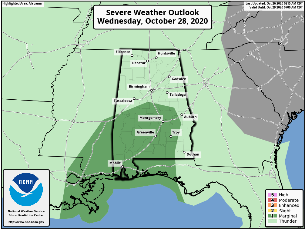
*A few isolated tornadoes are possible over the southern half of Alabama Wednesday night. A “marginal risk” (level 1/5) has been defined.
*Dangerous rip currents are likely along the coast from Gulf Shores to Panama City Beach tomorrow and Wednesday.
*Rain amounts will be heaviest across Southwest Alabama, where amounts of 3-4 inches are expected. Most other parts of Alabama will see 1-3 inches. Major flooding issues are not expected since Zeta will be moving along quickly.
*For most places, the significant rain will be over by midday Thursday.
Remember, this is a tropical system and the situation could change, so keep up with the latest updates over the next few days.
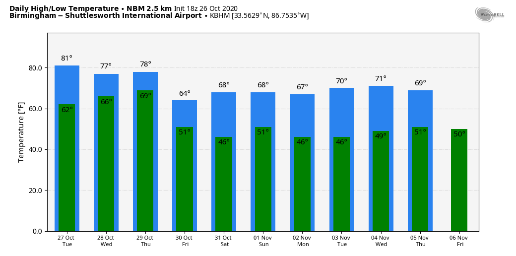
FRIDAY AND THE WEEKEND: We are expecting some very nice autumn weather for Friday and Saturday; a good supply of sunshine both days with highs around 70 degrees. Sunday will be partly sunny, and an upper trough could bring a few showers to the southeast part of the state. The high Sunday will be in the 67-70 degree range.
NEXT WEEK: For now the week looks mostly dry with seasonal temperatures; See the Weather Xtreme video for maps, graphics, and more details.
TIME CHANGE: Don’t forget we go back on standard time this weekend; set your clocks back one your before going to bed Saturday night. Sunset Sunday for Birmingham comes at 4:54p CT.
ON THIS DATE IN 1952: There have been thousands of weather reconnaissance and research flights into hurricanes in the Atlantic and Pacific since the mid-1940s. There have been several close calls, but only four flights have been lost. A B-29 Super-fortress flight into Super Typhoon Wilma 350 miles east of Leyte in the Philippines disappeared on this date. No trace was ever found of the plane or crew. In the last report, the flight was in the Super typhoon’s strongest winds, which were around 160 mph.
BEACH FORECAST: Click here to see the AlabamaWx Beach Forecast Center page.
WEATHER BRAINS: Don’t forget you can listen to our weekly 90 minute show anytime on your favorite podcast app. This is the show all about weather featuring many familiar voices, including our meteorologists here at ABC 33/40.
CONNECT: You can find me on all of the major social networks…
Facebook
Twitter
Instagram
Pinterest
Snapchat: spannwx
Look for the next Weather Xtreme video here by 7:00 a.m. tomorrow…
Category: Alabama's Weather, ALL POSTS, Weather Xtreme Videos
About the Author (Author Profile)
James Spann is one of the most recognized and trusted television meteorologists in the industry. He holds the AMS CCM designation and television seals from the AMS and NWA. He is a past winner of the Broadcast Meteorologist of the Year from both professional organizations.Subscribe
If you enjoyed this article, subscribe to receive more just like it.


