

Tornado Threat Increasing Over Southeastern Mississippi/Southwestern Alabama
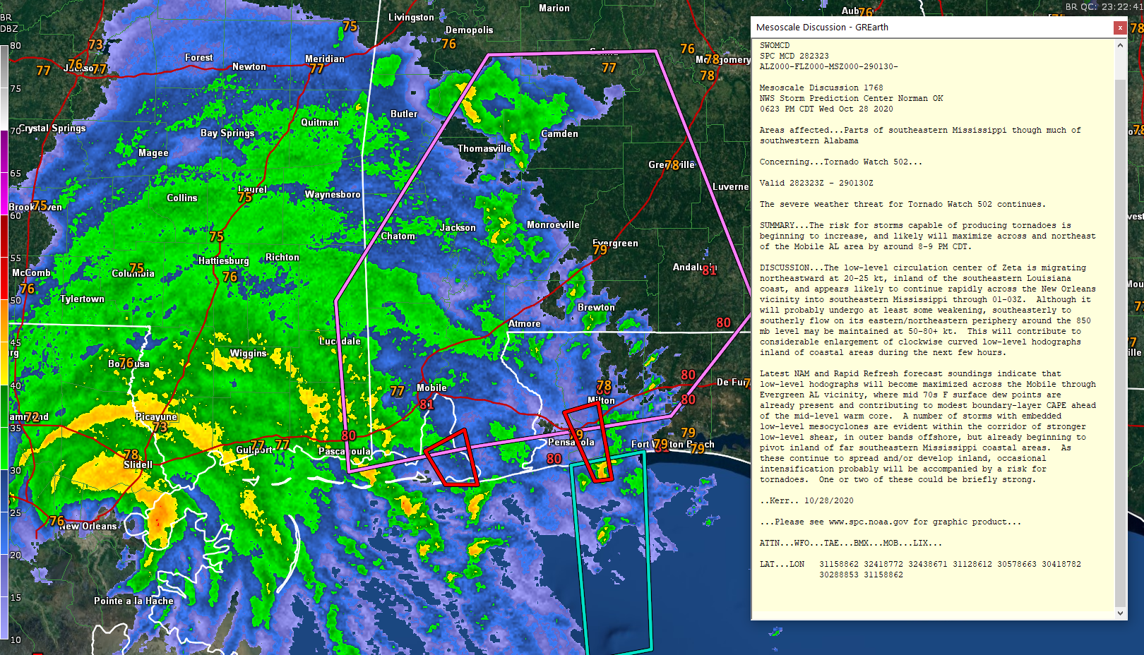
Mesoscale Discussion 1768
NWS Storm Prediction Center Norman OK
0623 PM CDT Wed Oct 28 2020
Areas affected…Parts of southeastern Mississippi though much of
southwestern Alabama
Concerning…Tornado Watch 502…
Valid 282323Z – 290130Z
The severe weather threat for Tornado Watch 502 continues.
SUMMARY…The risk for storms capable of producing tornadoes is
beginning to increase, and likely will maximize across and northeast
of the Mobile AL area by around 8-9 PM CDT.
DISCUSSION…The low-level circulation center of Zeta is migrating
northeastward at 20-25 kt, inland of the southeastern Louisiana
coast, and appears likely to continue rapidly across the New Orleans
vicinity into southeastern Mississippi through 01-03Z. Although it
will probably undergo at least some weakening, southeasterly to
southerly flow on its eastern/northeastern periphery around the 850
mb level may be maintained at 50-80+ kt. This will contribute to
considerable enlargement of clockwise curved low-level hodographs
inland of coastal areas during the next few hours.
Latest NAM and Rapid Refresh forecast soundings indicate that
low-level hodographs will become maximized across the Mobile through
Evergreen AL vicinity, where mid 70s F surface dew points are
already present and contributing to modest boundary-layer CAPE ahead
of the mid-level warm core. A number of storms with embedded
low-level mesocyclones are evident within the corridor of stronger
low-level shear, in outer bands offshore, but already beginning to
pivot inland of far southeastern Mississippi coastal areas. As
these continue to spread and/or develop inland, occasional
intensification probably will be accompanied by a risk for
tornadoes. One or two of these could be briefly strong.
..Kerr.. 10/28/2020
Category: Alabama's Weather, ALL POSTS, Severe Weather, Tropical
About the Author (Author Profile)
Bill Murray is the President of The Weather Factory. He is the site's official weather historian and a weekend forecaster. He also anchors the site's severe weather coverage. Bill Murray is the proud holder of National Weather Association Digital Seal #0001 @wxhistorianSubscribe
If you enjoyed this article, subscribe to receive more just like it.


