

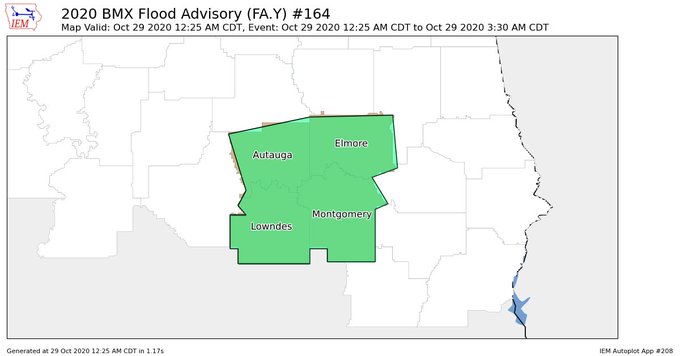
Flood Advisory for Autauga, Elmore, Lowndes, & Montgomery Counties Until 3:30 am
The National Weather Service in Birmingham has issued a
* Urban and Small Stream Flood Advisory for…
Autauga County in central Alabama…
Elmore County in east central Alabama…
Lowndes County in south central Alabama…
Montgomery County in south central Alabama…
* Until 330 AM CDT.
* At 1225 AM CDT, Doppler radar indicated heavy rain due to
thunderstorms. This will cause urban and small stream flooding.
Between 1 and 2 inches of rain have fallen.
Some locations that will experience flooding include…
Montgomery, Prattville, Millbrook, Wetumpka, Tallassee, Fort
Deposit, Mosses, Hayneville, Meadville, Pike Road, Elmore,
Coosada, Deatsville, Eclectic, Autaugaville, White Hall,
Gordonville, Billingsley, Lowndesboro and Benton.
Additional rainfall of 1 to 2 inches is expected over the area. This
additional rain will result in minor flooding.
PRECAUTIONARY/PREPAREDNESS ACTIONS…
Turn around, don’t drown when encountering flooded roads. Most flood
deaths occur in vehicles.
Excessive runoff from heavy rainfall will cause flooding of small
creeks and streams, urban areas, highways, streets and underpasses
as well as other drainage areas and low lying spots.
Category: Alabama's Weather, ALL POSTS, Severe Weather, Tropical
About the Author (Author Profile)
Scott Martin is an operational meteorologist, professional graphic artist, musician, husband, and father. Not only is Scott a member of the National Weather Association, but he is also the Central Alabama Chapter of the NWA president. Scott is also the co-founder of Racecast Weather, which provides forecasts for many racing series across the USA. He also supplies forecasts for the BassMaster Elite Series events including the BassMaster Classic.Subscribe
If you enjoyed this article, subscribe to receive more just like it.


