

Showers End This Evening; Dry Tomorrow With Lower Humidity
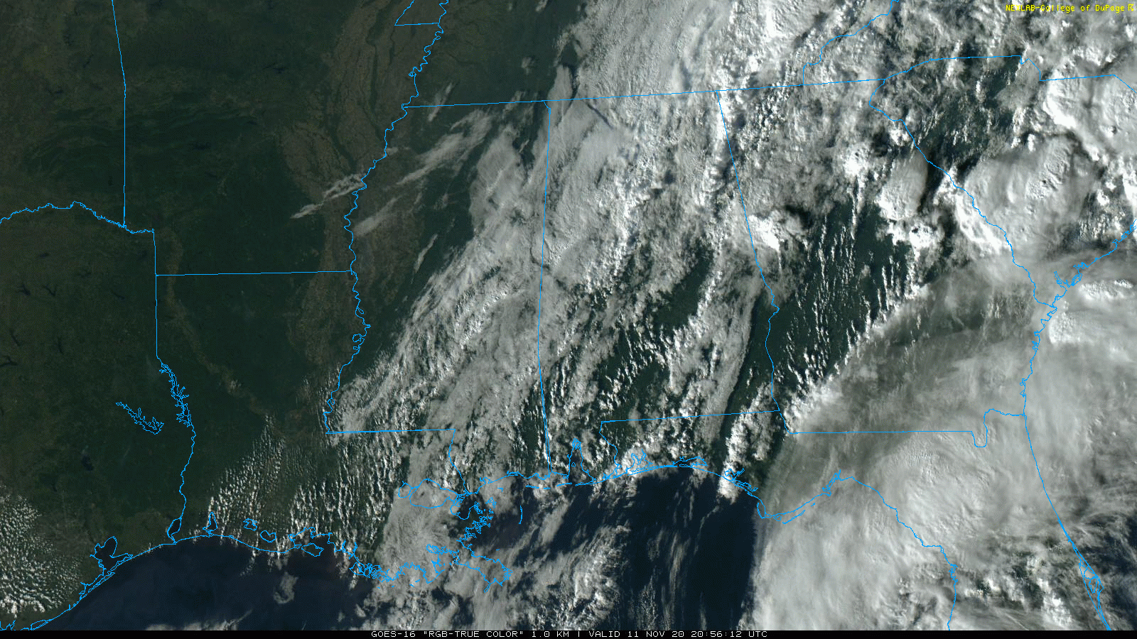
RADAR CHECK: Showers continue across much of Alabama this afternoon ahead of a cold front near the northwest corner of the state. Showers will end from west to east early tonight as dry air begins to push into the state.
Humidity levels will be much lower tomorrow; the sky will become mostly sunny with a high in the mid 70s. Friday will be picture perfect autumn day with sunshine in full supply; after a low in the upper 40s the high will be in the low 70s.
THE ALABAMA WEEKEND: Saturday will be another fine fall day. The low early Saturday will be in the 40-45 degree range, then we warm into the mid 70s by afternoon with a good supply of sunshine. Then, on Sunday, we will mention some risk of scattered showers during the afternoon and evening hours ahead of the next cold front, but moisture will be very limited and rain amounts should be light and spotty. Sunday’s high will be in the 70s with a partly sunny sky.
NEXT WEEK: The week will be dry and much cooler; expect highs in the 60s and lows in the 30s and 40s. Widespread frost seems likely by early Tuesday morning with a clear sky and light wind. See the Weather Xtreme video for maps, graphics, and more details.

ETA: Eta briefly reached hurricane strength in the Southeast Gulf of Mexico this morning, but it is back to tropical storm strength this afternoon with sustained winds of 70 mph. It will make landfall north of Tampa Bay tomorrow, and will emerge into the Atlantic tomorrow night.
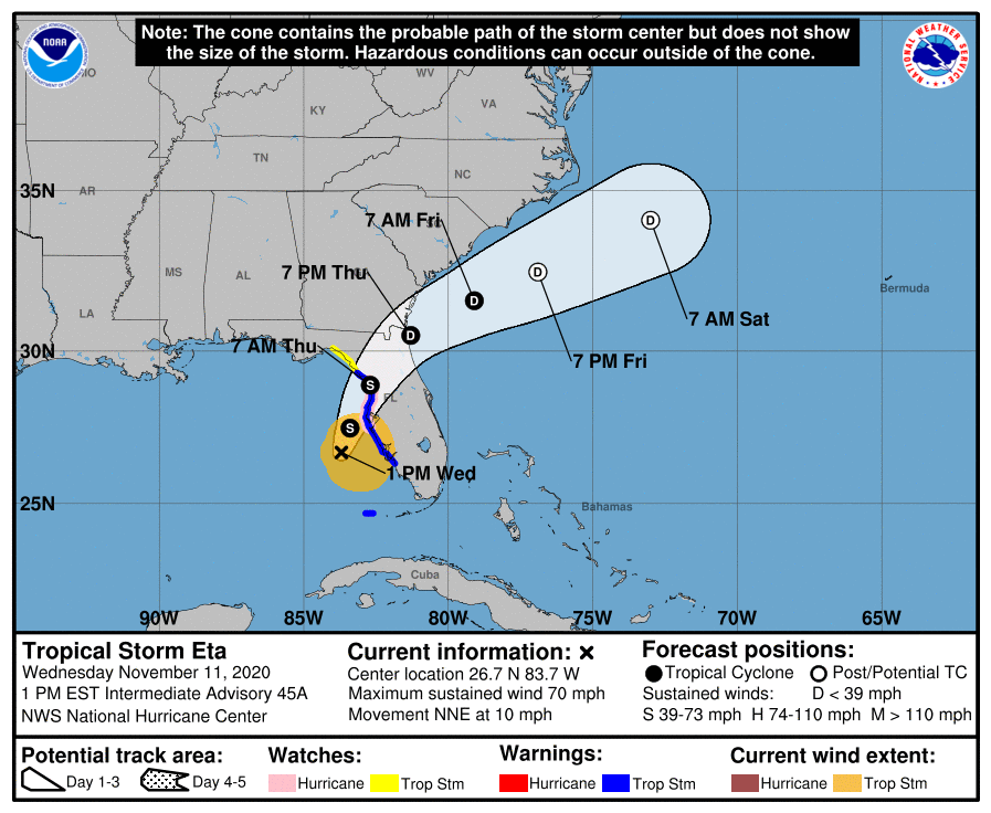
Eta will have no impact on Alabama’s weather.
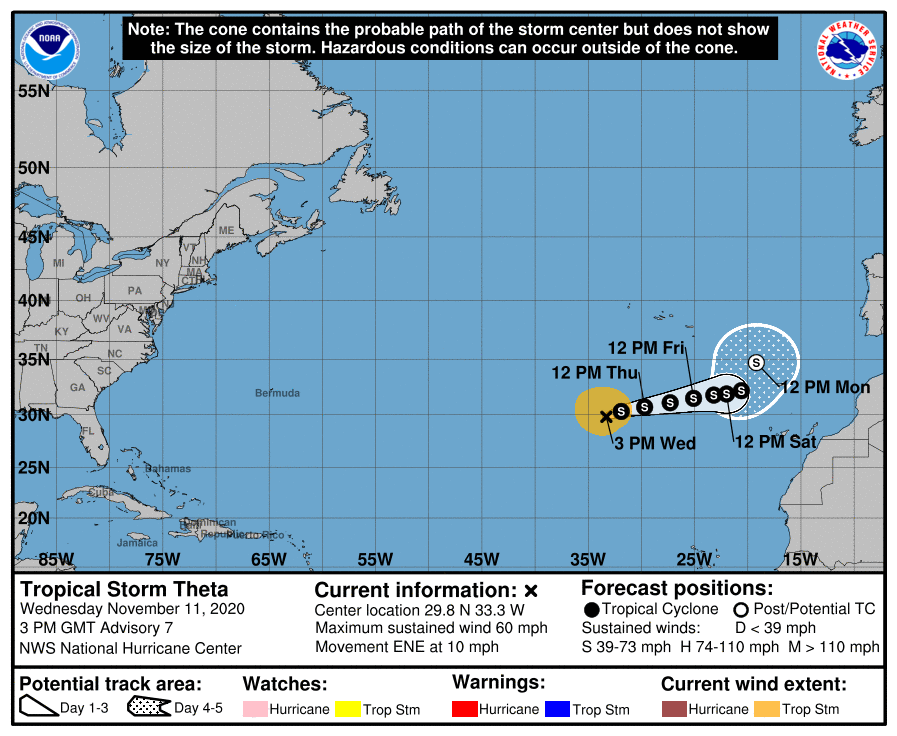
THETA: Tropical storm Theta is in the eastern Atlantic, moving to the east. No threat to the U.S… it will become post-tropical early next week southwest of Portugal.
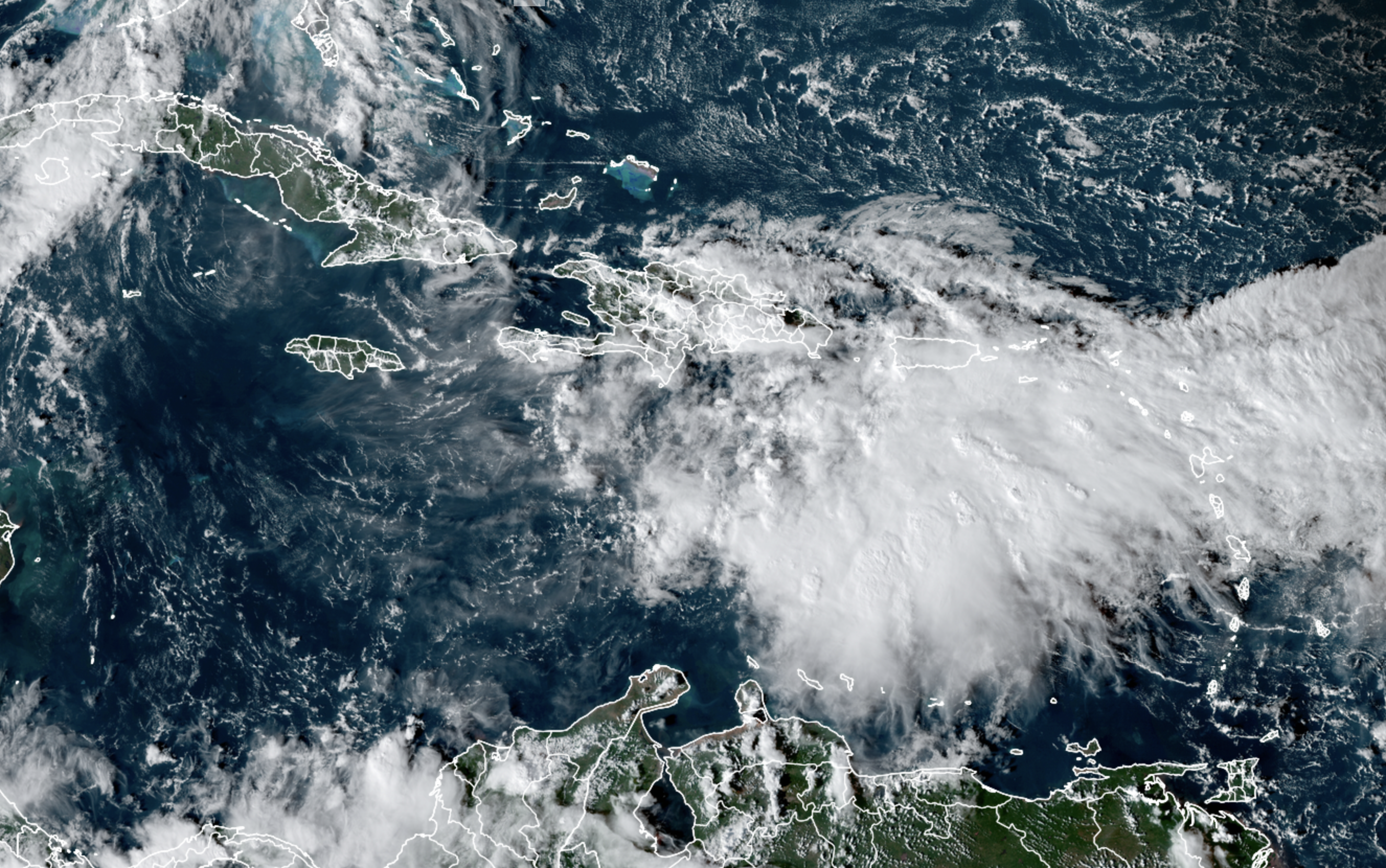
INVEST 98L: A tropical wave located over the east-central Caribbean Sea is producing a large area of disorganized showers and thunderstorms. The wave is expected to move slowly westward into more conducive environmental conditions over the next several days, and a tropical depression is likely to form late this week or this weekend when the disturbance reaches the central or western Caribbean Sea. Regardless of development, this system is expected to bring heavy rainfall along with possible flash flooding to the Virgin Islands, Puerto Rico, and portions of Hispaniola over the next day or so. If it reaches tropical storm strength, the name will be “Iota”.
ON THIS DATE IN 1940: An Armistice Day storm raged across the Great Lakes Region and the Upper Midwest. A blizzard left 49 dead in Minnesota, and gales on Lake Michigan caused shipwrecks resulting in another 59 deaths. Up to seventeen inches of snow fell in Iowa, and at Duluth MN the barometric pressure reached 28.66 inches. The blizzard claimed a total of 154 lives and killed thousands of cattle in Iowa. Huge snowdrifts isolated whole towns.
BEACH FORECAST: Click here to see the AlabamaWx Beach Forecast Center page.
WEATHER BRAINS: Don’t forget you can listen to our weekly 90 minute show anytime on your favorite podcast app. This is the show all about weather featuring many familiar voices, including our meteorologists here at ABC 33/40.
CONNECT: You can find me on all of the major social networks…
Look for the next Weather Xtreme video here by 7:00 a.m. tomorrow…
Category: Alabama's Weather, ALL POSTS, Weather Xtreme Videos
About the Author (Author Profile)
James Spann is one of the most recognized and trusted television meteorologists in the industry. He holds the AMS CCM designation and television seals from the AMS and NWA. He is a past winner of the Broadcast Meteorologist of the Year from both professional organizations.Subscribe
If you enjoyed this article, subscribe to receive more just like it.


