

Some Tropical Mischief Could Form Late Into the Work Week Behind Iota
While Iota continues to move toward Central America currently as a category 2 hurricane with maximum sustained winds of 100 MPH, we are just a few days away from the potential of a new tropical system developing over the Caribbean Sea. Here is the latest information from the National Hurricane Center on this latest potential system:
For the North Atlantic, Caribbean Sea, and the Gulf of Mexico:
The National Hurricane Center is issuing advisories on Hurricane Iota, located over the southwestern Caribbean Sea.
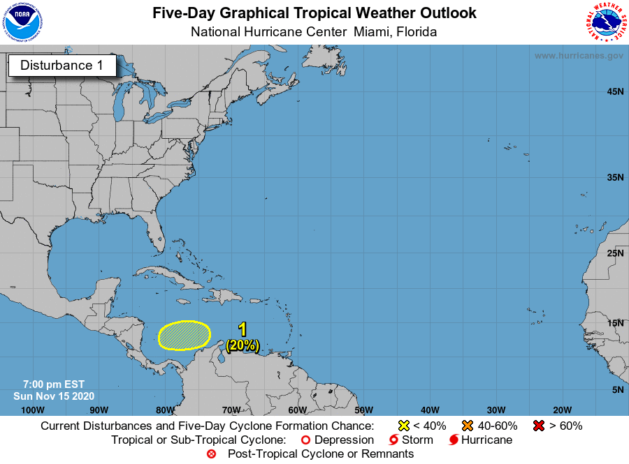
An area of low pressure could form in a few days over the central or southwestern Caribbean Sea. Development, if any, of this system should be slow to occur late this week while it moves slowly westward across the southwestern Caribbean Sea.
* Formation chance through 48 hours…low…near 0 percent.
* Formation chance through 5 days…low…20 percent.
As this system has not developed yet, there are not any tropical model depictions. Once the low starts to develop and garners an Invest name, then those model depictions will start to come out.
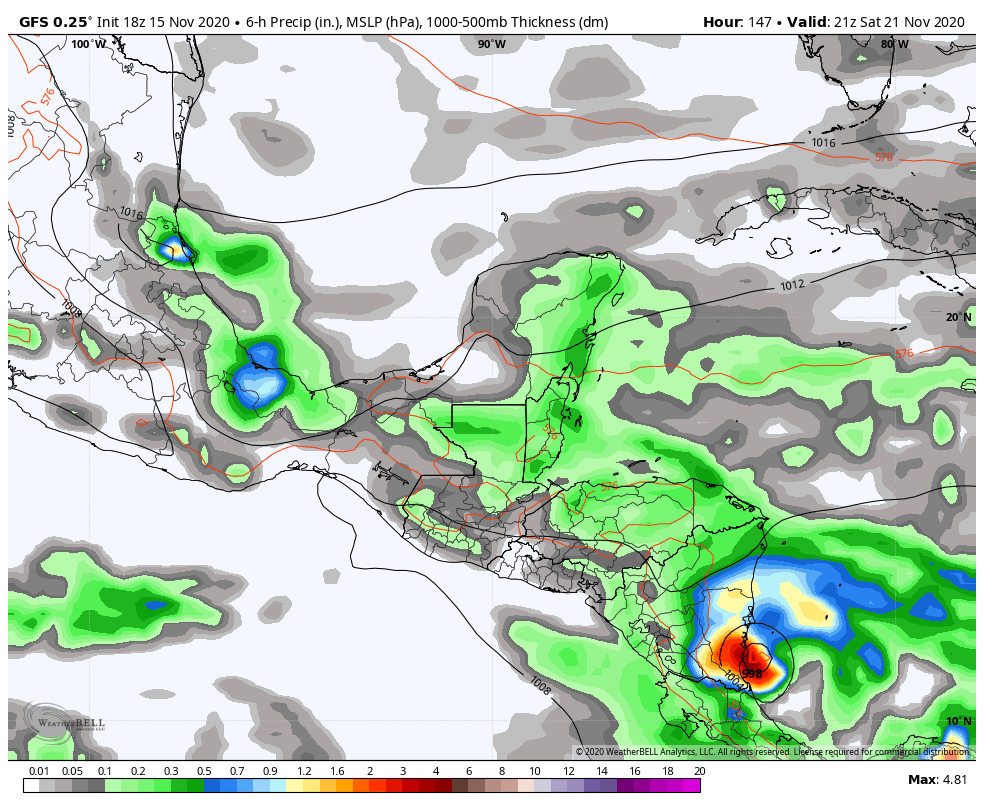
The good news is that the GFS is keeping this new system from becoming well-developed and may just be a weak tropical storm or a depression moving onshore in the southern parts of Nicaragua and the northern parts of Costa Rica on Saturday afternoon and evening. The bad news is that this will send even more heavy rains into an area that will have already experienced two major hurricanes within a two-week period. Even better news is that the European doesn’t even show a system out there to worry about after Iota.
We’ll have updates if anything forms out of this. There are no threats to the US Mainland over the Gulf of Mexico or the Atlantic Ocean.
About the Author (Author Profile)
Scott Martin is an operational meteorologist, professional graphic artist, musician, husband, and father. Not only is Scott a member of the National Weather Association, but he is also the Central Alabama Chapter of the NWA president. Scott is also the co-founder of Racecast Weather, which provides forecasts for many racing series across the USA. He also supplies forecasts for the BassMaster Elite Series events including the BassMaster Classic.Subscribe
If you enjoyed this article, subscribe to receive more just like it.


