

Quiet Weather Continues Through The Weekend
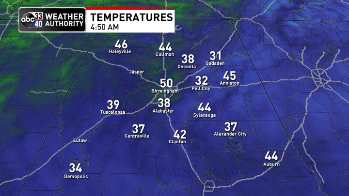
30s, 40s, and 50s: This morning is a good example of why it is best to use a range of temperatures when forecasting lows on a clear, calm morning across Alabama. Almost a 20 degree spread across the state (31 in Gadsden, 50 in Birmingham just before sunrise). Variations are due to wind, elevation, and UHI (the Urban Heat Island effect in Birmingham).
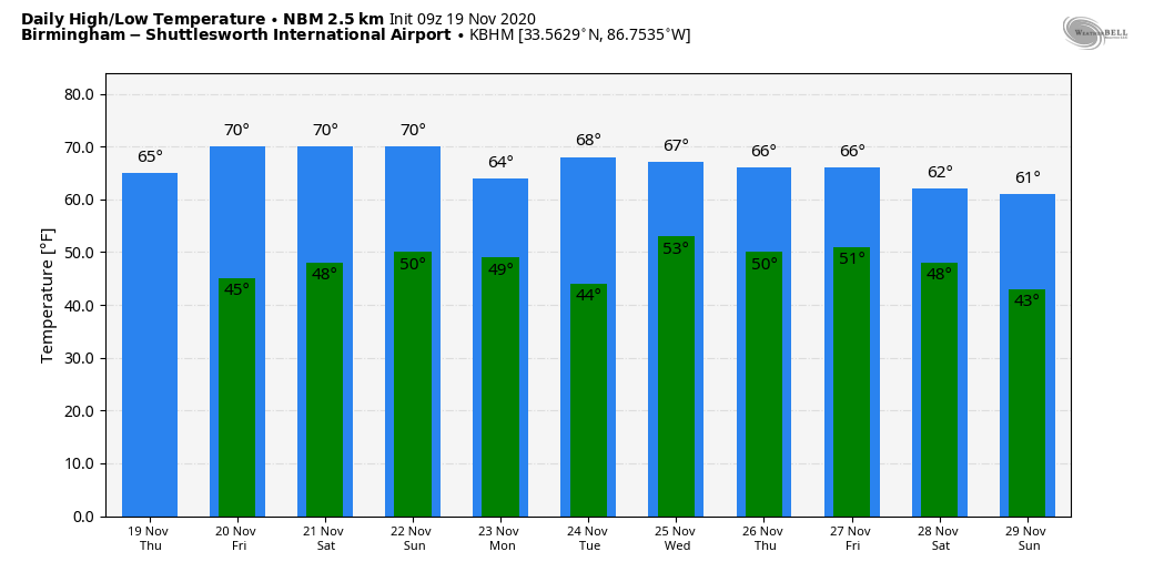
Sunny weather continues across Alabama today and tomorrow with a slow warming trend; the high today will be in the mid 60s, then close to 70 tomorrow.
THE ALABAMA WEEKEND: Saturday will be another sunny day with a high in the low 70s. Moisture levels begin to creep up Sunday, but for now the risk of a shower looks very low. Otherwise, we expect a partly sunny sky Sunday with a high in the mid 70s.
THANKSGIVING WEEK: For now the chance of rain looks very low Monday and Tuesday, but models are beginning to agree on the potential for a fairly dynamic storm system to form over the Central U.S. that would bring rain and thunderstorms to Alabama on Wednesday. The synoptic scale pattern would suggest potential for strong storms (this is the core of the late fall severe weather season in Alabama), but the amount of instability remains in question. Just too early to know if severe storms will be an issue, but clearly something to watch as we get closer. Dry air returns for Thanksgiving Day and “Black Friday” with highs in the 60s. See the Weather Xtreme video for maps, graphics, and more details.
FOOTBALL WEATHER: For the high school playoff games tomorrow night, the sky will be clear with temperatures falling through the 50s. Saturday, Alabama hosts Kentucky (3:00p CT kickoff at Bryant Denny Stadium)… the sky will be sunny with temperatures in the low 70s at kickoff, falling back into the 60s during the second half.
Auburn hosts Tennessee Saturday evening (6:00p kickoff at Jordan Hare Stadium)… a great night for football with a clear sky. Temperatures will fall from the low 60s at kickoff, into the upper 50s by the final whistle.
TROPICS: For the first time since late October we have no named tropical systems in the Atlantic basin. NHC is watching two areas for development; one in the Southwest Caribbean, and another one northeast of the Bahamas. Both have a low chance of development for now, and the Gulf of Mexico remains very quiet.
ON THIS DATE IN 1930: An estimated F4 tornado struck the town of Bethany, Oklahoma. Between 9:30 am and 9:58 am CST, it moved north-northeast from 3 miles west of the Oklahoma City limits, and hit the eastern part of Bethany. About 110 homes and 700 other buildings, or about a fourth of the town, were damaged or destroyed. Near the end of the damage path, 3.5 miles northeast of Wiley Post Airfield, the tornado hit the Camel Creek School. Buildings blew apart just as the students were falling to the floor and looking for shelter, and five students and a teacher were killed. A total of 23 people were killed and another 150 injured, with 77 being seriously injured.
BEACH FORECAST: Click here to see the AlabamaWx Beach Forecast Center page.
WEATHER BRAINS: Don’t forget you can listen to our weekly 90 minute show anytime on your favorite podcast app. This is the show all about weather featuring many familiar voices, including our meteorologists here at ABC 33/40.
CONNECT: You can find me on all of the major social networks…
Look for the next Weather Xtreme video here by 4:00 this afternoon… enjoy the day!
Category: Alabama's Weather, ALL POSTS, Weather Xtreme Videos
About the Author (Author Profile)
James Spann is one of the most recognized and trusted television meteorologists in the industry. He holds the AMS CCM designation and television seals from the AMS and NWA. He is a past winner of the Broadcast Meteorologist of the Year from both professional organizations.Subscribe
If you enjoyed this article, subscribe to receive more just like it.


