

Sunday Morning Forecast Update: Severe Weather Threat Higher for Wednesday; Rain Arrives Earlier Friday
Today dawned mild and dry across Alabama with variably cloudy skies. There was a little patchy fog in spots that had fewer clouds overnight.
Lows were in the upper 40s mostly with a few lower 50s, and even a few upper 30s in the normally colder Tennessee Valley spots, like Scottsboro (37F). It was 47F in Tuscaloosa, 48F in Anniston, and 50F in Birmingham. The warmest spot in the state was Eufaula with 55F.
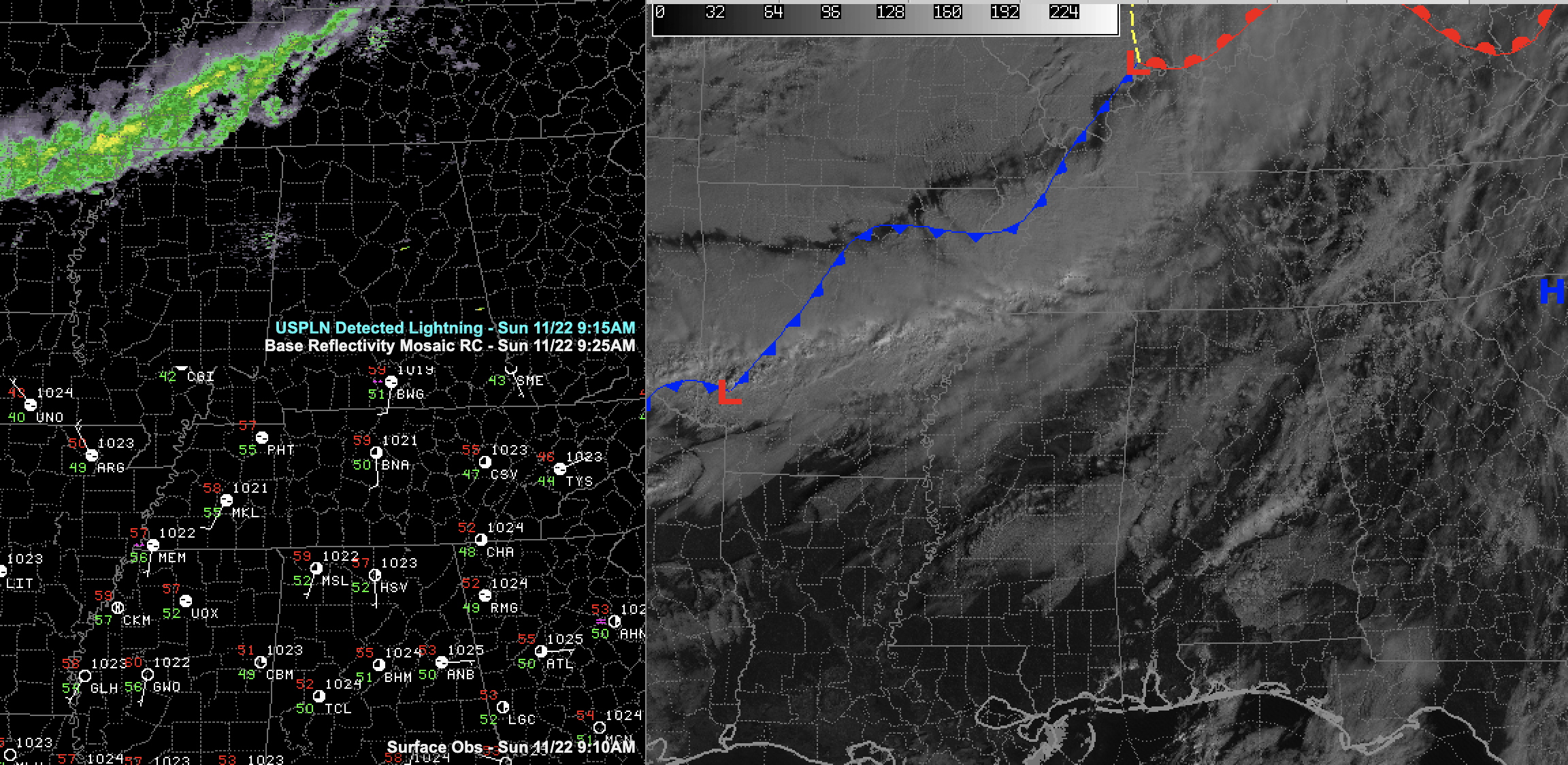
Our cold front lies between Little Rock and Memphis this morning and it will be near Cullman and Jasper by supper tonight. A fairly solid band of rain lies along and ahead of the front right now, but it will be weakening as it pushes southeast.
The best chances (and perhaps the only chances) for rain will be north of I-59 it appears.
Highs this afternoon will range from the upper 60s to lower 70s with some middle 70s near US-80.
It will become breezy tonight behind the front, with winds occasionally gusting to 15-20 mph. Lows will be in the upper 30s north of I-20 to lower 40s south.
The forecast has been updated. The main changes were to up the chances for severe weather on Wednesday afternoon and evening, and to bring rain in faster on Friday. Rainfall amounts for the weekend are looking more substantial.
I will have another update at noon. Have a great morning!
Category: Alabama's Weather, ALL POSTS
About the Author (Author Profile)
Bill Murray is the President of The Weather Factory. He is the site's official weather historian and a weekend forecaster. He also anchors the site's severe weather coverage. Bill Murray is the proud holder of National Weather Association Digital Seal #0001 @wxhistorianSubscribe
If you enjoyed this article, subscribe to receive more just like it.


