

Dry Tomorrow; Showers/Storms Return Late Wednesday
BLUE SKY: As advertised this morning, this has been a sunny, cool day for Alabama with temperatures in the 55-65 degree range this afternoon. Tonight will be clear and cold with a low in the 30s for most spots; some frost is likely, and colder spots could touch the freezing mark.
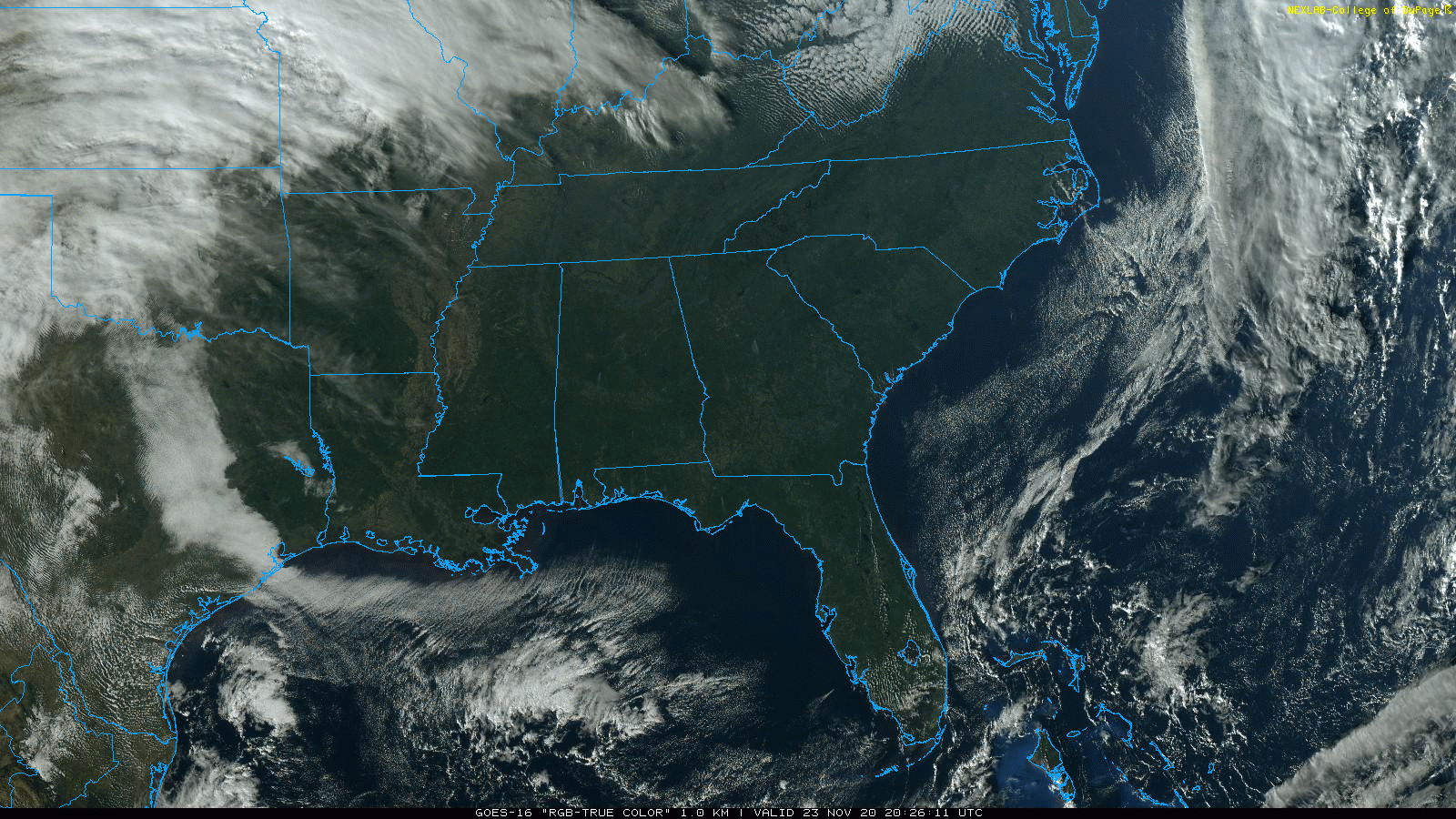
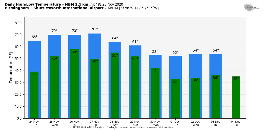
Tomorrow will be another mostly sunny day with a high between 67 and 70 degrees. Clouds begin to increase tomorrow night.
SHOWERS/STORMS RETURN: A cold front will bring a band of showers and thunderstorms into the state late Wednesday afternoon and Wednesday night. SPC maintains a low end “marginal risk” (level 1/5) over the northwest part of the state.
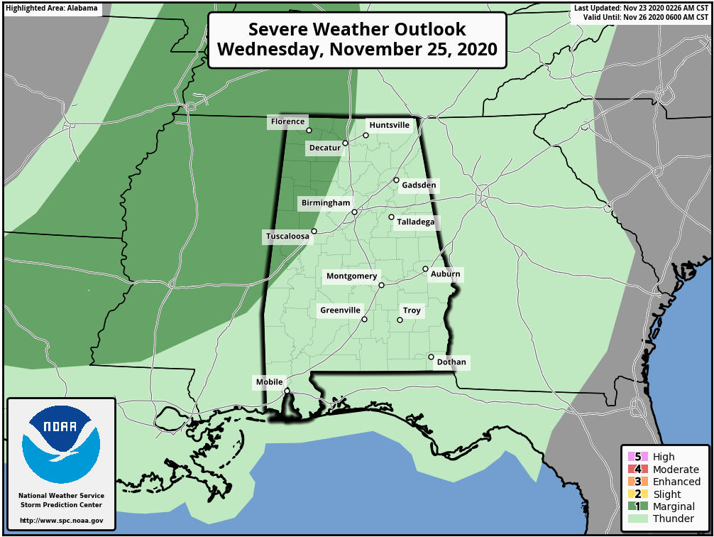
Surface based instability will be very limited, so despite very high low level shear values the overall severe weather threat for now looks fairly low. Heavier storms late Wednesday and Wednesday night could produce small hail and strong gusty winds as they pass through. Rain amounts of around 1/2 inch look likely.
THURSDAY/FRIDAY: The front will stall out over Central Alabama Thursday morning; the best chance of showers Thanksgiving Day across Alabama will most likely come over the eastern and southern counties. Otherwise, Thursday will be mostly cloudy with a high in the low 70s. The front will creep northward as a warm front Friday, and the day will be cloudy with a few showers likely (but not an all day wash-out). Friday’s highs will be in the mid 70s, about ten degrees above average for late November in Alabama.
THE ALABAMA WEEKEND: Models are not in particularly good agreement concerning the weekend weather in Alabama. But, we will need to mention a chance of showers Saturday with the front still hanging around. Some rain will be possible during Saturday’s Iron Bowl in Tuscaloosa, but it is too early to determine the timing, or amount of rain expected. The high Saturday afternoon will be in the 67-72 degree range.
Rain will increase statewide Sunday. New global model data now points to more of a heavy rain event as opposed to a severe weather threat, but they could easily change again. We will have much better clarity on what to expect Sunday after we get past the event Wednesday evening.
NEXT WEEK: Rain should taper off across the state Monday, followed by sharply colder, drier air for mid-week with highs in the 50s and lows in the 30s. See the Weather Xtreme video for maps, graphics, and more details.
TROPICS: A broad area of low pressure located a few hundred miles northeast of the central Bahamas continues to produce disorganized cloudiness and showers well to the northeast and east of its center. Strong upper-level winds are expected to limit additional development of the system before the low merges with a cold front on Tuesday. Later in the week, the system could become separated from the front and it might develop some subtropical characteristics while it meanders over the central Atlantic. It is no threat to the U.S… and the Gulf of Mexico remains quiet. The 2020 hurricane season ends in seven days.
ON THIS DATE IN 2004: A two day flash flood and severe weather event initiated across Alabama. The most destructive weather occurred during the early morning hours of the following day, Wednesday, November 24. A total of 16 tornadoes touched down across the state, including an F2 in East Alabama that killing a 75 year old woman in Bynum. A long track F2 impacted parts of Chilton and Coosa counties; the damage path was 49.1 miles long.
BEACH FORECAST: Click here to see the AlabamaWx Beach Forecast Center page.
WEATHER BRAINS: Don’t forget you can listen to our weekly 90 minute show anytime on your favorite podcast app. This is the show all about weather featuring many familiar voices, including our meteorologists here at ABC 33/40.
CONNECT: You can find me on all of the major social networks…
Look for the next Weather Xtreme video here by 7:00 a.m. tomorrow…
Category: Alabama's Weather, ALL POSTS, Weather Xtreme Videos
About the Author (Author Profile)
James Spann is one of the most recognized and trusted television meteorologists in the industry. He holds the AMS CCM designation and television seals from the AMS and NWA. He is a past winner of the Broadcast Meteorologist of the Year from both professional organizations.Subscribe
If you enjoyed this article, subscribe to receive more just like it.


