

Strong Storms Moving Into Portions of Walker, Winston, & Marion Counties
Special Weather Statement
National Weather Service Birmingham AL
926 AM CST Wed Nov 25 2020
ALZ011-014-015-251615-
Walker AL-Winston AL-Marion AL-
926 AM CST Wed Nov 25 2020
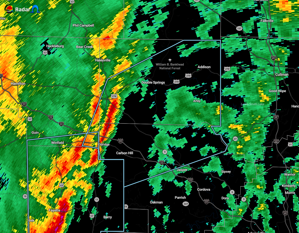
…SIGNIFICANT WEATHER ADVISORY FOR NORTHERN WALKER…SOUTHEASTERN
MARION AND WINSTON COUNTIES UNTIL 1015 AM CST…
At 925 AM CST, Doppler radar was tracking strong thunderstorms along
a line extending from near Lynn to 6 miles south of Glen Allen.
Movement was northeast at 50 mph.
Winds up to 40 mph will be possible with these storms.
Locations impacted include…
Jasper, Carbon Hill, Lynn, Arley, Double Springs, Addison, Kansas,
Nauvoo, Eldridge, Curry, Houston Recreational Area, Camp McDowell,
Smith Dam, Nesmith, Ashbank, Brushy Lake, Poplar Springs, Falls City,
Moreland and Smith Lake.
Category: Alabama's Weather, ALL POSTS, Severe Weather
About the Author (Author Profile)
Scott Martin is an operational meteorologist, professional graphic artist, musician, husband, and father. Not only is Scott a member of the National Weather Association, but he is also the Central Alabama Chapter of the NWA president. Scott is also the co-founder of Racecast Weather, which provides forecasts for many racing series across the USA. He also supplies forecasts for the BassMaster Elite Series events including the BassMaster Classic.Subscribe
If you enjoyed this article, subscribe to receive more just like it.


