

Strong Storms Will Soon Affect Portions of Walker, Tuscaloosa, Jefferson, and Fayette Counties
Special Weather Statement
National Weather Service Birmingham AL
949 AM CST Wed Nov 25 2020
ALZ013-015-023-024-251630-
Fayette AL-Walker AL-Jefferson AL-Tuscaloosa AL-
949 AM CST Wed Nov 25 2020
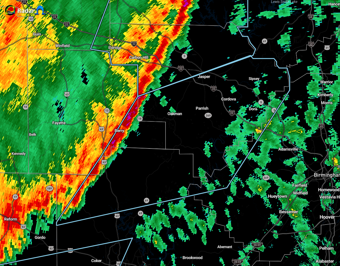
…SIGNIFICANT WEATHER ADVISORY FOR CENTRAL WALKER…NORTHWESTERN
TUSCALOOSA…NORTHWESTERN JEFFERSON AND SOUTHEASTERN FAYETTE COUNTIES
UNTIL 1030 AM CST…
At 948 AM CST, Doppler radar was tracking strong storms along a line
extending from 6 miles northwest of Oakman to near Berry to 7 miles
west of Samantha. Movement was east at 45 mph.
Winds up to 40 mph will be possible with these storms.
Locations impacted include…
Jasper, Sumiton, Cordova, Dora, Berry, Parrish, Oakman, Sipsey, West
Jefferson, Gorgas Steam Plant, Samantha, Gorgas, Boley Springs, Rocky
Hollow, Burnwell, Beloit, Quinton, Bankhead Lock And Dam, Lynns Park
and Whitson.
Category: Alabama's Weather, ALL POSTS, Severe Weather
About the Author (Author Profile)
Scott Martin is an operational meteorologist, professional graphic artist, musician, husband, and father. Not only is Scott a member of the National Weather Association, but he is also the Central Alabama Chapter of the NWA president. Scott is also the co-founder of Racecast Weather, which provides forecasts for many racing series across the USA. He also supplies forecasts for the BassMaster Elite Series events including the BassMaster Classic.Subscribe
If you enjoyed this article, subscribe to receive more just like it.


