

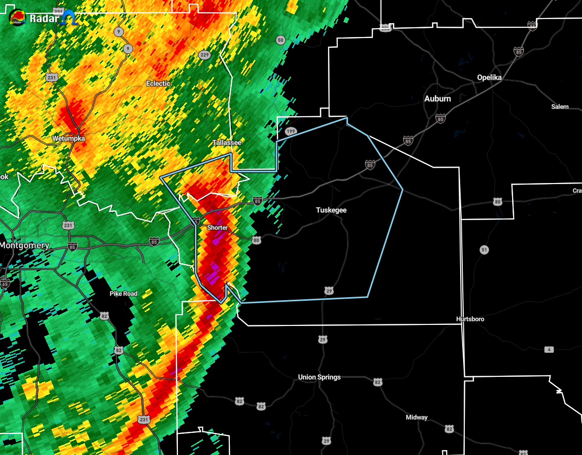
Strong Storms Now Affecting Portions of Elmore and Macon Counties
Special Weather Statement
National Weather Service Birmingham AL
229 PM CST Wed Nov 25 2020
ALZ043-045-252115-
Macon AL-Elmore AL-
229 PM CST Wed Nov 25 2020
…SIGNIFICANT WEATHER ADVISORY FOR SOUTHEASTERN ELMORE AND CENTRAL
MACON COUNTIES UNTIL 315 PM CST…
At 228 PM CST, Doppler radar was tracking a strong thunderstorm over
Shorter, or near Milstead, moving east at 35 mph.
Winds in excess of 40 mph will be possible with this storm.
Locations impacted include…
Tuskegee, Tallassee, Notasulga, Milstead, Shorter, Franklin,
Liverpool, Lake Tuskegee, Hardaway, Tuskegee National Forest,
Victoryland, Davisville, I 85 Rest Area, Uphapee Creek, Cross Keys
and Moton Field Municipal Airport.
PRECAUTIONARY/PREPAREDNESS ACTIONS…
To report severe weather, contact your nearest law enforcement
agency. They will relay your report to the National Weather Service
office in Birmingham.
Category: Alabama's Weather, ALL POSTS, Severe Weather
About the Author (Author Profile)
Scott Martin is an operational meteorologist, professional graphic artist, musician, husband, and father. Not only is Scott a member of the National Weather Association, but he is also the Central Alabama Chapter of the NWA president. Scott is also the co-founder of Racecast Weather, which provides forecasts for many racing series across the USA. He also supplies forecasts for the BassMaster Elite Series events including the BassMaster Classic.Subscribe
If you enjoyed this article, subscribe to receive more just like it.


