

A Brief Weather Check Just Before 4:00 pm
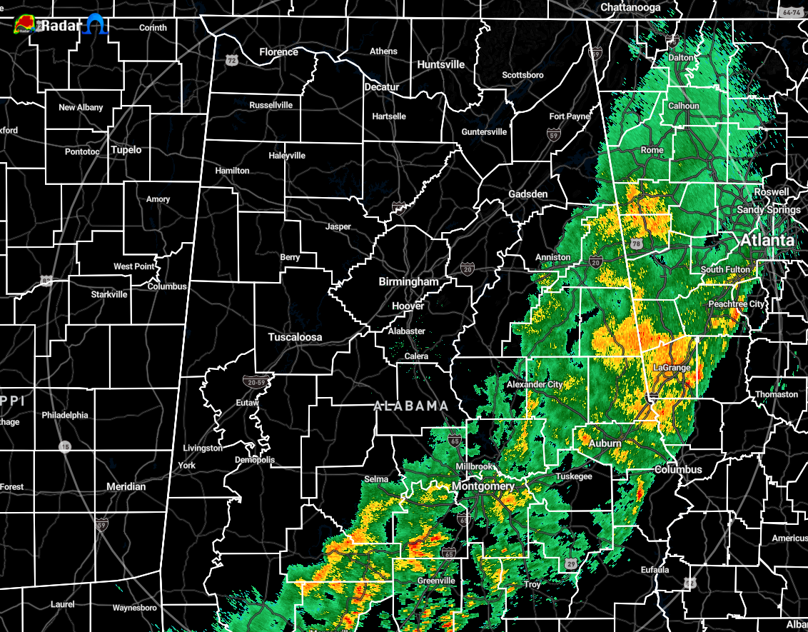
As of 3:50 pm, the line of showers and a few rumbles of thunder continue to move through the eastern and southeastern parts of Central Alabama with all of North Alabama dry at this point. We do not see any redevelopment over the north, northwest, or western parts of the area, and that may be a struggle to happen with the potential of the atmosphere not being able to recover after that first line of activity.
The good news is that there have been no watches or warnings issued for the area. We have had several Significant Weather Advisories issued for sub-severe wind gusts around 40 MPH, but that has been about it. I’ve only seen a few lightning strikes show up on radar throughout the day, but the cold front hasn’t got here yet. That cold front now extends from far West Tennessee south roughly along the Mississippi River through Central Louisiana.
With the rain that has already moved through the area, it looks like it may have stabilized the atmosphere just enough that the instability may not have enough time to rebuild back over the rain-free areas ahead of the cold front. However, there is increasing wind shear and helicity along and just ahead of the front, so there is a low potential for an isolated strong storm or two. Any strong storms would be mainly capable of gusty winds. The tornado threat is almost completely diminished at this point, but we’re keeping it as a non-zero threat.
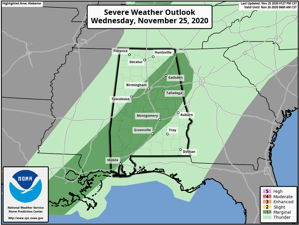
The Storm Prediction Center continues to have a Marginal Risk for severe storms mainly along and south of the I-59 corridor down to the I-85 corridor in Central Alabama for the rest of the evening, but looking at the local products, NWS Birmingham has removed the severe threat from its graphics. Once again, strong storms could produce gusty winds, but the severe threat has nearly diminished for the day.
Category: Alabama's Weather, ALL POSTS, Severe Weather
About the Author (Author Profile)
Scott Martin is an operational meteorologist, professional graphic artist, musician, husband, and father. Not only is Scott a member of the National Weather Association, but he is also the Central Alabama Chapter of the NWA president. Scott is also the co-founder of Racecast Weather, which provides forecasts for many racing series across the USA. He also supplies forecasts for the BassMaster Elite Series events including the BassMaster Classic.Subscribe
If you enjoyed this article, subscribe to receive more just like it.


