

Midday Nowcast: Clouds Increasing, Some Showers Later
It was a clear and cold start to the day with many us well down into the 40s, but we are warming up and by the end of the day should see highs in the upper 60s and lower 70s. Clouds are on the increase today and we should begin to see rain developing and moving into the state this afternoon and evening.
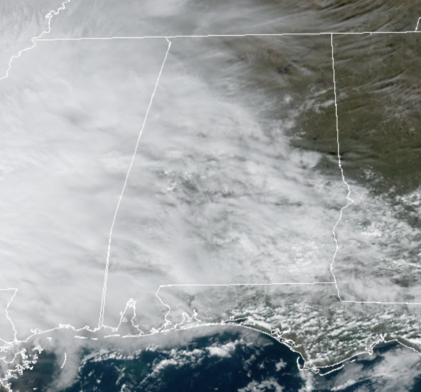
For the northern half of the state, rain amounts will be light and spotty, while the southern half of the state should see the more heavy and widespread rain from this round of rain. Some areas of rain will remain possible overnight with lows in the lower 50s for most locations, with some 40s to the north.
FRIDAY NIGHT LIGHTS: Some rain is possible for the high school football playoff games across the state tonight, with the most widespread rain over the southern half of the state. Temperatures will be in the upper 50s.
WEEKEND WEATHER: Tomorrow, the threat for rain shifts back south as the front moves south and most of tomorrow for the northern half of the state will be dry with more sun than clouds and highs in the mid-60s. Any showers will be confined to far South Alabama, and even there they will be widely scattered.
Then for Sunday a developing low pressure along the front will cause widespread rain and storms to return to Alabama especially by the afternoon and night. This looks to a be a soaking rain event for the state, with rain amounts of 1-2 inches likely, and a few strong storms are possible over the southern half of the state, where the SPC has defined a “marginal risk” (level 1/5) of severe thunderstorms.
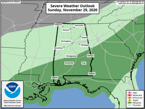
The northward extent of the severe weather threat will all depend on how far north the warm front moves back north, and for now, that looks to be the U.S. 80 corridor from Demopolis to Montgomery to Auburn. A few storms down there could produce small hail and strong gusty winds. A brief, isolated tornado can’t be totally ruled out.
IRON BOWL FORECAST: For the biggest football game of the year in Alabama (Auburn at Alabama; 2:30p CT kickoff at Bryant-Denny Stadium). The sky will be partly to mostly sunny; temperatures will fall from 65 degrees at kickoff to near 60 by the final whistle. No risk of rain.
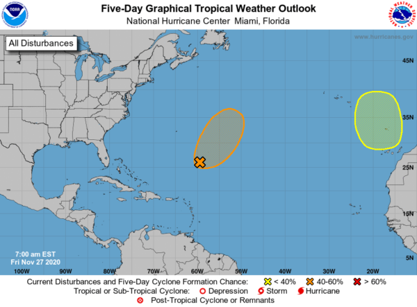
IN THE TROPICS: Showers and thunderstorms have decreased in coverage since near a well-defined, non-tropical low pressure several hundred miles southeast of Bermuda. Development is unlikely during the next day or so due to unfavorable upper-level winds. By Sunday, environmental conditions are expected to become a little more conducive for the low to briefly acquire subtropical characteristics as it moves northeastward ahead of a frontal system. By early next week, conditions are expected to become unfavorable for further development as the system interacts with or becomes absorbed by a frontal system. Formation chance through 48 hours…medium…40 percent.
Also, another non-tropical area of low pressure is expected to form over the far eastern Atlantic during the weekend. This system could gradually gain subtropical characteristics early next week while it moves slowly southward to the west and southwest of Portugal. Formation chance through 5 days…low…20 percent.
BEACH FORECAST CENTER: Get the latest weather and rip current forecasts for the beaches from Fort Morgan to Panama City on our Beach Forecast Center page. There, you can select the forecast of the region that you are interested in visiting.
WORLD TEMPERATURE EXTREMES: Over the last 24 hours, the highest observation outside the U.S. was 113.9F at Birdsville Airport, Australia. The lowest observation was -49.5F at Dome A, Antarctica.
CONTIGUOUS TEMPERATURE EXTREMES: Over the last 24 hours, the highest observation was 93F at Falcon Lake, TX. The lowest observation was -18F at Peter Sinks, UT.
WEATHER ON THIS DATE IN 1883: Fire engines were called out in New York City and New Haven, CT, as a result of the afterglow of the sunset due to vivid red ash from the Krakatoa Volcano explosion in August.
Category: Alabama's Weather, ALL POSTS
About the Author (Author Profile)
Macon, Georgia Television Chief Meteorologist, Birmingham native, and long time Contributor on AlabamaWX. Stormchaser. I did not choose Weather, it chose Me. College Football Fanatic. @Ryan_StinnetSubscribe
If you enjoyed this article, subscribe to receive more just like it.


