

Rain Moving Into West Alabama; Dry Tomorrow
**No afternoon Weather Xtreme video today… we are on a holiday schedule**
RADAR CHECK: A large mass of rain, with a few embedded thunderstorms, is moving into West Alabama this afternoon as a wave of low pressure forms on a stalled front to the south. Rain will continue to push into the state tonight; the most widespread rain comes over the southern 2/3 of the state. We note SPC has defined a “marginal risk” (level 1/5) of severe thunderstorms for the southwest corner of the state through tonight.
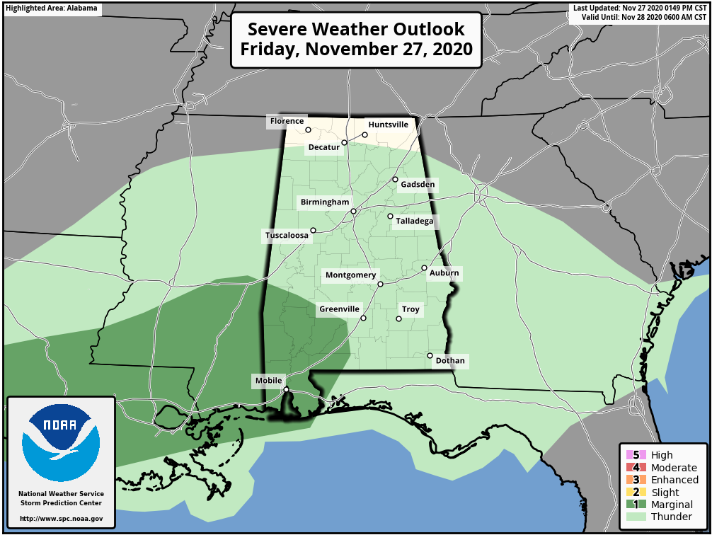
Heavier storms could produce small hail and strong gusty winds in the risk area through midnight.
THE ALABAMA WEEKEND: The wave moves on to the east, and the sky becomes mostly sunny tomorrow with a high in the mid to upper 60s. Clouds return tomorrow night, and another wave on the front will bring a widespread rain event to the state Sunday afternoon and Sunday night. Rain amounts of 1 to 2 inches are expected, and a few strong storms are possible over South Alabama; SPC maintains a “marginal risk” south of a line from Linden to Prattville to Lafayette.
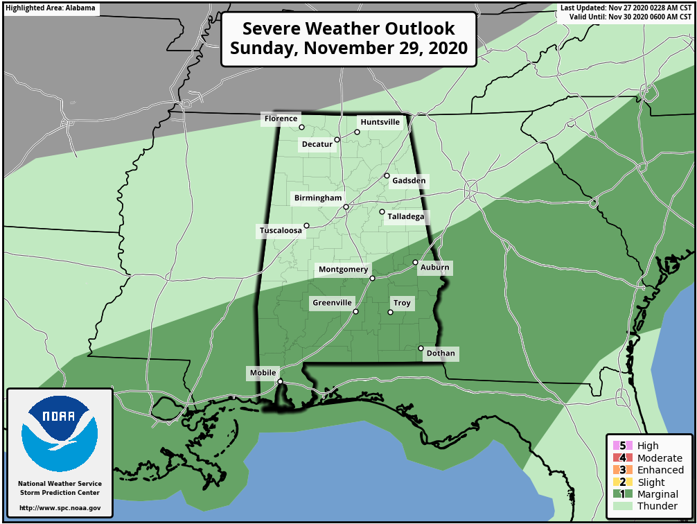
The main threat will come from small hail and strong winds, but an isolated, brief tornado can’t be ruled out.
NEXT WEEK: Rain ends very early Monday morning; then the coldest air so far this season blows into the state with a brisk, icy north wind. Temperatures will fall into the 30s over the northern part of the state. A few snow flurries are possible in the cold air over North Alabama, but there won’t be any impact or accumulation… the big story is the cold air. Temperatures drop into the 20-26 degree range by daybreak Tuesday over North/Central Alabama; a freeze is likely down the the Gulf Coast.
Tuesday will be sunny and cold with a high in the 40s, and we drop back into the 20s early Wednesday morning. Some rain is possible late in the week as moisture begins to return.
TROPICS: An elongated, non-tropical low pressure system located over 500 miles southeast of Bermuda is producing limited shower activity due to dry air in the surrounding environment and strong upper-level winds. Conditions are expected to remain generally unfavorable for development this weekend as the low moves northeastward ahead of an approaching frontal system. By early next week, the system is expected to become absorbed by this frontal system over the north-central Atlantic. No threat to land, and the Gulf of Mexico remains quiet. The 2020 Atlantic hurricane season ends Monday.
IRON BOWL: We are expecting picture perfect weather for tomorrow’s Iron Bowl in Tuscaloosa (Auburn at Alabama; 2:30p CT kickoff). The sky will be mostly sunny with temperatures falling from near 65 at kickoff, to 60 at the final whistle.
HIGH SCHOOL PLAYOFFS: Some rain is likely for the high school football playoff games across the state tonight, with the most widespread rain over the southern 2/3 of the state. Temperatures will be in the 50s.
ON THIS DATE IN 1898: A powerful storm, known as the “Portland Gale” impacted the coastal areas of New England on November 26 – 27, 1898. The storm formed when two areas of low pressures merged off the coast of New Jersey and traveled up the east coast. This storm produced hurricane force winds in Nantucket and sank more than 150 boats and ships.
ON THIS DATE IN 2019: Three EF-0 tornadoes touched down in Pike and Barbour counties in South Alabama.
BEACH FORECAST: Click here to see the AlabamaWx Beach Forecast Center page.
WEATHER BRAINS: Don’t forget you can listen to our weekly 90 minute show anytime on your favorite podcast app. This is the show all about weather featuring many familiar voices, including our meteorologists here at ABC 33/40.
CONNECT: You can find me on all of the major social networks…
Look for my next Weather Xtreme video here by 7:00 a.m. Monday… enjoy the weekend!
Category: Alabama's Weather, ALL POSTS, Weather Xtreme Videos
About the Author (Author Profile)
James Spann is one of the most recognized and trusted television meteorologists in the industry. He holds the AMS CCM designation and television seals from the AMS and NWA. He is a past winner of the Broadcast Meteorologist of the Year from both professional organizations.Subscribe
If you enjoyed this article, subscribe to receive more just like it.


