

Midday Nowcast: Sunny and Cold Tuesday
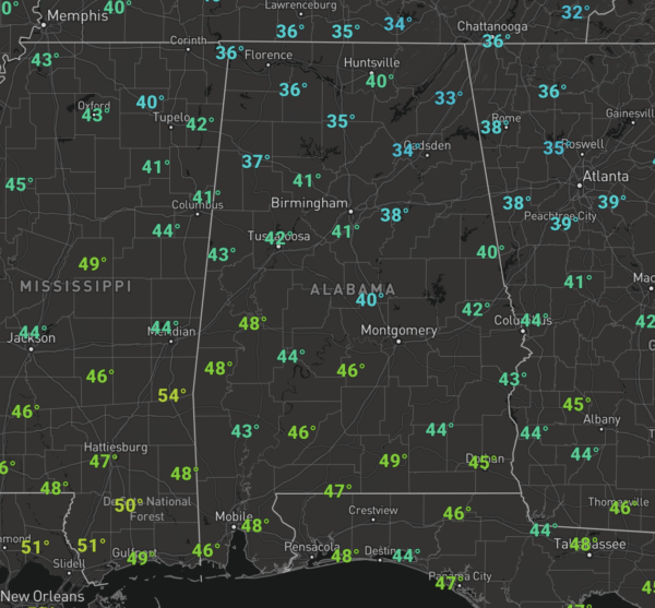
COLD START TO DECEMBER: Despite sunshine full supply today, it remains a cold December day for Alabama as temperatures this afternoon are not making it out of the 40s in most locations.

In fact, at midday, many spots across the northern half of the state were still in the 30s.
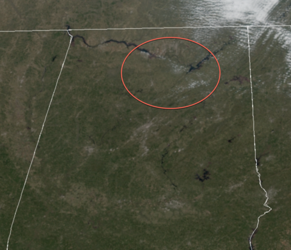
We are also seeing some of the snow that fell yesterday across North Alabama still showing up on the satellite imagery as the white areas within the highlighted circle. It looks like the heavier accumulations were just south of the Tennessee River from Decatur to Priceville to much of Marshall County around Arab.
Another freeze is ahead tonight with a clear sky and light winds, lows will easily be in the 20-25 degree range by first thing tomorrow morning.
WARMER WEDNESDAY: Tomorrow will be a warmer day, but still below average for this time of year as highs tomorrow climb into the lower and mid 50s for North/Central Alabama. We will see a few more clouds in the Alabama sky by tomorrow afternoon.
RAIN RETURNS: During the day Wednesday, a system will be developing in the Southern Plains, it will start to push east on Thursday, so look for clouds to increase through the day, and though much of the day looks dry, we can’t rule out the chance for some rain late in the day across West Alabama. However, it looks like the more widespread rain arrives Thursday night into Friday morning, with the rain ending from west to east during the afternoon hours Friday. Moisture will be limited; rain amounts of 1/4 to 1/2 inch look likely. Highs will be in the 50s both days.
BEACH FORECAST CENTER: Get the latest weather and rip current forecasts for the beaches from Fort Morgan to Panama City on our Beach Forecast Center page. There, you can select the forecast of the region that you are interested in visiting.
WORLD TEMPERATURE EXTREMES: Over the last 24 hours, the highest observation outside the U.S. was 117.7F at Bourke Airport, Australia. The lowest observation was -47.4F at Delyankir, Russia.
CONTIGUOUS TEMPERATURE EXTREMES: Over the last 24 hours, the highest observation was 86F at numerous places across Florida. The lowest observation was 0F at numerous locations across Minnesota.
WEATHER ON THIS DATE IN 2007: During December 1-3, a powerful storm with hurricane force winds struck the Northwest U.S. The storm brought heavy rain and wind gusts over 100 mph, with the highest reading being 129 mph at Bay City, OR. The strong winds brought power lines down, and the heavy rain caused widespread flooding and triggered landslides. According to reports, 8 fatalities were attributed to the storm and about 37,000 homes and businesses were left without power in Washington, Oregon, and northern California. President Bush declared a federal disaster in several counties in Washington and Oregon to provide recovery assistance.
Category: Alabama's Weather, ALL POSTS
About the Author (Author Profile)
Macon, Georgia Television Chief Meteorologist, Birmingham native, and long time Contributor on AlabamaWX. Stormchaser. I did not choose Weather, it chose Me. College Football Fanatic. @Ryan_StinnetSubscribe
If you enjoyed this article, subscribe to receive more just like it.


