

Midday Nowcast: Clouds Increasing, Rain on the Way
Moisture levels are on the rise and clouds continue to increase across the state today. An upper-level low is moving out of the southern Plains, while a surface low is developing along the Gulf Coast.
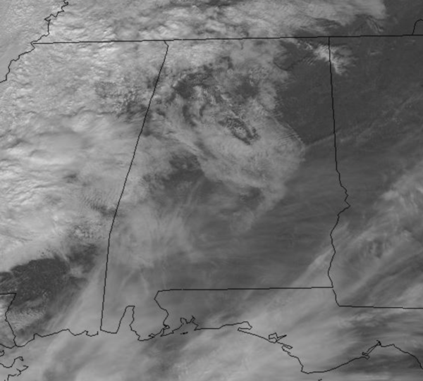
Widespread rain is ongoing across much of Mississippi at midday and we may see some areas of rain possible across West Alabama this afternoon, but most of the rain will arrive overnight and continue into the day tomorrow. With the clouds, highs will hold in the 50s this afternoon.
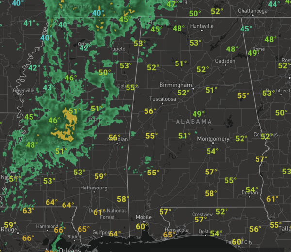
TONIGHT/TOMORROW: Expect a cloudy and cool night with lows in the 40s with widespread rain during the overnight hours and the rain will continue to linger into our Friday. The rain will end from west to east across the state tomorrow, with most of the rain out of the state, by mid to later afternoon. Highs tomorrow will be in the 50s again, and rainfall amounts the next 24 hours should be around the 1/2 inch mark. The surface low tracks along the Gulf Coast, so though some rumbles of thunder are possible in North/Central Alabama, there is no threat of severe storms. The only areas that could see some stronger storms tomorrow will be down in the Florida Panhandle.
WEEKEND WEATHER: We are forecasting dry conditions both Saturday and Sunday, with more clouds than sun expected both days. Highs Saturday will be in the mid 50s, while upper 50s to low 60s are possible across much of the state. Lows will be cold with lower 30s expected both nights.
FOOTBALL WEATHER: Saturday Auburn will host Texas A&M at Jordan-Hare Stadium (11:00a CT kickoff)… the sky will be mostly sunny with temperatures rising from near 50 at kickoff, into the mid 50s by the final whistle.
Then, Saturday night Alabama will travel to Baton Rouge to take on LSU (7:00p CT kickoff); the sky will be clear with temperatures falling from 52 at kickoff, into the upper 40s by the fourth quarter.
BEACH FORECAST CENTER: Get the latest weather and rip current forecasts for the beaches from Fort Morgan to Panama City on our Beach Forecast Center page. There, you can select the forecast of the region that you are interested in visiting.
WORLD TEMPERATURE EXTREMES: Over the last 24 hours, the highest observation outside the U.S. was 111.6F at Urandangi Airport, Australia. The lowest observation was -54.9F at Delyankir, Russia.
CONTIGUOUS TEMPERATURE EXTREMES: Over the last 24 hours, the highest observation was 85F at Camarillo and Santee, CA The lowest observation was -33F at Peter Sinks, UT.
BEACH FORECAST: Click here to see the AlabamaWx Beach Forecast Center page.
Category: Alabama's Weather, ALL POSTS
About the Author (Author Profile)
Macon, Georgia Television Chief Meteorologist, Birmingham native, and long time Contributor on AlabamaWX. Stormchaser. I did not choose Weather, it chose Me. College Football Fanatic. @Ryan_StinnetSubscribe
If you enjoyed this article, subscribe to receive more just like it.


