

A Few Showers Tomorrow; Widespread Rain Sunday Night
CLOUDS MOVING IN: We have seen a steady increase in mid and high level clouds across Alabama this afternoon, but the low levels remain dry and there is no rain on radar. Temperatures are mostly in the mid to upper 60s, about ten degrees above average for mid-December in Alabama. Tonight will be mostly cloudy, and a few showers could reach the northwest corner of the state by daybreak tomorrow.
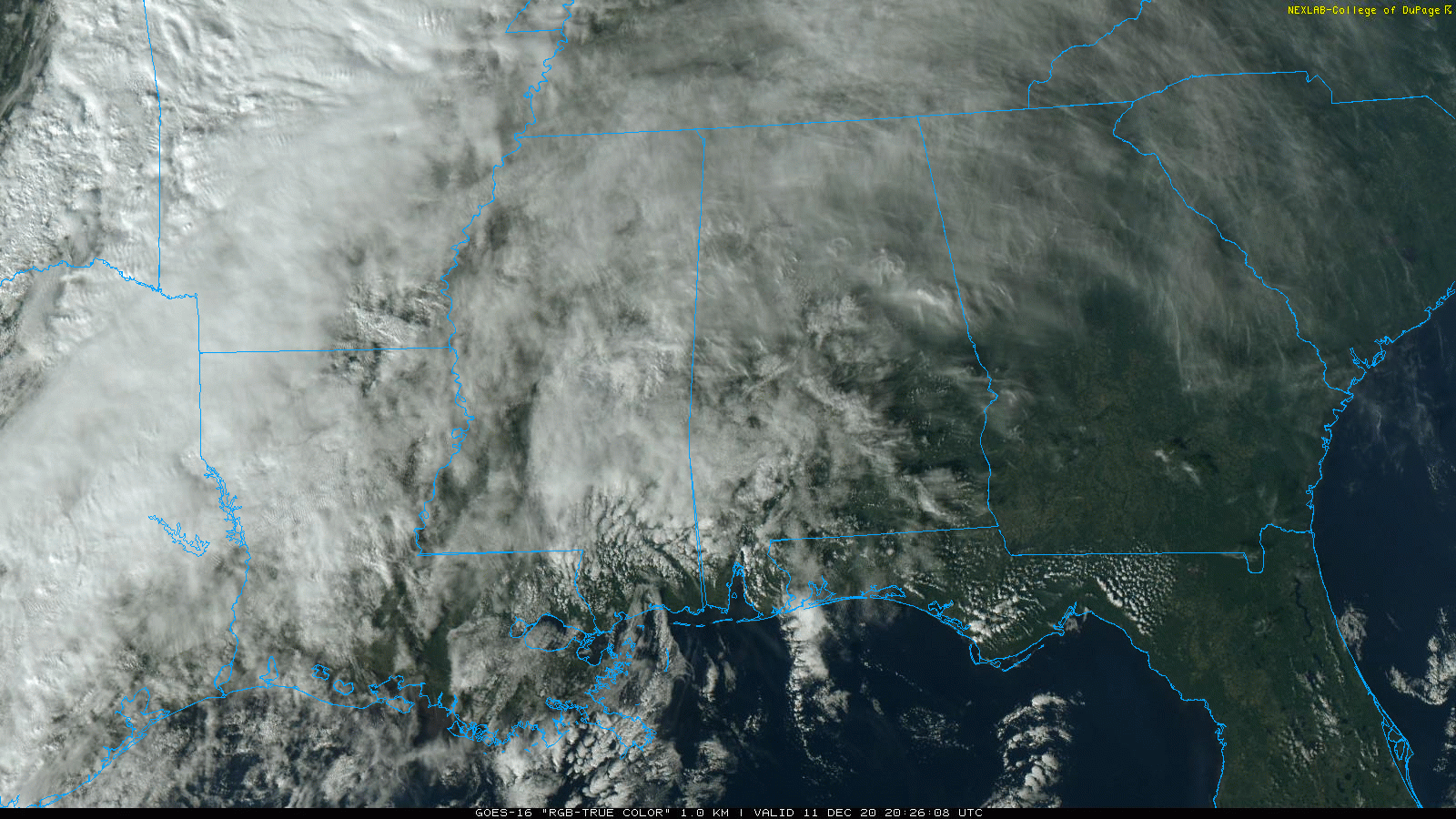
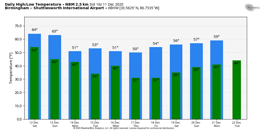
THE ALABAMA WEEKEND: A cold front will push a weakening band of showers into the state tomorrow morning. For North and West Alabama, the best chance of some rain will come during the morning hours, and by afternoon the showers will be south and east of Birmingham. It certainly won’t rain all day, there is no risk of severe storms, and probably no thunder. Rain amounts will be 1/4″ or less for most places… otherwise tomorrow will be a cloudy day with a high in the mid 60s.
The front will become stationary over South Alabama, where a few showers could linger tomorrow night into Sunday, but the rest of the state will be dry. Then, a wave of low pressure forms on the front, and will bring widespread rain to the state late Sunday afternoon and Sunday night. No risk of severe storms, and no thunder. Rain amounts around one inch are likely before it stops early Monday morning. Sunday will remain relatively mild with a high in the 60s.
NEXT WEEK: The sky becomes partly sunny Monday, and the high will drop back into the mid to upper 50s. The next disturbance could bring a little scattered light rain Tuesday night or Wednesday morning, but with limited moisture rain amounts, if any, should be very light. Wednesday will be sharply colder over North Alabama with temperatures holding in the 40s most of the day. Then, Thursday and Friday will be mostly sunny with highs in the 50s and lows in the 30s. Next chance of rain will come at some point the following weekend (December 19-20)… See the Weather Xtreme video for maps, graphics, and more details.
FOOTBALL WEATHER: Alabama will take on Arkansas in Fayetteville tomorrow (11:00a CT kickoff)… the weather looks dry but cold. The sky will be cloudy with temperatures rising from 40 degrees at kickoff, into the mid 40s during the second half. UAB plays Rice in Houston tomorrow (11:00a CT kickoff)… the sky will be sunny with temperatures rising from 66 at kickoff, to near 70 by the second half. Then, tomorrow evening, Auburn travels to Starkville to taken on Mississippi State (6:30p CT kickoff). The sky will be mostly fair with temperatures falling the low 50s at kickoff, into the mid 40s by the final whistle.
ON THIS DATE IN 1961: It was middle day of a three day severe weather event for the Deep South, which included 13 tornadoes. On December 11, 1961 an F3 tornado tore through Jacksonville, in Calhoun County, causing signifiant damage to the campus of Jacksonville State University. The tornado was down for about three miles; there were no fatalities.
BEACH FORECAST: Click here to see the AlabamaWx Beach Forecast Center page.
WEATHER BRAINS: Don’t forget you can listen to our weekly 90 minute show anytime on your favorite podcast app. This is the show all about weather featuring many familiar voices, including our meteorologists here at ABC 33/40.
CONNECT: You can find me on all of the major social networks…
Look for my next Weather Xtreme video here by 7:00 a.m. Monday… enjoy the weekend!
Category: Alabama's Weather, ALL POSTS, Weather Xtreme Videos
About the Author (Author Profile)
James Spann is one of the most recognized and trusted television meteorologists in the industry. He holds the AMS CCM designation and television seals from the AMS and NWA. He is a past winner of the Broadcast Meteorologist of the Year from both professional organizations.Subscribe
If you enjoyed this article, subscribe to receive more just like it.


