

Showers Continue to Move Slowly Through Central Alabama at Midday
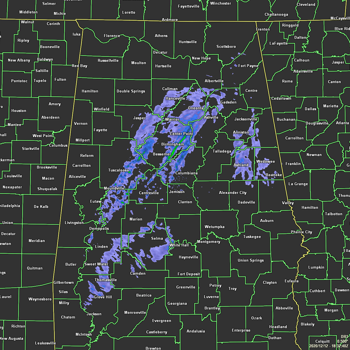
Showers continue to move across Central Alabama as of the midday hour, with conditions drying out over the northwestern and extreme western parts of the area. Showers will continue to move west to east across the area for the rest of your Saturday with locations west of I-59 becoming around sunset. A chance of showers will linger across the east and southeastern parts of the area during the late-night and overnight hours. Highs will be in the lower 60s to the lower 70s across the area. Colder air will move in behind the showers and lows will dip into the mid-30s to the upper 50s from northwest to southeast.
The remainder of the lingering shower activity should be out of the area before sunrise on Sunday, but another system will move in and bring rain and a few rumbles of thunder back into the mix for Sunday afternoon through the late night and overnight hours. Some could be heavy at times, especially over the northern half of the area, but not enough to cause any flooding issues. Afternoon highs will be in the lower 60s to the lower 70s.
Category: Alabama's Weather, ALL POSTS
About the Author (Author Profile)
Scott Martin is an operational meteorologist, professional graphic artist, musician, husband, and father. Not only is Scott a member of the National Weather Association, but he is also the Central Alabama Chapter of the NWA president. Scott is also the co-founder of Racecast Weather, which provides forecasts for many racing series across the USA. He also supplies forecasts for the BassMaster Elite Series events including the BassMaster Classic.Subscribe
If you enjoyed this article, subscribe to receive more just like it.


