

Fog Dissipating, Sunshine Soon for Most, A Nice Afternoon Ahead, Heavy Rain Tonight
After a foggy start across much of the area this morning, drier air moving in behind a cold front has dissipated much of the fog and most areas will see increasing sunshine.
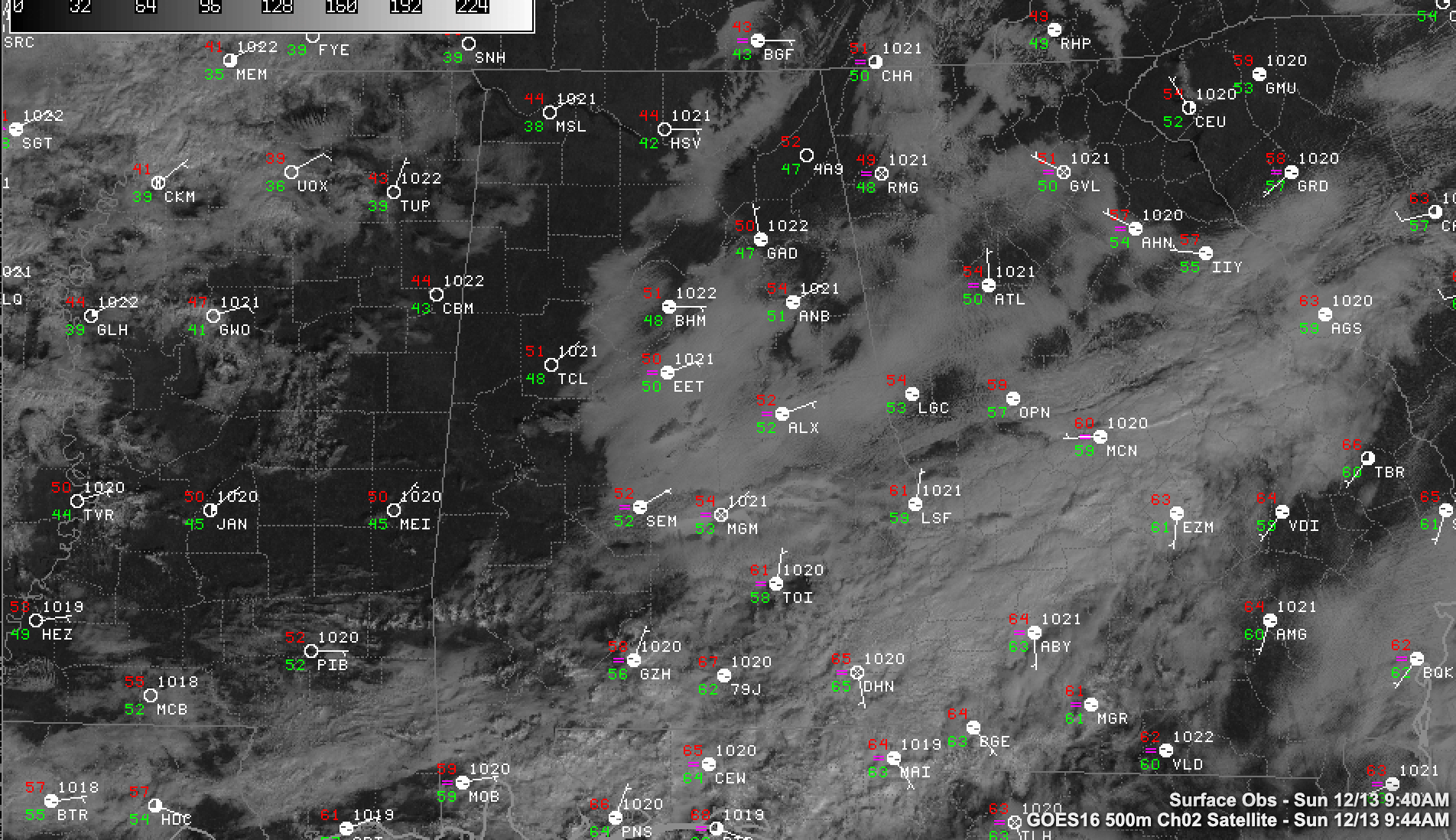
It’s chilly with 30s across the Tennesse Valley, and 40s to lower 50s along I-59.
Highs this afternoon will be in the upper 50s across the North, with middle 60ss along I-59, and upper 60s over SOouth Central sections. There will even be some lower 70s south of I-85.
The frontal system will stall over South Alabama this afternoon and will wait on a fast-moving disturbance over North Texas that will spin up a surface low over Louisiana later today. This low will strengthen as it tracks across Alabama tonight, leading to increasing rain and some storms to the south. It will become windy as well overnight.
No severe weather is expected in Alabama, with any chances for that limited to Louisiana. The best chances for thunder in Alabama will be across the southern half of the state.
Rainfall could become heavy at times tonight as the low tracks across the state. The rain should begin to exit that state before sunrise.
Monday will start off cloudy, cold, and windy with a little drizzle. Temperatures will not be able to get out of the 40s north of I-20.
The northwestern half of the state will have a freeze Monday night, with readings in the 20s northwest of I-59.
Category: Alabama's Weather, ALL POSTS
About the Author (Author Profile)
Bill Murray is the President of The Weather Factory. He is the site's official weather historian and a weekend forecaster. He also anchors the site's severe weather coverage. Bill Murray is the proud holder of National Weather Association Digital Seal #0001 @wxhistorianSubscribe
If you enjoyed this article, subscribe to receive more just like it.


