

While Isolated Damaging Wind Gusts Are Possible, Severe Watch Not Likely to Be Issued Tonight
SUMMARY
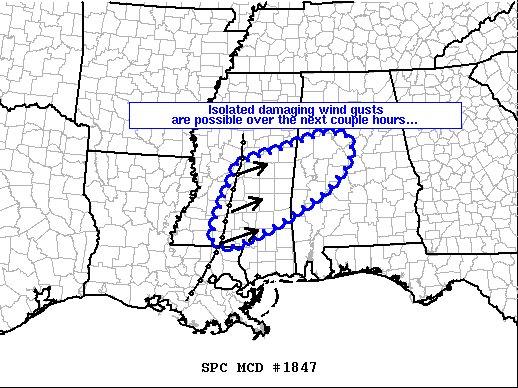
An isolated damaging-wind threat is possible with a line of storms quickly moving through the discussion area.
DISCUSSION
The latest radar mosaic/objective analyses indicate a relatively narrow band of strongly forced convection near/just east of the I-55 corridor in Mississippi. These storms were aided by strong forcing aloft associated with an advancing mid-level wave near the ArkLaTex and marginally unstable near-surface parcels. Strong wind fields/shear and downward momentum processes may foster a few damaging wind gusts with this line as it sweeps quickly east-northeastward across the discussion area over the next few hours. A brief uptick in intensity is possible if slightly more buoyant area (characterized by mid 60s F dewpoints currently across southeastern Mississippi/southern Alabama) can migrate northward and interact with the line. A WW issuance is not anticipated due to the isolated nature of the threat.
Category: Alabama's Weather, ALL POSTS, Severe Weather
About the Author (Author Profile)
Scott Martin is an operational meteorologist, professional graphic artist, musician, husband, and father. Not only is Scott a member of the National Weather Association, but he is also the Central Alabama Chapter of the NWA president. Scott is also the co-founder of Racecast Weather, which provides forecasts for many racing series across the USA. He also supplies forecasts for the BassMaster Elite Series events including the BassMaster Classic.Subscribe
If you enjoyed this article, subscribe to receive more just like it.


