

Other Than Rain, Still Rather Quiet as of 9:30 pm
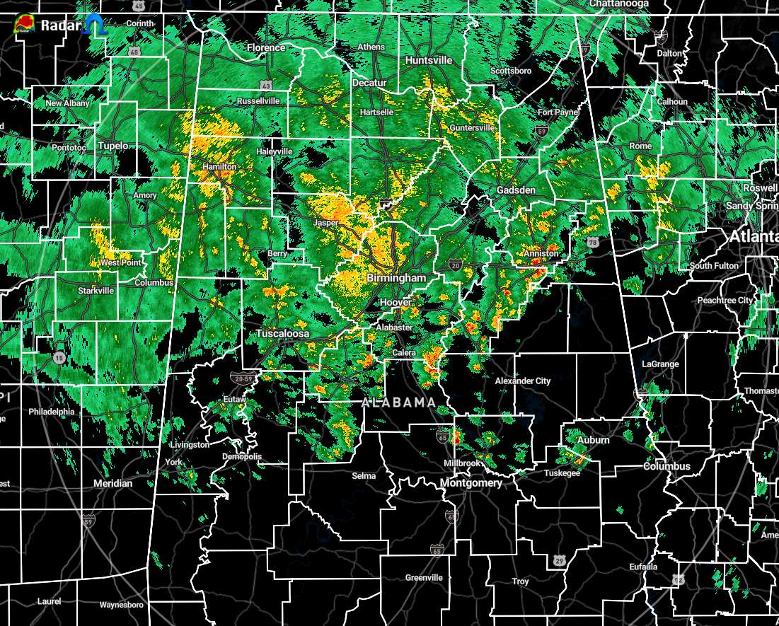
As of 9:28 pm, showers with some embedded heavier rain continues to fall over portions of North/Central Alabama located along and north of the I-20/59 corridor. All activity remains under severe limits, but a marginal risk for severe storms continues from now through the overnight hours until sunrise.
The surface low will move into the southwestern portions of Central Alabama around or before 11:00 pm tonight and that is when we will see the main window for any stronger to severe storms open up. The low will progress roughly along the I-20/59 corridor across the area and should exit the state by 4:00 am.
We can expect pressure gradient winds to increase out ahead of the low as it gets closer to the area and will remain breezy after it passes.
There have been no change in thought with the forecast for tonight as there will be a very small risk of isolated damaging wind gusts and a brief tornado. Stay tuned.
Category: Alabama's Weather, ALL POSTS, Severe Weather
About the Author (Author Profile)
Scott Martin is an operational meteorologist, professional graphic artist, musician, husband, and father. Not only is Scott a member of the National Weather Association, but he is also the Central Alabama Chapter of the NWA president. Scott is also the co-founder of Racecast Weather, which provides forecasts for many racing series across the USA. He also supplies forecasts for the BassMaster Elite Series events including the BassMaster Classic.Subscribe
If you enjoyed this article, subscribe to receive more just like it.


