

Strong Storms Affecting Portions of Elmore, Bullock, Macon, Tallapoosa, & Montgomery Counties
…SIGNIFICANT WEATHER ADVISORY FOR ELMORE…NORTHWESTERN BULLOCK…
MACON…SOUTHERN TALLAPOOSA AND MONTGOMERY COUNTIES UNTIL 330 AM
CST…
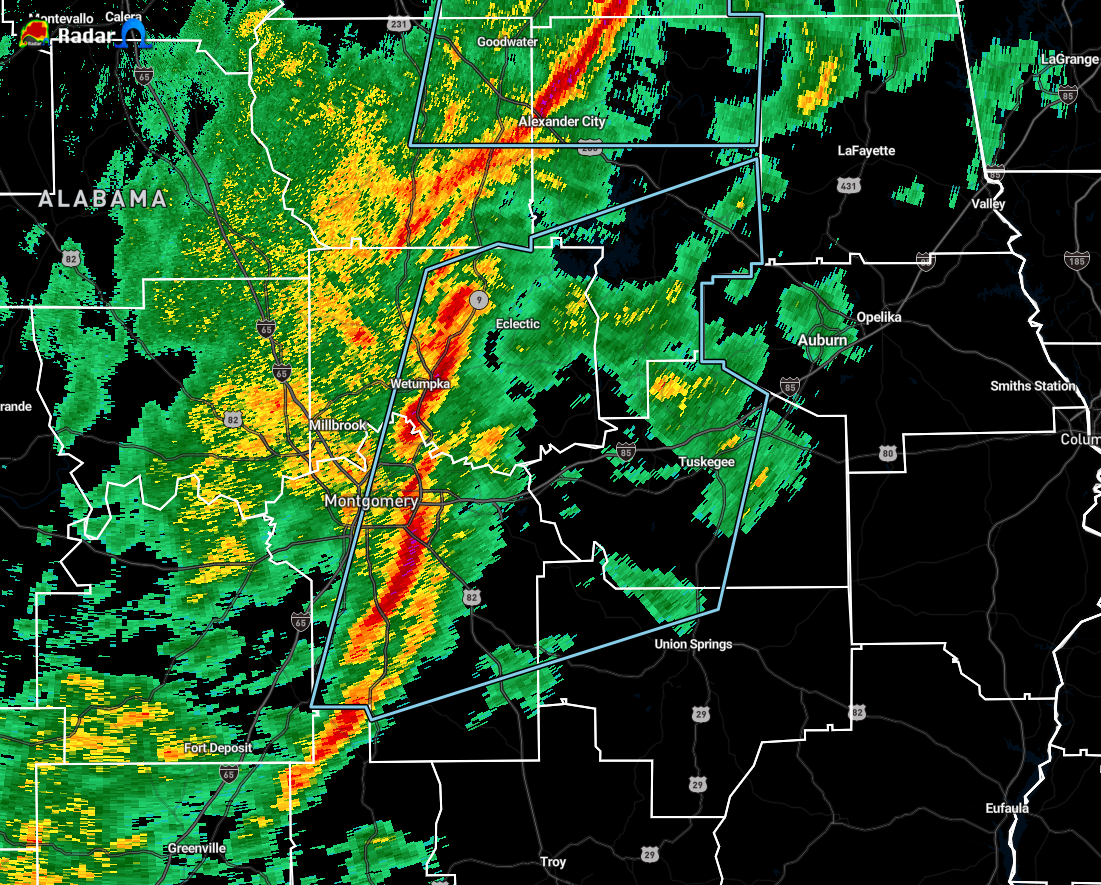
At 238 AM CST, Doppler radar was tracking strong thunderstorms along
a line extending from near Dexter to near Sellers. Movement was east
at 55 mph.
Winds in excess of 40 mph will be possible with these storms.
Locations impacted include…
Montgomery, Tuskegee, Wetumpka, Tallassee, Dadeville, Camp Hill,
Notasulga, Milstead, Pike Road, Eclectic, Shorter, Franklin, Waverly,
Martin Dam, Hyundai Motors Of Alabama, Santuck, Auburn University In
Montgomery, Lake Tuskegee, Snowdoun and Tuskegee National Forest.
PRECAUTIONARY/PREPAREDNESS ACTIONS…
Torrential rainfall is also occurring with these storms, and may lead
to localized flooding. Do not drive your vehicle through flooded
roadways.
Category: Alabama's Weather, ALL POSTS, Severe Weather
About the Author (Author Profile)
Scott Martin is an operational meteorologist, professional graphic artist, musician, husband, and father. Not only is Scott a member of the National Weather Association, but he is also the Central Alabama Chapter of the NWA president. Scott is also the co-founder of Racecast Weather, which provides forecasts for many racing series across the USA. He also supplies forecasts for the BassMaster Elite Series events including the BassMaster Classic.Subscribe
If you enjoyed this article, subscribe to receive more just like it.


